|
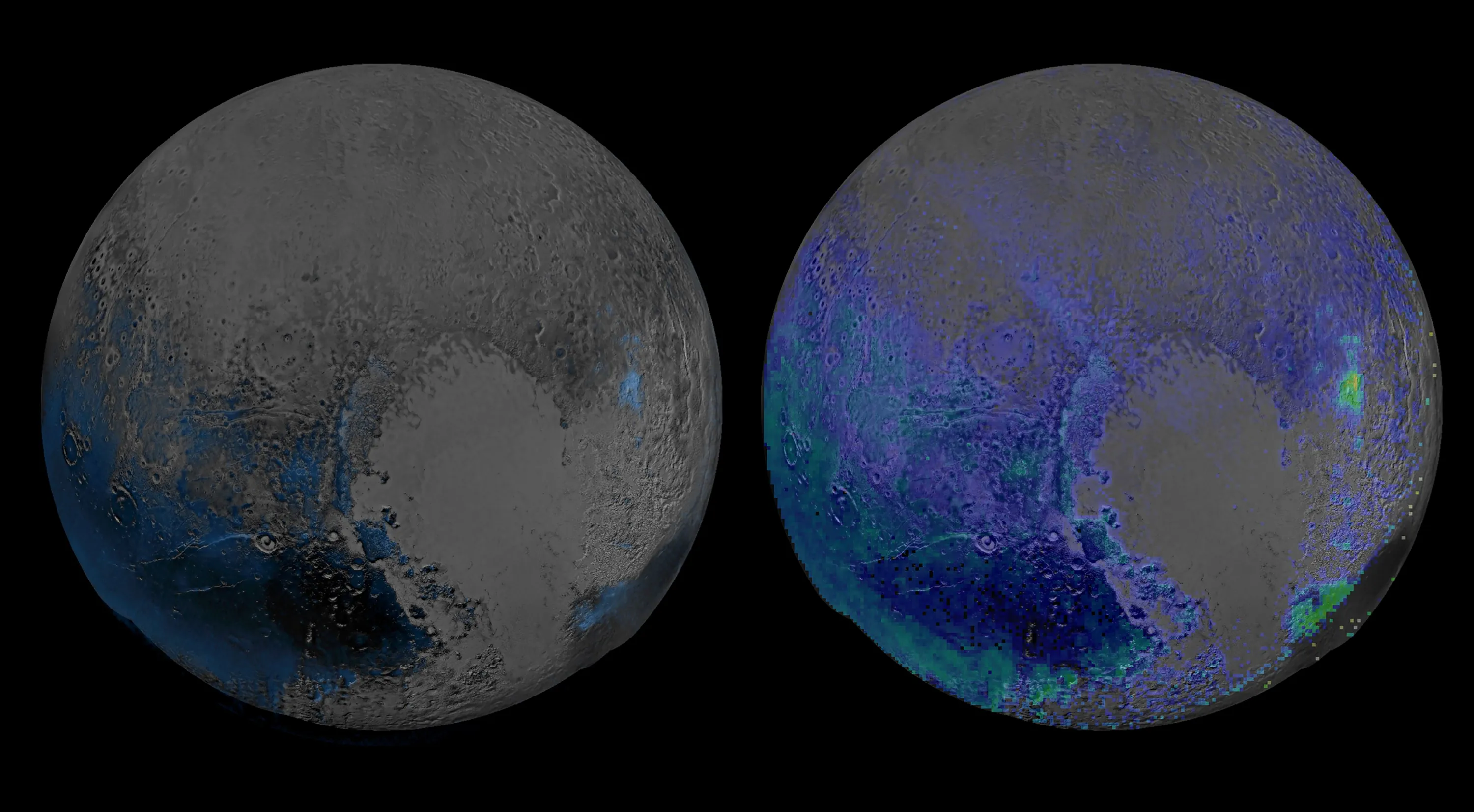
This NASA image captured by NASA's New Horizons spacecraft released January 28, 2016 shows a false-color image, derived from observations in infrared light by the Ralph/Linear Etalon Imaging Spectral Array (LEISA) instrument, showing where the spectral features of water ice are abundant on Plutos surface. The scans, taken about 15 minutes apart, were stitched into a combined multispectral Pluto data cube covering the full hemisphere visible to New Horizons as it flew past Pluto. Water ice is Pluto's crustal "bedrock, the canvas on which its more volatile ices paint their seasonally changing patterns. Initial New Horizons maps of Pluto's water ice bedrock compared LEISA spectra with a pure water ice template spectrum, resulting in the map at left. The new map shows exposed water ice to be considerably more widespread across Pluto's surface than was previously known an important discovery. But despite its much greater sensitivity, the map still shows little or no water ice in the informally named places called Sputnik Planum (the left or western region of Plutos heart) and Lowell Regio (far north on the encounter hemisphere). This indicates that at least in these regions, Pluto's icy bedrock is well hidden beneath a thick blanket of other ices such as methane, nitrogen and carbon monoxide. (Photo by AFP Photo/NASA)
|