|
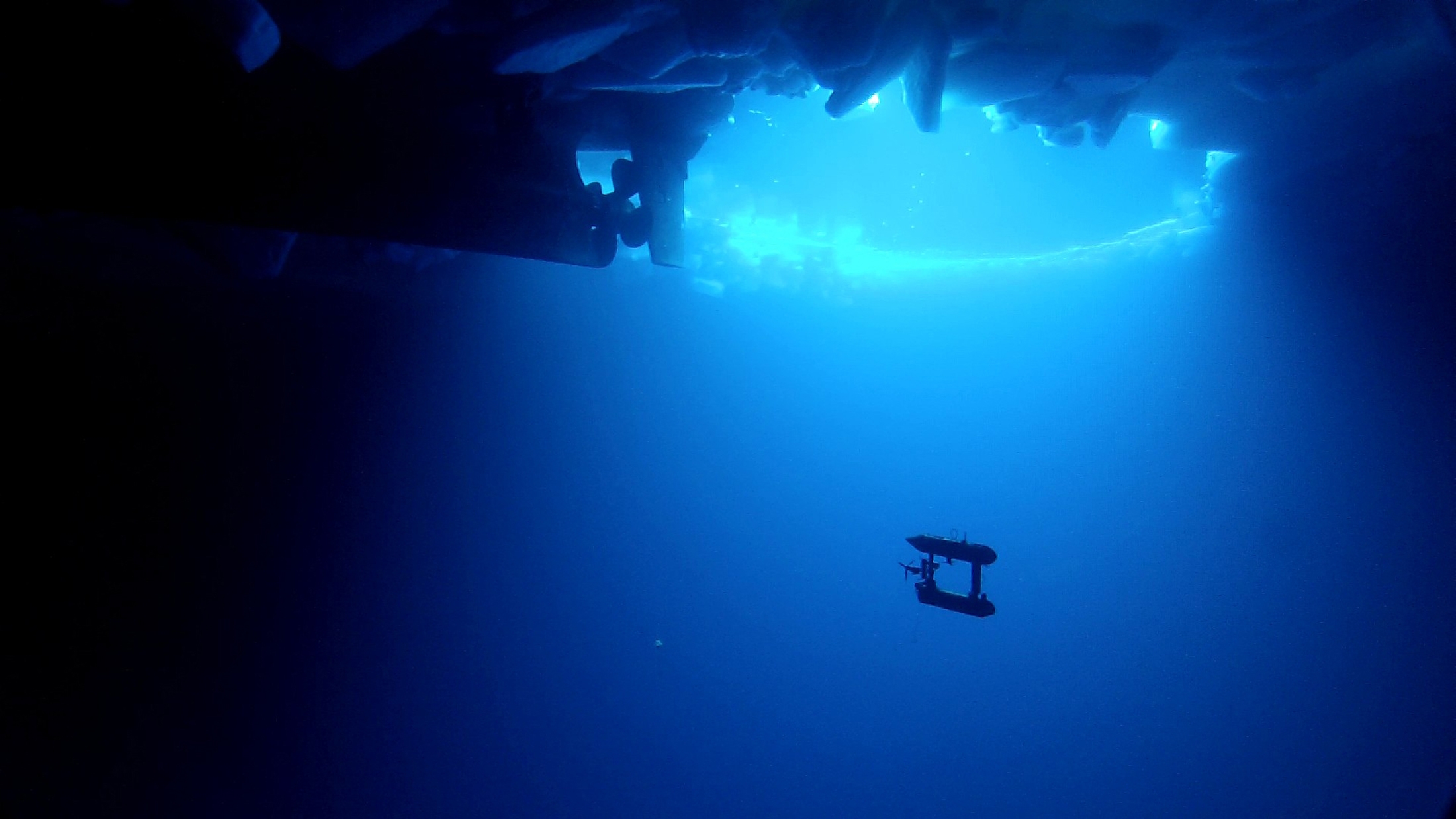
A free-swimming robot submarine, manoeuvres beneath sea ice in Eastern Antarctica in this undated handout picture made available on October 11, 2012. Scientists have produced the first three dimensional map of the surface beneath Antarctic sea ice, helping them better understand the impact of climate change on Antarctica. The team of scientists from eight countries have used a robot submarine to chart a frozen and inverted world of mountains and valleys, allowing accurate measurements of the crucial thickness of Antarctic sea ice. (Photo by Australian Antarctic Division/Reuters)
|