|
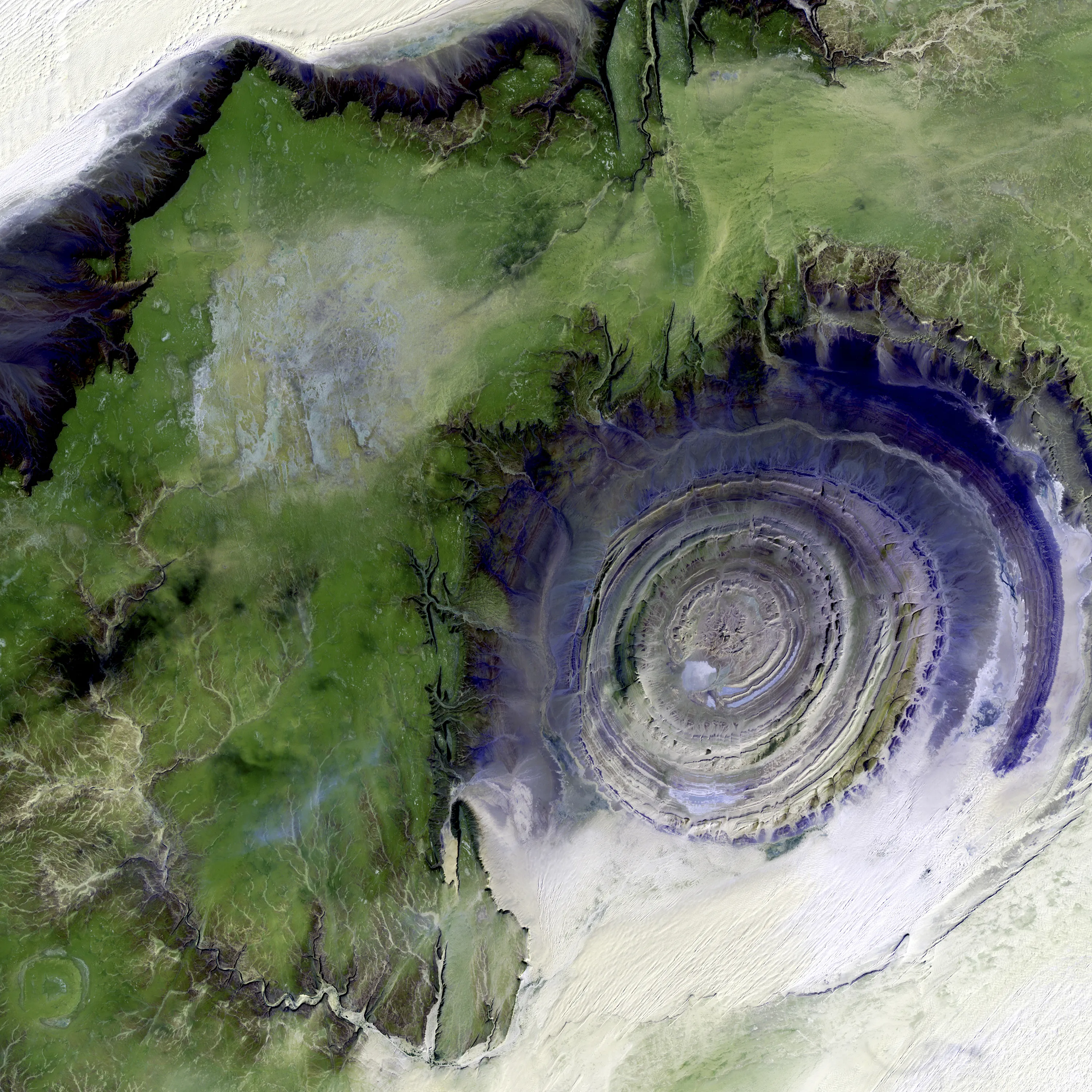
Richat Structure, Mauritania. The so-called Richat Structure is a geological formation in the Maur Adrar Desert in the African country of Mauritania. Although it resembles an impact crater, the Richat Structure formed when a volcanic dome hardened and gradually eroded, exposing the onion-like layers of rock. This image was acquired on January 11, 2001, by Landsat 7′s Enhanced Thematic Mapper plus (ETM+) sensor.
This is a false-color composite image made using shortwave infrared, infrared, and green wavelengths, and has been sharpened using the sensor’s panchromatic band. (Photo by NASA/GSFC/USGS EROS Data Center)
|