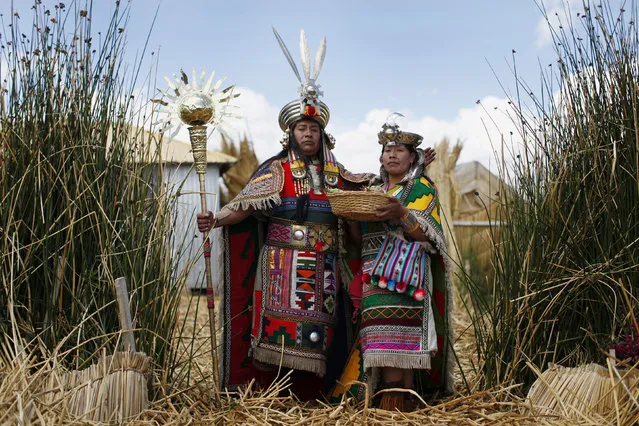
An Andean man and a woman, depicting Inca's legendary characters Manco Capac and Mama Ocllo, pose for a portrait in a Uros island at Lake Titicaca before a re-enactment in Puno November 5, 2014. The Uros islands are a group of 70 man-made totora reed islands floating on the lake, which according to Peru's tourism board iPeru is the world's highest navigable lake at over 4,000 meters above sea level. The Uros people fish and hunt, but tourism is their main source of livelihood. (Photo by Enrique Castro-Mendivil/Reuters)
07 Nov 2014 12:52:00,post received
0 comments