Loading...
Done
Tourists enjoy the rare opportunity to walk in water as they visit Badwater Basin, the normally driest place in the US, in Death Valley National Park, Inyo County, California on February 18, 2024. Badwater Basin, an endorheic basin in Death Valley National Park, was flooded by Hurricane Hilary in August 2023 and recent rains in California. It is the lowest point in North America, at 282 feet (86 meters) below sea level. (Photo by David Swanson/AFP Photo)

Tourists enjoy the rare opportunity to walk in water as they visit Badwater Basin, the normally driest place in the US, in Death Valley National Park, Inyo County, California on February 18, 2024. Badwater Basin, an endorheic basin in Death Valley National Park, was flooded by Hurricane Hilary in August 2023 and recent rains in California. It is the lowest point in North America, at 282 feet (86 meters) below sea level. (Photo by David Swanson/AFP Photo)
Details
27 Feb 2024 07:33:00
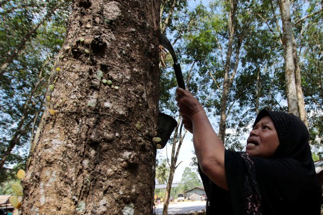
A woman works in a rubber plantation in Yala province, southern Thailand, January 30, 2017. (Photo by Surapan Boonthanom/Reuters)

A woman works in a rubber plantation in Yala province, southern Thailand, January 30, 2017. Thai rubber exporters say they have enough of the commodity in stockpiles to ensure only minimal disruption to scheduled shipments in the wake of deadly floods in key growing regions. (Photo by Surapan Boonthanom/Reuters)
Details
02 Feb 2017 05:08:00
Women walk in the strong winds from Typhoon Guchol in Nagoya, Japan on June 19, 2012

Women walk in the strong winds from Typhoon Guchol in Nagoya, Japan on June 19, 2012. The storm lashed southwestern Japan with strong winds and heavy rain as it moved toward the center of the country, forcing airlines and train operators to cancel services amid warnings of flooding and landslides. (Photo by Kyodo News)
Details
20 Jun 2012 11:06:00
Somali Famine Refugees Seek Aid In Mogadishu

Weakened by sickness and malnutrition, Arbty Mohammad, 2, lies in the Banadir Hospital on August 12, 2011 in Mogadishu, Somalia. Some 100,000 Somalis have flooded into Mogadishu from drought and famine stricken areas of the country. The UN warned Friday that a cholera epidemic could spread through Mogadishu, as Somalis fill unsanitary makeshift camps throughout the capital. (Photo by John Moore/Getty Images)
Details
14 Aug 2011 14:13:00
Hurricane Irene

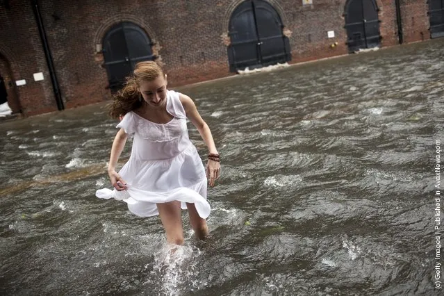
A local resident of Red Hook, Betty Walsh, crosses a flooded street in Red Hook August 28, 2011 in the Brooklyn borough of New York City. While Hurricane Irene has been downgraded to a tropical storm, it has knocked out power to more than 3 million people and is attributed to 15 deaths as it travels up the Eastern seaboard. (Photo by Robert Nickelsberg/Getty Images)
Details
30 Aug 2011 13:20:00
Hurricane Irene

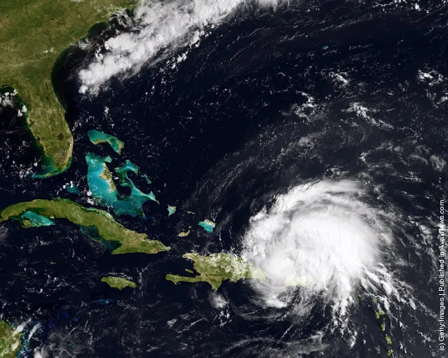
In this handout GOES satellite image provided by the National Oceanic and Atmospheric Administration (NOAA), Irene reaches hurricane strength as it moves across Puerto Rico towards Hispaniola August 22, 2011 in the Caribbean Sea. Irene, the first hurricane of the Atlantic storm season, brought torrential rains and winds to Puerto Rico, downing trees and powerlines and flooding streets. The expected path will bring Irene through the Bahamas and is likely to hit Florida and up the east coast of the U.S. (Photo by NOAA via Getty Images)
Details
23 Aug 2011 12:47:00
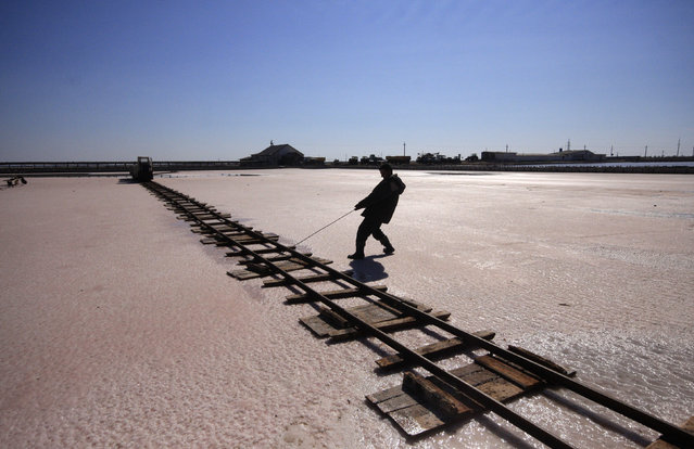
A worker lays rails across the bed of a drained area of a lake used for the production of salt at the Sasyk-Sivash lake near the city of Yevpatoria in Crimea, October 5, 2014. (Photo by Pavel Rebrov/Reuters)

A worker lays rails across the bed of a drained area of a lake used for the production of salt at the Sasyk-Sivash lake near the city of Yevpatoria in Crimea, October 5, 2014. The area has a long tradition of salt production, prepared from salt flats flooded with water from the Black Sea. (Photo by Pavel Rebrov/Reuters)
Details
07 Oct 2014 11:24:00
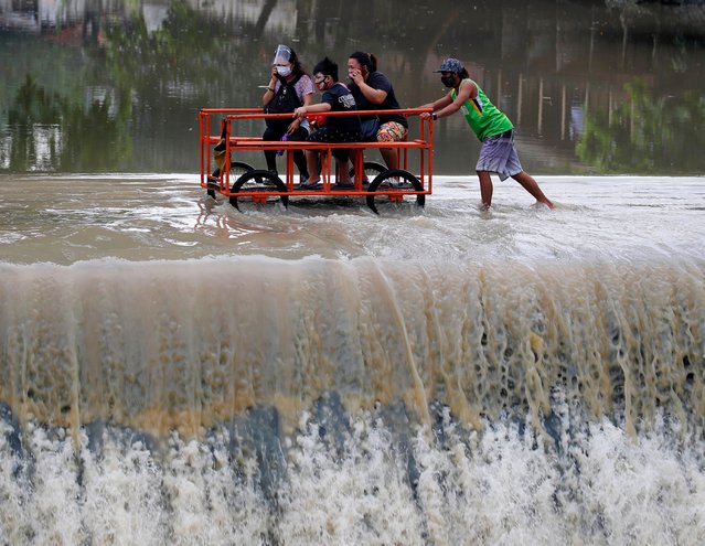
Villagers riding a rickshaw maneuver along an overflowing dam at the border between Cavite province and Las Pinas city, in Las Pinas, Philippines, 25 October 2020. According to Philippine Atmospheric Geophysical and Astronomical Services Administration (PAGASA), Typhoon Molave will make landfall in the evening of 25 October in southern Luzon island. An alert was issued to residents for possible floods and landslides. (Photo by Francis R Malasig/EPA/EFE)

Villagers riding a rickshaw maneuver along an overflowing dam at the border between Cavite province and Las Pinas city, in Las Pinas, Philippines, 25 October 2020. According to Philippine Atmospheric Geophysical and Astronomical Services Administration (PAGASA), Typhoon Molave will make landfall in the evening of 25 October in southern Luzon island. An alert was issued to residents for possible floods and landslides. (Photo by Francis R Malasig/EPA/EFE)
Details
28 Oct 2020 00:01:00