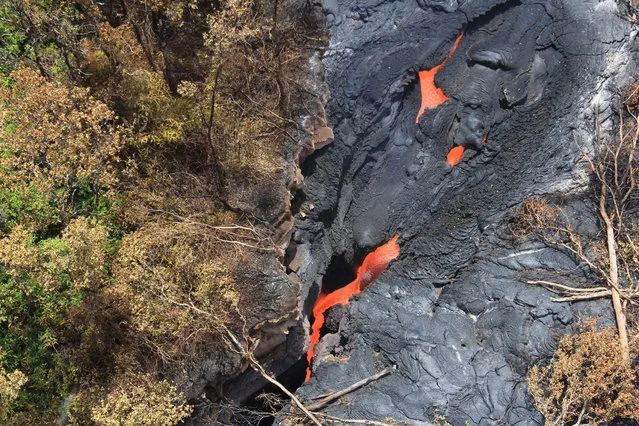
In this September 1, 2014 photo released by the U.S. Geological Survey, fluid lava streams from the June 27 lava flow from the Kilauea volcano in Pahoa, Hawaii. The June 27 lava flow is named for the date it began erupting from a new vent. The Hawaiian Volcano Observatory issued a warning Thursday, September 4, 2014 to a rural community in the path of a lava flow on Hawaii's Big Island, as the molten rock moved to within a mile of homes. Observatory scientists said lava from the Kilauea volcano could reach the Kaohe Homesteads in five to seven days if it continues advancing through cracks in the earth. (Photo by AP Photo/U.S. Geological Survey)
07 Sep 2014 12:47:00,post received
0 comments