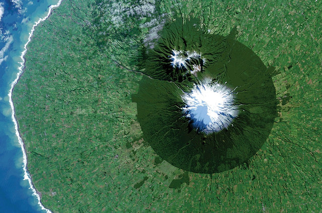
Egmont National Park in New Zealand with Mt. Taranaki at its center is seen in a Landsat 8 satellite image taken July 3, 2014 and released by NASA November 14, 2014. The image is from the book “Sanctuary: Exploring the World's Protected Areas from Space”, published by the Institute for Global Environmental Strategies with support from NASA, which was released this week. (Photo by Reuters/NASA/USGS)
16 Nov 2014 12:15:00,post received
0 comments