Loading...
Done
Plus Fours Routefinder - Worlds First Navigation System

Invented in 1920′s this could be world’s first navigation system. No satellites or digital screens were used in the making of this portable navigation system. Called Plus Fours Routefinder, this little invention was designed to be worn on your wrist, and the “maps” were printed on little wooden rollers which you would turn manually as you drove along.
Details
19 Mar 2014 15:14:00
Purev and Buyantogtokh enjoy the warmth of the fire in the snow in Altai Mountains, Mongolia, September 2016. (Photo by Joel Santos/Barcroft Images)

Purev and Buyantogtokh enjoy the warmth of the fire in the snow in Altai Mountains, Mongolia, September 2016. Navigate the snowy wilds of Mongolia with this nomadic reindeer herding family. Photographer Joel Santos dived 1000km into the depths of Northern Mongolia to visit the Ganbaa family near Khovsgol Lake. (Photo by Joel Santos/Barcroft Images)
Details
17 Dec 2016 08:05:00
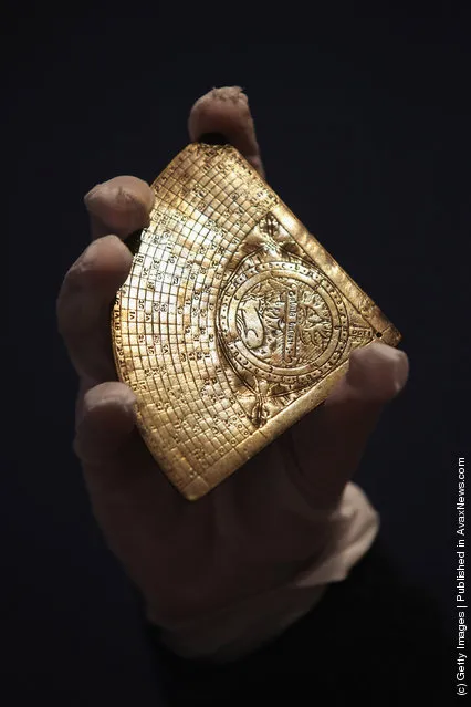
A rare 14th century time-telling device device in Bonhams auction house

A gallery assistant holds a rare 14th century time-telling device device in Bonhams auction house on December 9, 2011 in London, England. The instrument, which dates from 1396 and was discovered in a shed in Queensland, Australia, is due to be auctioned on December 13, 2011 and is expected to fetch 200,000 GBP. (Photo by Oli Scarff/Getty Images)
Details
10 Dec 2011 09:44:00
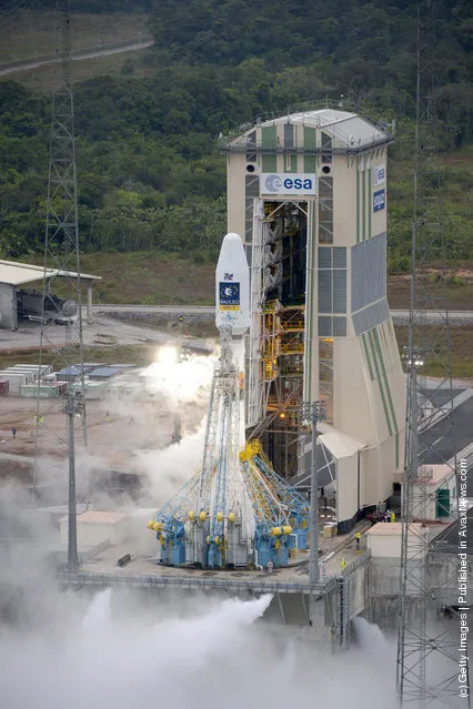
Soyuz VS01 rocket is lifts off at the European Spaceport in Kourou, French Guiana

Soyuz VS01 is lifts off at the European Spaceport on October 21, 2011 in Kourou, French Guiana. The Soyuz VS01 rocket is carrying the first two satellites of Europe's Galileo navigation satellite system into orbit. (Photo by Stephane Corvaja/ESA via Getty Images)
Details
22 Oct 2011 10:13:00
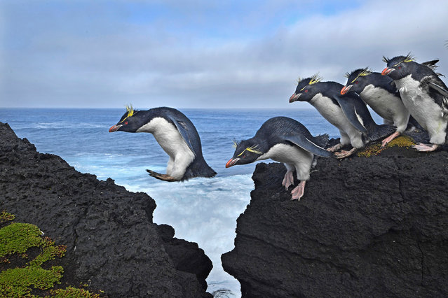
Rockhopper penguins live up to their name as they navigate the rugged coastline of Marion Island in the southern Indian Ocean. (Photo by Thomas P. Peschak)

Rockhopper penguins live up to their name as they navigate the rugged coastline of Marion Island in the southern Indian Ocean. (Photo by Thomas P. Peschak)
Details
18 Mar 2018 00:03:00
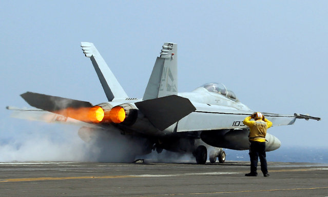
A U.S. Navy F18 fighter jet takes off from aircraft carrier USS Carl Vinson during a FONOPS (Freedom of Navigation Operation Patrol) in South China Sea, March 3, 2017. (Photo by Erik De Castro/Reuters)

A U.S. Navy F18 fighter jet takes off from aircraft carrier USS Carl Vinson during a FONOPS (Freedom of Navigation Operation Patrol) in South China Sea, March 3, 2017. The U.S. military took journalists Friday to the carrier on routine patrol off the disputed South China Sea, sending a signal to China and American allies of its resolve to ensure freedom of navigation and overflight in one of the world's security hotspots. (Photo by Erik De Castro/Reuters)
Details
06 Mar 2017 00:01:00
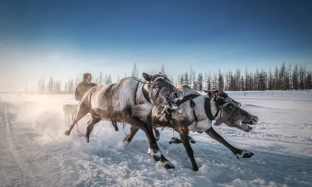
Take me away, deer, Russia. The Nenet people of Arctic Russia use reindeer and sledges as a prime mode of transport. The animals’ navigational ability means that in severe conditions they are sometimes the only hope of survival. (Photo by Kamil Nureev/Smithsonian Photo Contest)

Take me away, deer, Russia. The Nenet people of Arctic Russia use reindeer and sledges as a prime mode of transport. The animals’ navigational ability means that in severe conditions they are sometimes the only hope of survival. (Photo by Kamil Nureev/Smithsonian Photo Contest)
Details
06 Mar 2017 00:05:00
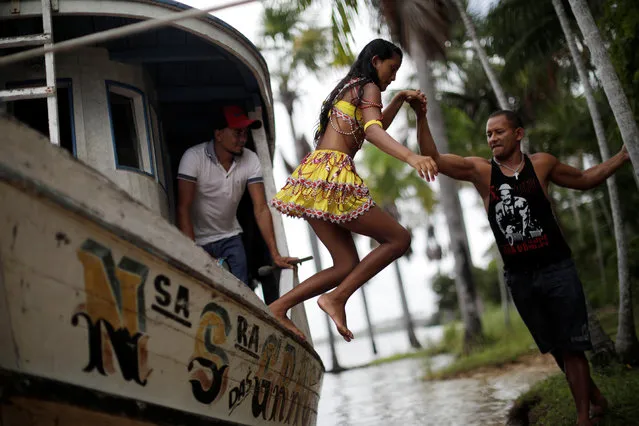
A member of the “Bloco Ultima Hora” group gets off a boat during Carnival of the Waters, where costumed and colorful boats navigate the river Tentem, around the islands near the city of Cameta, Brazil on February 8, 2018. (Photo by Ueslei Marcelino/Reuters)

A member of the “Bloco Ultima Hora” group gets off a boat during Carnival of the Waters, where costumed and colorful boats navigate the river Tentem, around the islands near the city of Cameta, Brazil on February 8, 2018. (Photo by Ueslei Marcelino/Reuters)
Details
14 Feb 2018 00:02:00