Loading...
Done
Baldwin Street - The World's Steepest Street

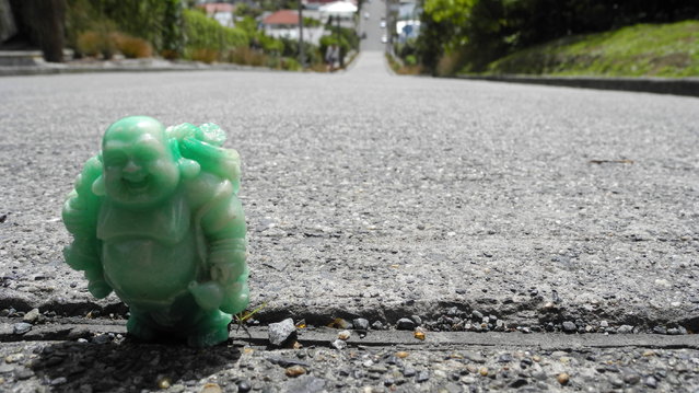
Baldwin Street, in Dunedin, New Zealand, is considered the world's steepest residential street. It is located in the residential suburb of North East Valley, 3.5 kilometres (2.2 mi) northeast of Dunedin's city centre.
Details
19 Jan 2014 15:26:00
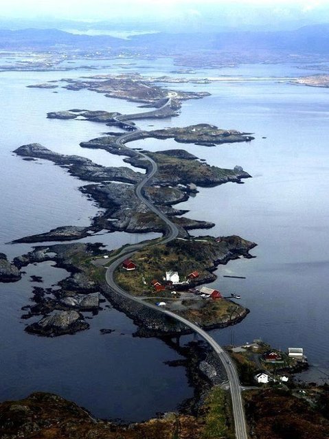
The Atlantic Road, Norway

The Atlantic Ocean Road or the Atlantic Road (Norwegian: Atlanterhavsveien) is a 8.3-kilometer (5.2 mi) long section of County Road 64 that runs through an archipelago in Eide and Averøy in Møre og Romsdal, Norway. It passes by Hustadvika, an unsheltered part of the Norwegian Sea, connecting the island of Averøy with the mainland and Romsdalshalvoya peninsula. It runs between the villages of Karvag on Averoy and Vevang in Eida. It is built on several small islands and skerries, which are connected by several causeways, viaducts and eight bridges – the most prominent being Storseisundet Bridge.
Details
18 Jan 2014 11:42:00
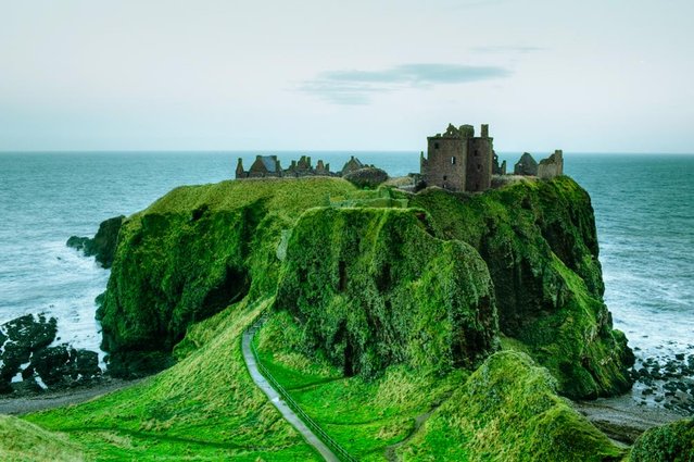
Dunnottar Castle In Scottish

Dunnottar Castleis a ruined medieval fortress located upon a rocky headland on the north-east coast of Scotland, about 3 kilometres (1.9 mi) south of Stonehaven. The surviving buildings are largely of the 15th and 16th centuries, but the site is believed to have been fortified in the Early Middle Ages. Dunnottar has played a prominent role in the history of Scotland through to the 18th-century Jacobite risings because of its strategic location and the strength of its situation. Dunnottar is best known as the place where the Honours of Scotland, the Scottish crown jewels, were hidden from Oliver Cromwell's invading army in the 17th century. The property of the Keiths from the 14th century, and the seat of the Earl Marischal, Dunnottar declined after the last Earl forfeited his titles by taking part in the Jacobite rebellion of 1715. The castle was restored in the 20th century and is now open to the public.
Details
13 Jan 2014 11:31:00
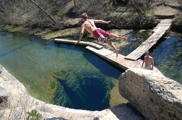
Dive The Deadly Jacob’s Well In Texas

Jacob's Well is a perennial karstic spring in the Texas Hill Country flowing from the bed of Cypress Creek, located northwest of Wimberley, Texas. The twelve foot (four meter) diameter mouth of the spring serves as a popular swimming spot for the local land owners whose properties adjoin Cypress Creek. From the opening in the creek bed, Jacob's Well cave descends vertically for about thirty feet (ten meters), then continues downward at an angle through a series of silted chambers separated by narrow restrictions, finally reaching a depth of one hundred and twenty feet (forty meters). Until the modern era, the Trinity Aquifer-fed natural artesian spring gushed water from the mouth of the cave, with a measured flow in 1924 of one hundred and seventy gallons per second (six hundred and forty liters per second) discharging six feet (two meters) into the air. The spring is the greatest source of water recharging the Edwards Aquifer.
Details
03 Jan 2014 08:20:00
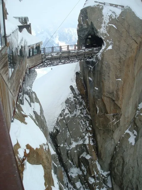
Aiguille du Midi In The French Alps

The name “Aiguille du Midi” translates literally as “Needle of the Noon” or “Needle of the South”. It gets its name from its tapered form and from its position when viewed from Chamonix: it approximately indicates noon when the sun passes over its summit.
Details
27 Dec 2013 10:52:00
Guatape Rock In Colombia

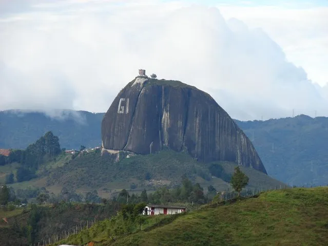
Guatapé is a town and municipality in Antioquia Department, Colombia. Part of the subregion of Eastern Antioquia. Guatapé is located in the outskirts of Medellín, bordering a reservoir created by the Colombian government for a hydro-electric dam, built in the late 1960s. This quaint town is the gathering place for "Las Vegas", or the small farms of the area. It is also a growing area of recreation for citizens of Medellín, and aims to be a tourist destination for foreign travellers.
Guatapé was founded in 1811, by the Spaniard Don Francisco Giraldo y Jimenez. The name "Guatapé", comes from the Quechua language, related to "stones and water". The area was visited by the conquistadors circa 1551.
Details
25 Dec 2013 09:18:00
The Giant Hand of Atacama

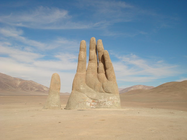
The Mano de Desierto is a large-scale sculpture of a hand located in the Atacama Desert in Chile, 75 km to the south of the city of Antofagasta, on the Panamerican Highway. The nearest point of reference is the “Ciudad Empresarial La Negra” (La Negra Business City). The sculpture was constructed by the Chilean sculptor Mario Irarrázabal at an altitude of 1,100 meters above sea level. Irarrázabal used the human figure to express emotions like injustice, loneliness, sorrow and torture. Its exaggerated size is said to emphasize human vulnerability and helplessness. The work has a base of iron and cement, and stands 11 metres (36 ft) tall. Funded by Corporación Pro Antofagasta, a local booster organization, the sculpture was inaugurated on March 28, 1992.
Details
21 Dec 2013 10:18:00
Broadway Tower In English

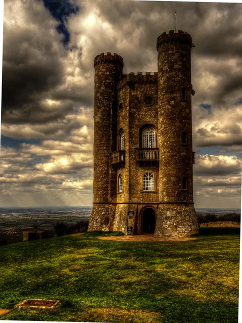
Broadway Tower is a folly located on Broadway Hill, near the village of Broadway, in the English county of Worcestershire, at the second highest point of the Cotswolds after Cleeve Hill. Broadway Tower's base is 1,024 feet (312 metres) above sea level. The tower itself stands 55 feet (17 metres) high. The “Saxon” tower was designed by James Wyatt in 1794 in the form of a castle, and built for Lady Coventry in 1799. The tower was built on a “beacon” hill, where beacons were lit on special occasions. Lady Coventry wondered if a beacon on this hill could be seen from her house in Worcester – approximately 22 miles (35 km) away – and sponsored the construction of the folly to find out. The beacon could be seen clearly.
Details
19 Dec 2013 10:06:00