|
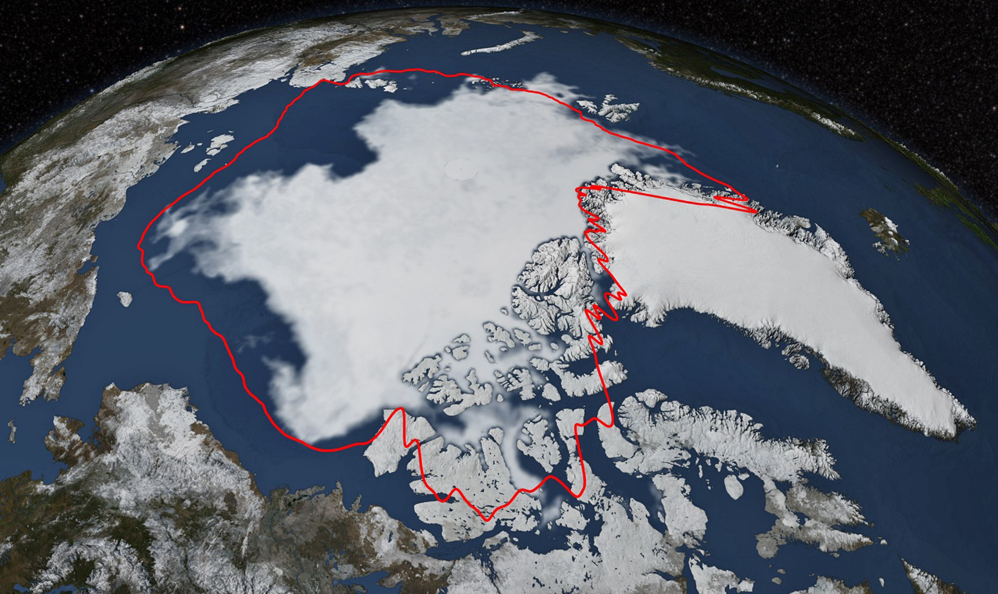
Arctic sea ice hits its annual minimum as seen in this satellite picture provided by the Japan Aerospace Exploration Agency GCOM-W1 satellite and NASA taken September 17, and released September 22, 2014. The red line in this image shows the 1981-2010 average minimum extent. Over the 2014 summer, Arctic sea ice melted back from its maximum extent reached in March to a coverage area of 1.94 million square miles (5.02 million square kilometers), according to analysis from NASA and NASA-supported National Snow and Ice Data Center (NSIDC) scientists. This year's minimum extent is similar to last year's and below the 1981-2010 average of 2.40 million square miles (6.22 million square km). (Photo by Reuters/NASA/Goddard Scientific Visualization Studio)
|