Loading...
Done
Corinth Canal

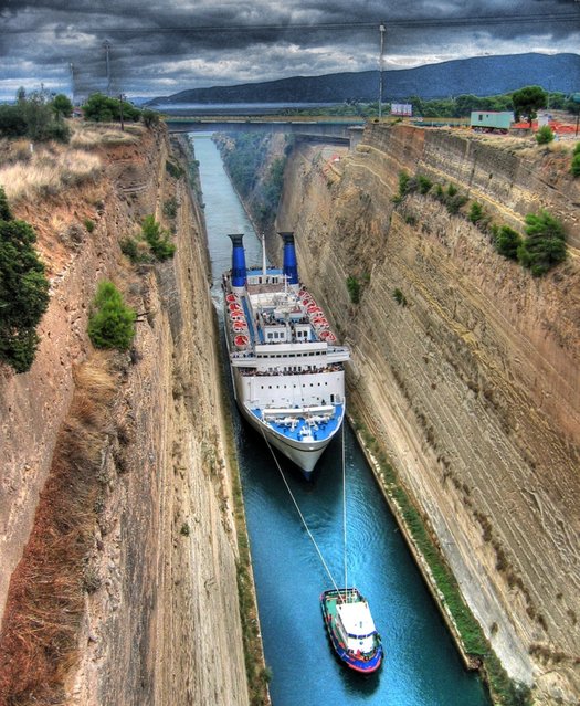
The Corinth Canal is a canal that connects the Gulf of Corinth with the Saronic Gulf in the Aegean Sea. It cuts through the narrow Isthmus of Corinth and separates the Peloponnesian peninsula from the Greek mainland, thus effectively making the former an island. The builders dug the canal through the Isthmus at sea level; no locks are employed. It is 6.4 kilometres (4.0 mi) in length and only 21.3 metres (70 ft) wide at its base, making it unpassable for most modern ships. It now has little economic importance.

Details
12 Mar 2013 12:21:00
Marcello Di Francesco took third place in the Macro category for this picture of an Emperor shrimp (Periclimenes imperator), taken in the waters near Indonesia's Ambon Island

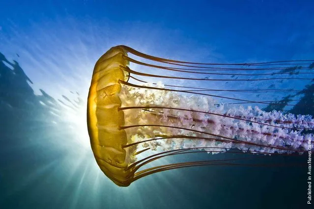
More than 700 underwater images were submitted for the 2012 Annual Underwater Photography Contest, hosted by the University of Miami's Rosenstiel School of Marine & Atmospheric Science. This year, for the first time, the University of Miami set up a “Fan Favorite” category for its underwater photo competition. Internet users could vote for their favorite among five pictures. Todd Aki's photo of a jellyfish took the prize, snaring 599 of the 1,221 votes cast. (Photo by Todd Aki)
Details
22 Apr 2012 12:47:00
Underground River

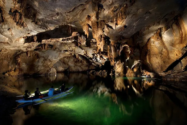
The Puerto Princesa Subterranean River National Park is located about 50 kilometres (30 mi) north of the city centre of Puerto Princesa, Palawan, Philippines. The river is also called Puerto Princesa Underground River. The national park is located in the Saint Paul Mountain Range on the northern coast of the island. It is bordered by St. Paul Bay to the north and the Babuyan River to the east. The City Government of Puerto Princesa has managed the National Park since 1992. The park is also known as St. Paul's Subterranean River National Park, or St. Paul Underground River. The entrance to the Subterranean River is a short hike from the town of Sabang.
Details
16 Jul 2012 11:37:00
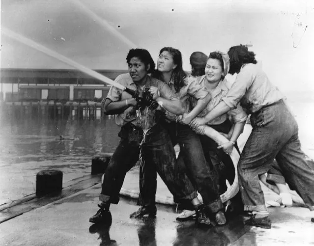
Women fire fighters directing a hose after the Japanese attack on the US naval base at Pearl Harbour (Pearl Harbor). (Photo by Three Lions/Getty Images)

“Pearl Harbor, known to Hawaiians as Puʻuloa, is a lagoon harbor on the island of Oʻahu, Hawaiʻi, west of Honolulu. Much of the harbor and surrounding lands is a United States Navy deep-water naval base. It is also the headquarters of the U.S. Pacific Fleet. The attack on Pearl Harbor by the Empire of Japan on December 7, 1941, brought the United States into World War II”. – Wikipedia

Photo: Women fire fighters directing a hose after the Japanese attack on the US naval base at Pearl Harbour (Pearl Harbor). (Photo by Three Lions)


Details
07 Dec 2012 09:01:00


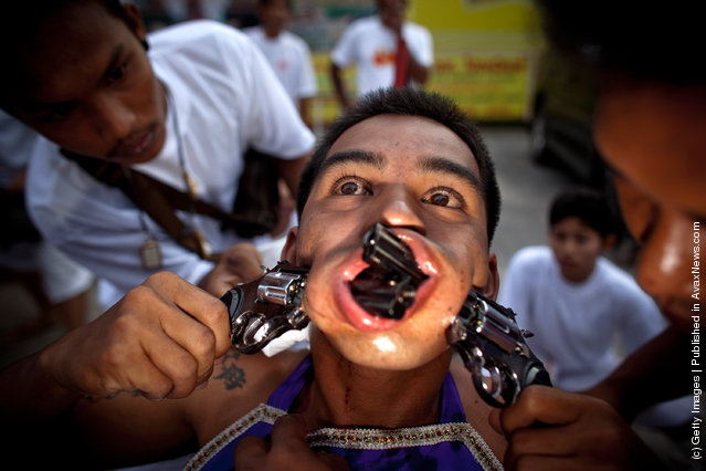
A devotee of the Chinese shrine of Samkong, pierces his cheeks with toy guns during a procession of Vegetarian Festival on October 11, 2010 in Phuket, Thailand. Ritual Vegetarianism in Phuket Island traces it roots back to the early 1800's. The festival begins on the first evening of the ninth lunar month and lasts for nine days. Participants in the festival perform acts of body piercing as a means of shifting evil spirits from individuals onto themselves and bring the community good luck. (Photo by Athit Perawongmetha/Getty Images)
Details
09 Jul 2011 11:55:00


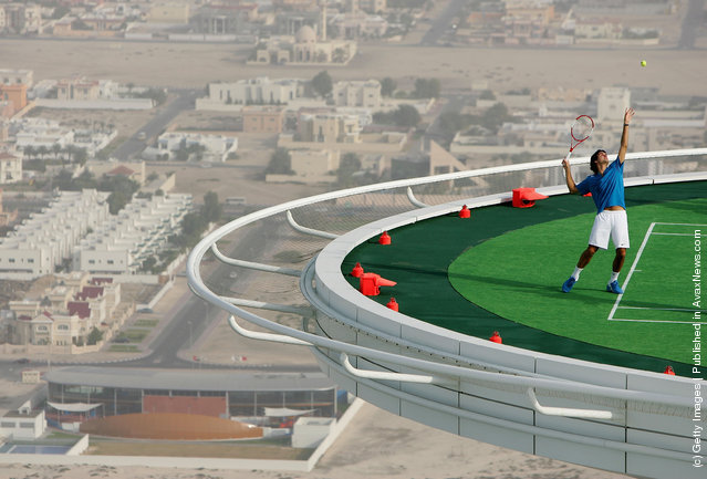
In preparation for the Dubai Duty Free Men's Open, Andre Agassi and Roger Federer of Switzerland, couldn't resist the temptation to have a friendly “hit” on the world's most unique tennis court, the Helipad of the Burj Al Arab, the world's most luxurious hotel. Standing 321 metres high on a man made island, the majestic Burj Al Arab is without doubt the most recognizable hotel in the world. The hotel's helipad, which is situated 211 metres high covers a surface area of 415 square metres. The pictures were taken on February 22, 2005, in Dubai, United Arab Emirates. (Photo by Getty Images for Dubai Duty Free)
Details
18 Jul 2011 13:40:00

A handout image provided by the New Zealand Defence Force shows aid supplies being unloaded by Fijian soldiers from an Royal New Zealand Airforce C-130 Hercules plane in Suva, Fiji, 23 February 2016. Tool kits, generators, ration packs, water containers and chainsaws make up part of the New Zealand relief following Tropical Cyclone Winston. The death toll from the cyclone that hit Fiji over the weekend climbed to 29, local media reported ON 23 February. (Photo by Sam Shepherd/EPA/NZ Defence Force)

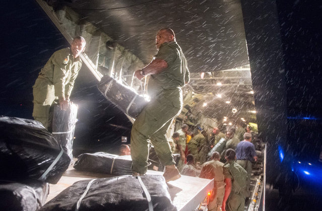
A handout image provided by the New Zealand Defence Force shows aid supplies being unloaded by Fijian soldiers from an Royal New Zealand Airforce C-130 Hercules plane in Suva, Fiji, 23 February 2016. Tool kits, generators, ration packs, water containers and chainsaws make up part of the New Zealand relief following Tropical Cyclone Winston. The death toll from the cyclone that hit Fiji over the weekend climbed to 29, local media reported ON 23 February. Cyclone Winston, the most powerful storm in Fiji's history, battered the country's main island of Viti Levu and other smaller surrounding islands on Saturday, the Fiji Broadcasting Corporation reported. (Photo by Sam Shepherd/EPA/NZ Defence Force)
Details
24 Feb 2016 12:56:00
“Lofoten Glow”. I was desperately searching a good sunrise spot this particular morning. Normally Storvatnet Lake is completely covered in snow, so you can only imagine my surprise when I saw these crazy ice formations almost being shot out of the frozen lake. I put my crampons on and took a big risk walking out. Photo location: Storvatnet, Lofoten Islands in Northern Norway. (Photo and caption by Stian Klo/National Geographic Photo Contest)

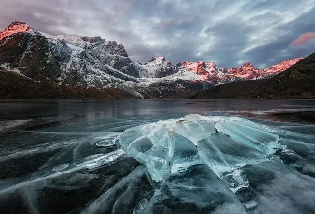
“Lofoten Glow”. I was desperately searching a good sunrise spot this particular morning. Normally Storvatnet Lake is completely covered in snow, so you can only imagine my surprise when I saw these crazy ice formations almost being shot out of the frozen lake. I put my crampons on and took a big risk walking out. I could hear the ice cracking underneath my feet, and when you’re all alone in a fjord/canyon like this – the cracks are echoed and sound really frightening. Was it worth it? I sure think so! Photo location: Storvatnet, Lofoten Islands in Northern Norway. (Photo and caption by Stian Klo/National Geographic Photo Contest)
Details
08 Apr 2014 09:40:00