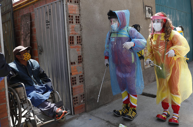
Clowns Perlita and Tapetito, wearing protective gear amid the new coronavirus pandemic, speak with resident Enrique Zeballos as they arrive to disinfect his home free of charge, in El Alto, Bolivia, Friday, September 11, 2020. The lack of traditional employment for the clowns due to the pandemic has led them towards other avenues of making money. But for people with limited income they provide their disinfection services free of charge. (Photo by Juan Karita/AP Photo)
13 Sep 2020 00:07:00,post received
0 comments