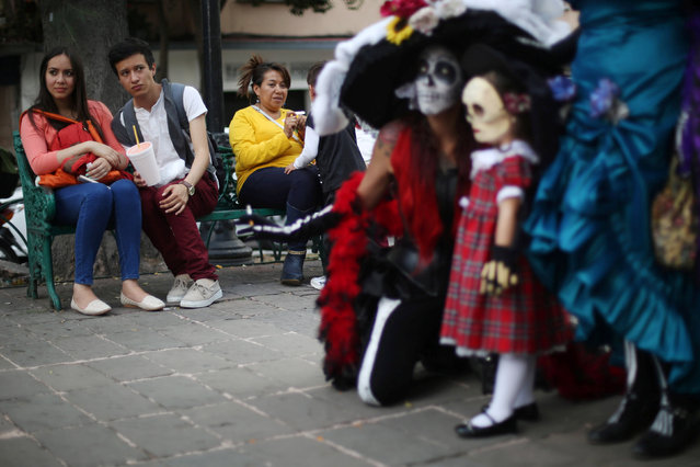
People watch participants, whose faces are painted as popular Mexican figure “Catrina”, during the annual Catrina Fest, part of Day of the Dead celebrations, in Mexico City, Mexico, November 2, 2016. (Photo by Edgard Garrido/Reuters)
A white Bengal tiger cub born in captivity is seen during a press presentation at Huachipa's private zoo in Lima, Peru, March 16, 2016. (Photo by Mariana Bazo/Reuters)
Men and Women dressed as zombies walk through Hyde Park on February 25, 2012 in Sydney, Australia. The annual Zombie Walk raises money for the Brain Foundation and this year teamed up with FX channel in promotion of “The Walking Dead” series premiering in Australia this weekend. (Photo by Brendon Thorne/Getty Images)
Actress with the Donbass Opera Theatre prepares to perform Eugene Onegin in Donetsk, Ukraine, Saturday, February 7, 2015. For the few dozen spectators that turn up, the weekly performances at the city's opera house serve as a respite from the war raging outside between Russian-backed separatists and Ukrainian government forces. (Photo by Petr David Josek/AP Photo)
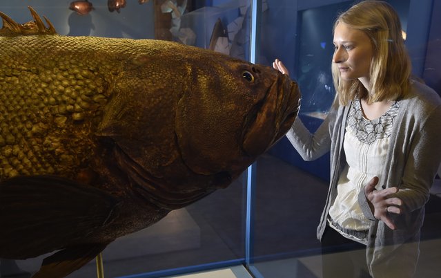
Museum employee Victoria views a giant grouper fish specimen at the Natural History Museum in west London March 25, 2015. It forms part of a new exhibition, “Coral Reefs: Secret Cities of the Sea”, featuring a panoramic virtual dive and over 250 specimens from the Museum's coral, fish and marine invertebrate collection, which opens on March 27. (Photo by Toby Melville/Reuters)
Dargavs is a small necropolis outside the village of Dargavs in North Ossetia-Alania. It comprises 99 different tombs and crypts. It is often called city of the dead. Some sources say the oldest of the crypts dates back to the 12th century, though others say the oldest crypt dates back to 14th century and some say it dates to the 16th century. At the back of the complex there is a tower, though the top of it is destroyed.
From Britain to China to Mali, new maps showing travel times to the nearest urban centre reveal huge differences between countries. Using Open Street Map and Google, a University of Oxford team have created a visual breakdown that suggests major inequalities when it comes to commuting. Here: China. The dataset used for China was unique as it relied solely on Open Street Map, due to restrictions on accessing Google data. The population is densely concentrated in the east and accessibility is increased, whereas rural provinces in the west remain remote. (Photo by Daniel Weiss/Jennifer Rozier/Malaria Atlas Project/University of Oxford)