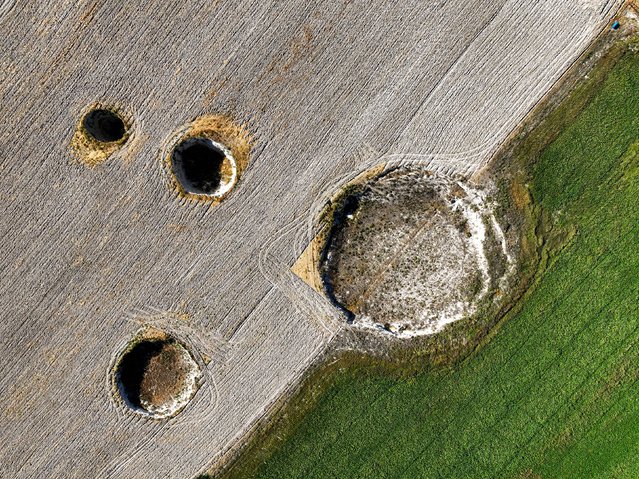
An aerial view of sinkholes (obruk), caused by some form of collapse of the surface layer, in Konya, Turkiye on September 17, 2024. Many sinkholes are observed in the fields of Eseli Plateau located within the borders of Resadiye Neighborhood in the north-west of Karapinar district, where sinkhole formation has increased rapidly in recent years. (Photo by Serhat Cetinkaya/Anadolu via Getty Images)
09 Oct 2024 04:18:00,post received
0 comments