
28 May 2013 11:56:00,post received
0 comments
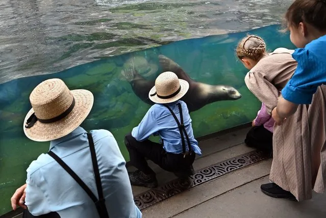
Visitors watch a California sea lion at the Smithsonian National Zoological Park on Thursday May 26, 2022 in Washington, DC. (Photo by Matt McClain/The Washington Post)
10 Jun 2022 04:33:00,post received
0 comments

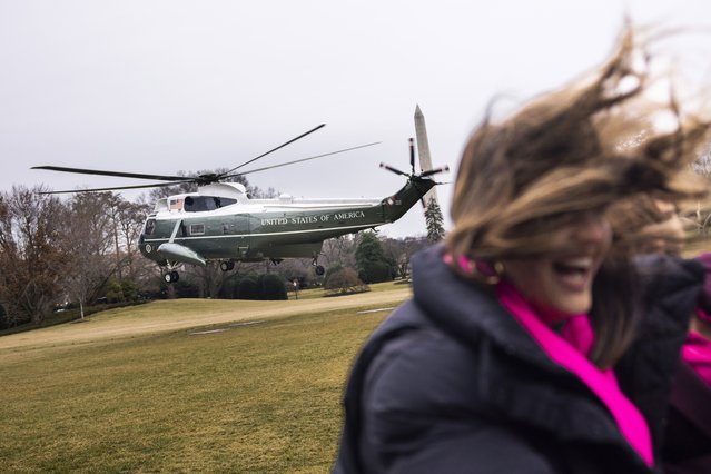
Marine One with US President Joe Biden onboard takes off from the South Lawn of the White House in Washington, DC, on April 16, 2024. Biden is travelling to Scranton, Pennsylvania. (Photo by Drew Angerer/AFP Photo)
25 Apr 2024 03:47:00,post received
0 comments
US President Joe Biden departs the White House for California, where he will review damage from recent flooding, in Washington, DC, USA, 19 January 2023. (Photo by Jim Lo Scalzo/EPA/EFE)
24 Jan 2023 04:56:00,post received
0 comments


From Britain to China to Mali, new maps showing travel times to the nearest urban centre reveal huge differences between countries. Using Open Street Map and Google, a University of Oxford team have created a visual breakdown that suggests major inequalities when it comes to commuting. Here: China. The dataset used for China was unique as it relied solely on Open Street Map, due to restrictions on accessing Google data. The population is densely concentrated in the east and accessibility is increased, whereas rural provinces in the west remain remote. (Photo by Daniel Weiss/Jennifer Rozier/Malaria Atlas Project/University of Oxford)
12 Jan 2018 06:43:00,post received
0 comments
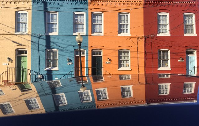
A group of colorful row houses are reflected on to the top of a black car parked on 3600 block of N street in the Georgetown section of Washington DC, February 16, 2017. (Photo by John McDonnell/The Washington Post)
13 May 2017 09:28:00,post received
0 comments
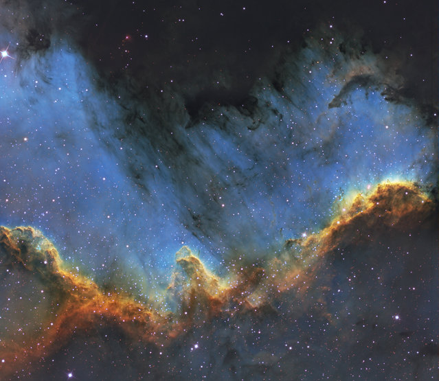
Amateur astronomer Bill Snyder has been involved with astrophotography since 2007. Photo: The Cygnus Wall is in the southern area of NGC7000 also known as the North America Nebula. It is approximately 1800 light years from Earth, and is in the constellation Cygnus. The Wall is an energized shock front and contains the most concentrated star formations in the nebula. The size of the North America Nebula is about 4 full moons. (Photo and caption by Bill Snyder)
30 Oct 2013 09:15:00,post received
0 comments