Loading...
Done
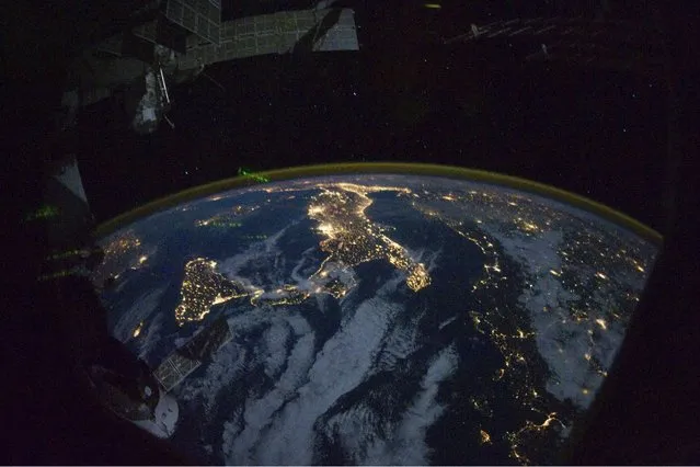
This image provided by NASA shows parts of Europe and Africa very easily recognizable in this night time image shot by one of the Expedition 25 crew members aboard the International Space Station flying 220 miles above Earth on Thursday Oct. 28, 2010. The view “looks” northward over Sicily and the “boot” of Italy, with the Mediterranean Sea representing most of the visible water in the view and the Adriatic Sea to the right of center. Tunisia is partially visible at left. Part of a docked Russian spacecraft and other components of the ISS are in the foreground. (Photo by AP photo/NASA)

This image provided by NASA shows parts of Europe and Africa very easily recognizable in this night time image shot by one of the Expedition 25 crew members aboard the International Space Station flying 220 miles above Earth on Thursday October 28, 2010. The view “looks” northward over Sicily and the “boot” of Italy, with the Mediterranean Sea representing most of the visible water in the view and the Adriatic Sea to the right of center. Tunisia is partially visible at left. Part of a docked Russian spacecraft and other components of the ISS are in the foreground. (Photo by AP Photo/NASA)
Details
11 May 2013 12:29:00
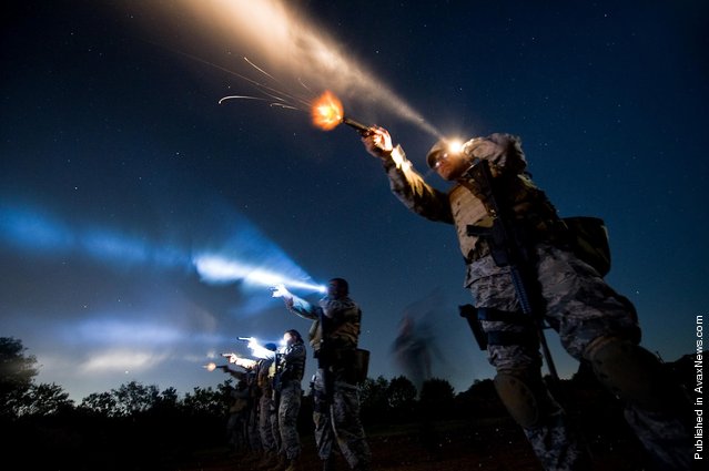
Tech. Sgt. Milo Hinson, 3rd Combat Camera Squadron, uses a flashlight while shooting a Berretta 9mm during the night-fire portion of Advance Weapons, Tactics and Techniques training in San Antonio. During night-fire training, airmen learn how to tactically illuminate targets with flashlights and practice using night vision goggles

Tech. Sgt. Milo Hinson, 3rd Combat Camera Squadron, uses a flashlight while shooting a Berretta 9mm during the night-fire portion of Advance Weapons, Tactics and Techniques training in San Antonio. During night-fire training, airmen learn how to tactically illuminate targets with flashlights and practice using night vision goggles. (Photo by Staff Sgt. Jonathan Snyder/U.S. Air Force). 2011
Details
12 Apr 2012 12:53:00
Sepak Takraw – ISTAF Super Series Korea 2014-15 – Gunsan City, South Korea April 26, 2015: Thailand's Fueangfa (L) in action during the final. (Photo by Jeremy Lee/Reuters)

Sepak Takraw – ISTAF Super Series Korea 2014-15 – Gunsan City, South Korea April 26, 2015: Thailand's Fueangfa (L) in action during the final. (Photo by Jeremy Lee/Reuters)
Details
02 May 2015 14:26:00
A trainer tries to convince a dog to jump over an obstacle during the Dog Olympic Games in Rio de Janeiro, Brazil, Sunday, September 18, 2016. Owner of the dog park and organizer of the animal event Marco Antonio Toto says his goal is to socialize humans and their pets while celebrating sports. (Photo by Silvia Izquierdo/AP Photo)

A trainer tries to convince a dog to jump over an obstacle during the Dog Olympic Games in Rio de Janeiro, Brazil, Sunday, September 18, 2016. Owner of the dog park and organizer of the animal event Marco Antonio Toto says his goal is to socialize humans and their pets while celebrating sports. (Photo by Silvia Izquierdo/AP Photo)
Details
19 Sep 2016 09:05:00
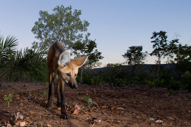
The maned wolf is among the large mammals in the Brazilian Cerrado that are threatened by the increasing conversion of grasslands into farmland for grazing and growing crops. (Photo by Ben Cranke/Nature Picture Library/Alamy Stock Photo)

Global wildlife populations will decline by 67% by 2020 unless urgent action is taken to reduce human impact on species and ecosystems, warns the biennial Living Planet Index report from WWF (World Wide Fund for Nature) and ZSL (Zoological Society of London). From elephants to eels, here are some of the wildlife populations most affected by human activity. Here: The maned wolf is among the large mammals in the Brazilian Cerrado that are threatened by the increasing conversion of grasslands into farmland for grazing and growing crops. (Photo by Ben Cranke/Nature Picture Library/Alamy Stock Photo)
Details
28 Oct 2016 10:47:00
An aerial view shows people touring between the large-scale ice sculptures at the 18th Harbin Ice and Snow World during its trial run opening to public in Harbin city, Heilongjiang province, China, 21 December 2016. Some 180,000 cubic meters of ice and 150,000 cubic meters of snow were used to build the 800,000-square-meter ice wonderland. The 33rd Harbin International Ice and Snow Festival will kick off on 05 January 2017 that will last about three months. (Photo by Tian Weitao/EPA)

An aerial view shows people touring between the large-scale ice sculptures at the 18th Harbin Ice and Snow World during its trial run opening to public in Harbin city, Heilongjiang province, China, 21 December 2016. Some 180,000 cubic meters of ice and 150,000 cubic meters of snow were used to build the 800,000-square-meter ice wonderland. The 33rd Harbin International Ice and Snow Festival will kick off on 05 January 2017 that will last about three months. (Photo by Tian Weitao/EPA)
Details
23 Dec 2016 08:04:00
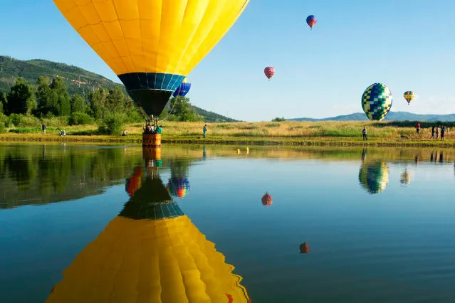
A balloon dips into Bald Eagle lake during the 36th Annual Hot Air Balloon Rodeo in Steamboat Springs, Colorado on July 9, 2017. (Photo by Jason Connolly/AFP Photo)

A balloon dips into Bald Eagle lake during the 36th Annual Hot Air Balloon Rodeo in Steamboat Springs, Colorado on July 9, 2017. (Photo by Jason Connolly/AFP Photo)
Details
21 Aug 2017 07:30:00
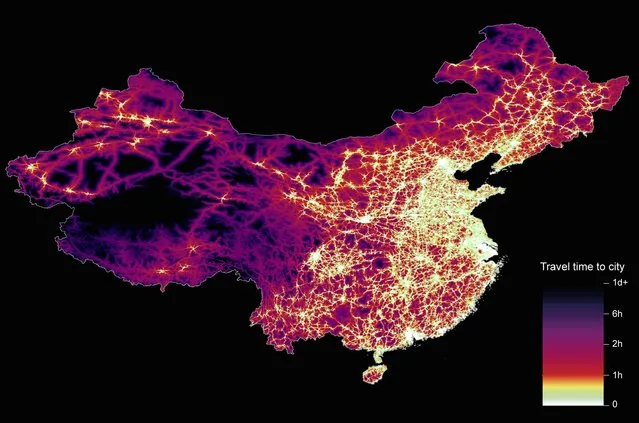
From Britain to China to Mali, new maps showing travel times to the nearest urban centre reveal huge differences between countries. Using Open Street Map and Google, a University of Oxford team have created a visual breakdown that suggests major inequalities when it comes to commuting. Here: China. The dataset used for China was unique as it relied solely on Open Street Map, due to restrictions on accessing Google data. The population is densely concentrated in the east and accessibility is increased, whereas rural provinces in the west remain remote. (Photo by Daniel Weiss/Jennifer Rozier/Malaria Atlas Project/University of Oxford )

From Britain to China to Mali, new maps showing travel times to the nearest urban centre reveal huge differences between countries. Using Open Street Map and Google, a University of Oxford team have created a visual breakdown that suggests major inequalities when it comes to commuting. Here: China. The dataset used for China was unique as it relied solely on Open Street Map, due to restrictions on accessing Google data. The population is densely concentrated in the east and accessibility is increased, whereas rural provinces in the west remain remote. (Photo by Daniel Weiss/Jennifer Rozier/Malaria Atlas Project/University of Oxford)
Details
12 Jan 2018 06:43:00