Two dancers pass each other as they compete in a heat during the All Scotland Championships in Irish Dancing at the Royal Concert Hall in Glasgow, Scotland. The championships attract over 2000 dancers from more than 300 dance schools, from countires such as North America, South Africa, Australia and Russia. (Photo by David Moir/Reuters)
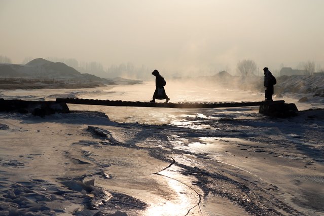
A view of the silhouettes of people, passing across a bridge over the frozen Lake Murat, trying to go on their daily lives despite the cold during winter season in Agri, Turkiye on February 10, 2025. (Photo by Abdullah Soylemez/Anadolu via Getty Images)
Caroline Wozniacki of Denmark serves to Alisa Kleybanova of Russia during the BNP Paribas Open at the Indian Wells Tennis Garden on March 15, 2011 in Indian Wells, California. (Photo by Matthew Stockman/Getty Images)
From Britain to China to Mali, new maps showing travel times to the nearest urban centre reveal huge differences between countries. Using Open Street Map and Google, a University of Oxford team have created a visual breakdown that suggests major inequalities when it comes to commuting. Here: China. The dataset used for China was unique as it relied solely on Open Street Map, due to restrictions on accessing Google data. The population is densely concentrated in the east and accessibility is increased, whereas rural provinces in the west remain remote. (Photo by Daniel Weiss/Jennifer Rozier/Malaria Atlas Project/University of Oxford)
Competitors in the Big Air challenge at the Proryv-2016 festival of extreme sports in Moscow, Russia on March 27, 2016. (Photo by Xinhua/Rex Features/Shutterstock)
Children are engulfed by foam during the Bubble Show event in Beijing, China, Sunday, June 26, 2016. Thousands of residents enjoy colored foam churned out by machines along a running track at the event designed for children and parents' interaction. (Photo by Ng Han Guan/AP Photo)