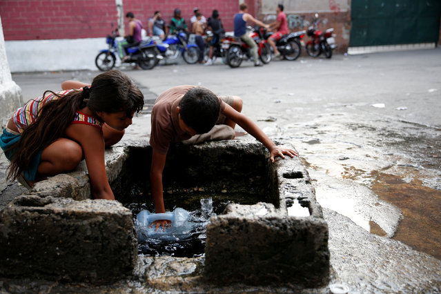
Children fill plastic containers with water from a well on a street, close to a neighbourhood called “The Tank” in the slum of Petare in Caracas, Venezuela, March 17, 2016. Although their nation has one of the world's biggest hydroelectric dams and vast rivers like the fabled Orinoco, Venezuelans are still suffering water and power cuts most days. The problems with stuttering services have escalated in the last few weeks: yet another headache for the OPEC nation's 30 million people already reeling from recession, the world's highest inflation rate, and scarcities of basic goods. President Nicolas Maduro blames a drought, while the opposition blames government incompetence. (Photo by Carlos Garcia Rawlins/Reuters)
08 May 2016 11:15:00,post received
0 comments