Loading...
Done
The Majesty Of Norway's Dalsnibba Mountain

Dalsnibba is a mountain in Stranda Municipality in More og Romsdal county, Norway. It is located at the end of the Geiranger valley, about 21 kilometres (13 mi) south of the village of Geiranger and the Geirangerfjorden. The 2-square-kilometre (0.77 sq mi) lake Djupvatnet lies directly to the southeast of the mountain. The mountain is located very near the county border with both Oppland and Sogn og Fjordane counties, in the southeastern part of Møre og Romsdal county.
Details
24 Jul 2013 10:28:00
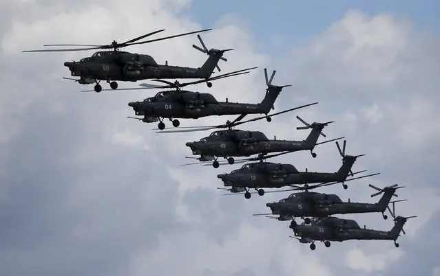
Russian Mi-28N from the Berkuty (Golden Eagles) helicopter display team fly in formation during the “Aviadarts” military aviation competition at the Dubrovichi range near Ryazan, Russia, August 2, 2015. (Photo by Maxim Shemetov/Reuters)

Russian Mi-28N from the Berkuty (Golden Eagles) helicopter display team fly in formation during the “Aviadarts” military aviation competition at the Dubrovichi range near Ryazan, Russia, August 2, 2015. The aircraft started dipping down due to back propeller failure and crashed, killing one of two pilots, according to a Reuters photographer and official representatives of the competition. The aviation contest is part of the International Army Games, which are held in Russia from the 1st till the 15th of August with participants from 17 countries, according to organizers. (Photo by Maxim Shemetov/Reuters)
Details
03 Aug 2015 11:46:00
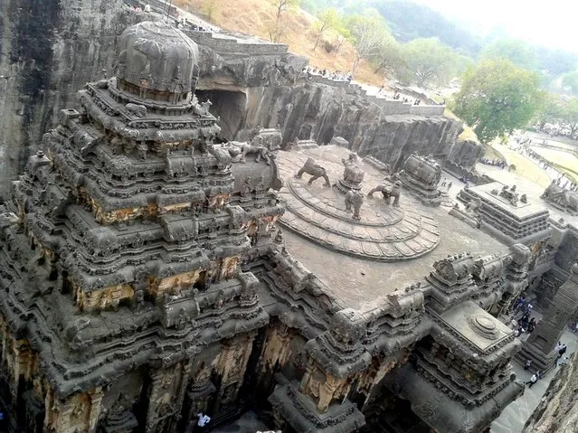
Ellora Cave Temples

Ellora is an archaeological site, 29 km (18 mi) North-West of the city of Aurangabad in the Indian state of Maharashtra built by the Rashtrakuta dynasty. It is also known as Elapura (in the Rashtrakuta literature-Kannada).
Details
06 May 2014 14:08:00
In this Friday, March 28, 2014 photo, singers of the Moranbong Band, Jong Su Hyang, foreground, and  Pak Mi Kyong, left perform on their stage in Pyongyang, North Korea. Step aside, Sea of Blood Opera. North Korean leader Kim Jong Un's favorite guitar-slinging, miniskirt-sporting girl group, the Moranbong Band, is back. And these ladies know how to shimmy. (Photo by Jon Chol Jin/AP Photo)

In this Friday, March 28, 2014 photo, singers of the Moranbong Band, Jong Su Hyang, foreground, and Pak Mi Kyong, left perform on their stage in Pyongyang, North Korea. Step aside, Sea of Blood Opera. North Korean leader Kim Jong Un's favorite guitar-slinging, miniskirt-sporting girl group, the Moranbong Band, is back. And these ladies know how to shimmy. (Photo by Jon Chol Jin/AP Photo)
Details
27 Apr 2014 07:07:00
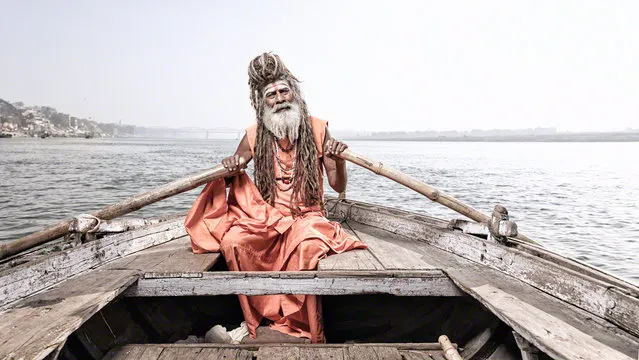
Varanasi: India's City of Death and Life

Varanasi is a city on the banks of the Ganges in Uttar Pradesh, 320 kilometres (200 mi) southeast of the state capital, Lucknow. It is holiest of the seven sacred cities (Sapta Puri) in Hinduism and Jainism. Hindus believe that death at Varanasi brings salvation. It is one of the oldest continuously inhabited cities in the world and the oldest in India.
Details
02 May 2013 12:41:00
Seven Sisters Waterfall, Norway

The Seven Sisters is the 39th tallest waterfall in Norway. The waterfall consists of seven separate streams, and the tallest of the seven has a free fall that measures 250 metres (820 ft). The waterfall is located along the Geirangerfjorden in Stranda Municipality in Møre og Romsdal county, Norway. The waterfall is located just south of the historic Knivsflå farm, across the fjord from the old Skageflå farm. The falls are about 6.5 kilometres (4.0 mi) west of the village of Geiranger. It is part of the Geiranger World Heritage Site.
Details
11 Dec 2013 10:13:00
Corinth Canal

The Corinth Canal is a canal that connects the Gulf of Corinth with the Saronic Gulf in the Aegean Sea. It cuts through the narrow Isthmus of Corinth and separates the Peloponnesian peninsula from the Greek mainland, thus effectively making the former an island. The builders dug the canal through the Isthmus at sea level; no locks are employed. It is 6.4 kilometres (4.0 mi) in length and only 21.3 metres (70 ft) wide at its base, making it unpassable for most modern ships. It now has little economic importance.

Details
12 Mar 2013 12:21:00
Underground River

The Puerto Princesa Subterranean River National Park is located about 50 kilometres (30 mi) north of the city centre of Puerto Princesa, Palawan, Philippines. The river is also called Puerto Princesa Underground River. The national park is located in the Saint Paul Mountain Range on the northern coast of the island. It is bordered by St. Paul Bay to the north and the Babuyan River to the east. The City Government of Puerto Princesa has managed the National Park since 1992. The park is also known as St. Paul's Subterranean River National Park, or St. Paul Underground River. The entrance to the Subterranean River is a short hike from the town of Sabang.
Details
16 Jul 2012 11:37:00