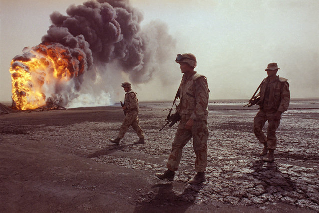
In this March 7, 1991 file photo, a U.S. Marine patrol walks across the charred oil landscape near a burning well during perimeter security patrol near Kuwait City. Twenty five years after the first U.S. Marines swept across the border into Kuwait in the 1991 Gulf War, American forces find themselves battling the extremist Islamic State group, born out of al-Qaida, in the splintered territories of Iraq and Syria. The Arab allies that joined the 1991 coalition are fighting their own conflicts both at home and abroad, as Iran vies for greater regional power following a nuclear deal with world powers. (Photo by John Gaps III/AP Photo)
23 Feb 2016 11:43:00,post received
0 comments