Loading...
Done
Omo River People, Ethiopia

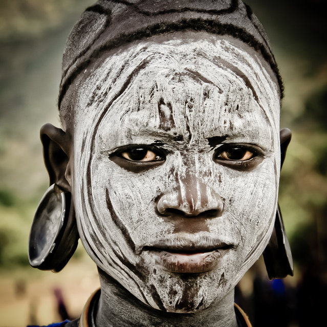
“The Omo River is an important river of southern Ethiopia. Its course is entirely contained within the boundaries of Ethiopia, and empties into Lake Turkana on the border with Kenya. The lower valley of the Omo is currently believed by some to have been a crossroads for thousands of years as various cultures and ethnic groups migrated around the region. To this day, the people of the Lower Valley of the Omo, including the Mursi, Suri, Nyangatom, Dizi and Me'en, are studied for their diversity”. – Wikipedia (Photo by Hamerscat)

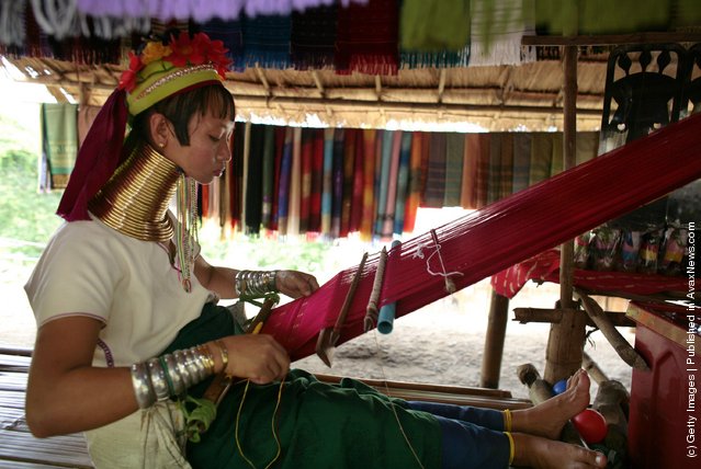
SEE ALSO: «Ethiopia By Brent Stirton»

Details
04 Oct 2012 09:05:00


Mah Chan, a Long Neck Padaung hill tribe woman weaves a scraf for sale to tourists in a small village where 30 familes live July 13, 2006 in Chiang Dao, Thailand. All the Long Neck villages are set up for tourists and just over a year ago the hill tribe members were hand picked to move closer to Chiang Mai from more remote communities so that they could be more accessible. The Padaung women famously wear brass rings around their necks, beginning at five-years-old, to distort the growth of their collarbones and making them look like they have long necks. They are originally from eastern Burma near the Thailand border. (Photo by Paula Bronstein/Getty Images)
Details
19 Apr 2011 11:56:00


A North Korean soldier looks through a window at Australian Prime Minister Julia Gillard (L) and her partner Tim Mathieson (C) while they visit the United Nations Command Military Armistice Commission (UNCMAC) meeting room at the border village of Panmunjom, between South and North Korea, on April 24, 2011 South Korea. Gillard will visit Japan, the Republic of Korea and China during a bilateral tour of North Asia from April 20-27. (Photo by Jeon Heon-Kyun-pool/Getty Images)
Details
26 Apr 2011 06:48:00
A Turkana boy herds cows as he carries a rifle in north western Kenya near the town of Kibish inside the Turkana region of the Ilemy Triangle September 26, 2014. (Photo by Goran Tomasevic/Reuters)

A Turkana boy herds cows as he carries a rifle in north western Kenya near the town of Kibish inside the Turkana region of the Ilemy Triangle September 26, 2014. The Turkana people have historically clashed over ethnic differences and precious resources such as fishing, pasture and fresh water with other tribes bordering their territory, such as the Dassanach from southern Ethiopia. (Photo by Goran Tomasevic/Reuters)
Details
26 Sep 2014 13:08:00
A  view of empty houses in the deserted town of Pripyat near the closed Chernobyl nuclear power plant  Ukraine,  November 27, 2012. (Photo by Efrem Lukatsky/AP Photo)

“Pripyat is a ghost town near the Chernobyl Nuclear Power Plant, within the Chernobyl Exclusion Zone, part of Kiev Oblast (province) of northern Ukraine, near the border with Belarus”. – Wikipedia

Photo: A view of empty houses in the deserted town of Pripyat near the closed Chernobyl nuclear power plant Ukraine, November 27, 2012. Pripyat, the city of 47,000 had already been evacuated after the April 26, 1986, explosion of Reactor No. 4 (Photo by Efrem Lukatsky/AP Photo)
Details
07 Jan 2013 10:50:00
Local residents evacuate onto a street minutes after an earthquake in central Kathmandu, Nepal, May 12, 2015. (Photo by Athit Perawongmetha/Reuters)

Local residents evacuate onto a street minutes after an earthquake in central Kathmandu, Nepal, May 12, 2015. A 7.3 magnitude earthquake killed at least 37 people and spread panic in Nepal on Tuesday, bringing down buildings already weakened by a devastating tremor less than three weeks ago and unleashing landslides in Himalayan valleys near Mount Everest. The earthquake was centered 76 km (47 miles) east of the capital in a hilly area close to the border with Tibet, according to coordinates provided by the U.S. Geological Survey. (Photo by Athit Perawongmetha/Reuters)
Details
13 May 2015 11:36:00
Glacier National Park Montana

Glacier National Park is a national park located in the U.S. state of Montana, on the Canada–United States border with the Canadian provinces of Alberta and British Columbia. The park encompasses over 1,000,000 acres (4,000 km2) and includes parts of two mountain ranges (sub-ranges of the Rocky Mountains), over 130 named lakes, more than 1,000 different species of plants and hundreds of species of animals. This vast pristine ecosystem is the centerpiece of what has been referred to as the "Crown of the Continent Ecosystem", a region of protected land encompassing 16,000 square miles (41,000 km2).
Details
29 Oct 2013 11:13:00
Komodo National Park

The Komodo National Park is a national park in Indonesia located within the Lesser Sunda Islands in the border region between the provinces of East Nusa Tenggara and West Nusa Tenggara. The park includes the three larger islands Komodo, Padar and Rinca, and 26 smaller ones, with a total area of 1,733 km² (603 km² of it land). The national park was founded in 1980 to protect the Komodo dragon, the world's largest lizard. Later it was dedicated to protecting other species, including marine species. In 1991 the national park was declared a UNESCO World Heritage Site and later as Man and Biosphere Reserve.
Details
12 Aug 2013 12:28:00