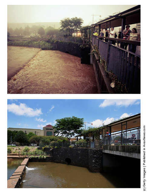
In this composite image (top) flooding is seen in the Toowoomba central business district on January 10, 2011 and (bottom) the same location as seen on January 5, 2012 in Toowoomba, Australia. January 10 marks the one year anniversary of the inland tsunami that devestated southern Queensland's Lockyer valley killing 23 people. (Photos by Dan Proud (top) and Lisa Maree Williams (bottom) /Getty Images)
06 Jan 2012 13:10:00,post received
0 comments