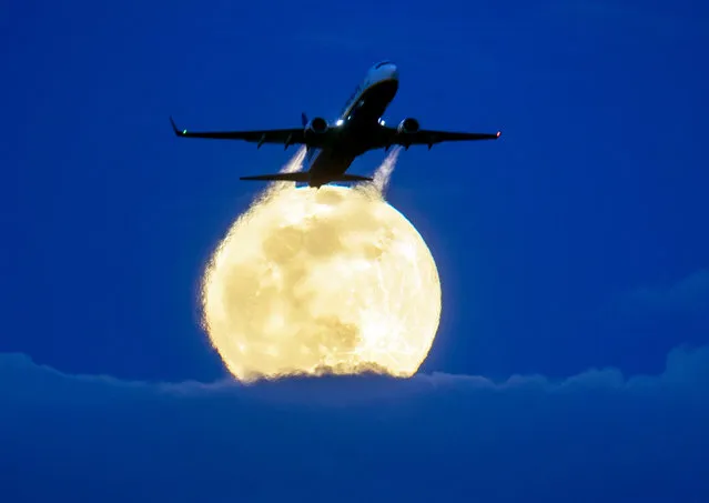
An aircraft passes the rising full moon that breaks through the clouds at the airport in Frankfurt, Germany, Monday, March 9, 2020. (Photo by Michael Probst/AP Photo)
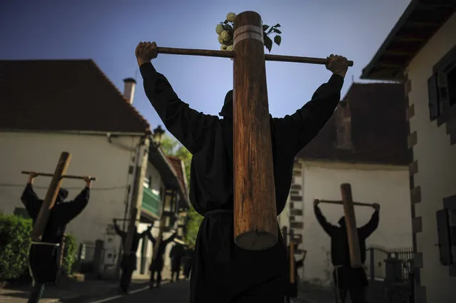
Masked penitents holds their crosses during spring “Romeria Cruceros de Arce”, in Roncesvalles, northern Spain, Sunday, May 10, 2015. Every year on the second Sunday in spring, people with crosses march from their small Pyrenees towns to Roncesvalles Church in tribute of the Virgin. (Photo by Alvaro Barrientos/AP Photo)
A Rafale fighter jet flies over France's Charles de Gaulle aircraft carrier as it makes its way in the Gulf, January 28, 2016. (Photo by Philippe Wojazer/Reuters)
An environmental activist performs during a protest in front of the headquarters of Brazilian mining company Vale SA in downtown Rio de Janeiro, Brazil, November 16, 2015. The collapse of two dams at a Brazilian mine, owned by Vale SA and BHP Billiton Ltd, has cut off drinking water for quarter of a million people and saturated waterways downstream with dense orange sediment that could wreck the ecosystem for years to come. Nine people were killed, 19 are still listed as missing and 500 people were displaced from their homes when the dams burst at an iron ore mine in southeastern Brazil on November 5. (Photo by Sergio Moraes/Reuters)
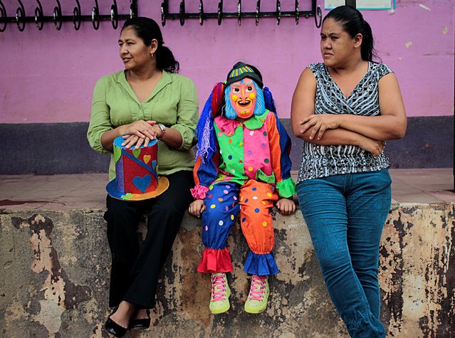
A child dressed as a clown takes part in the celebration of the Virgen de los Desamparados, or Our Lady of the Abandoned, at Diria town, Nicaragua May 14, 2016. (Photo by Oswaldo Rivas/Reuters)
Maria, 18, wearing a traditional Sevillana outfit, poses for a portrait during the traditional Feria de Abril (April fair) in the Andalusian capital of Seville April 16, 2013. (Photo by Marcelo del Pozo/Reuters)
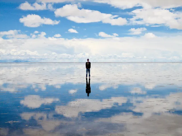
Salar de Uyuni (or Salar de Tunupa) is the world's largest salt flat at 10,582 square kilometers (4,086 sq mi). It is located in the Potosí and Oruro departments in southwest Bolivia, near the crest of the Andes, and is elevated 3,656 meters (11,995 ft) above mean sea level. The Salar was formed as a result of transformations between several prehistoric lakes. It is covered by a few meters of salt crust, which has an extraordinary flatness with the average altitude variations within one meter over the entire area of the Salar.
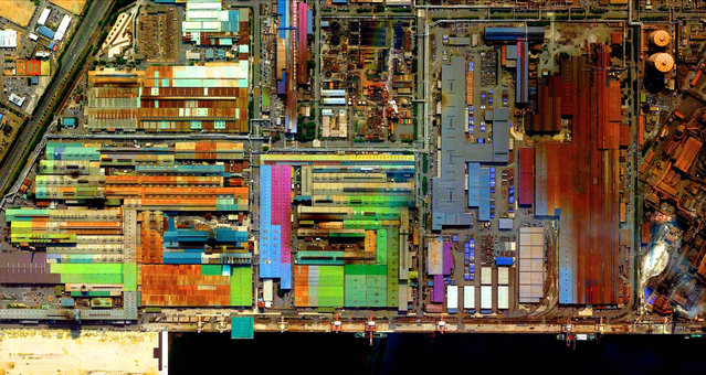
This series of pictures shot by satellite, show the man-made world as astronauts see it. Artist Benjamin Grant uses Google Earth to find the most compelling satellite images of human civilization. The stunning pictures of sprawling metropolises and vast reservoirs are sometimes unidentifiable until zoomed in. In order to find an extraordinary picture in the practically endless supply of satellite data, Benjamin focuses on the themes of current events or environmental issues. Here: Industrial Sector, Tokai, Japan. (Photo by Benjamin Grant/Digital Globe/Caters News)