Loading...
Done
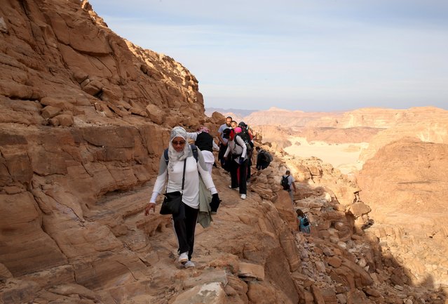
Hikers walk to reach the top of Naqba Rum area in South Sinai, Egypt, November 20, 2015. (Photo by Asmaa Waguih/Reuters)

Hikers walk to reach the top of Naqba Rum area in South Sinai, Egypt, November 20, 2015. Bedouins in the "Sinai is Safe" group guided more than 100 hikers over a 25 km (15 mile) trek over the trails of the White Canyon and the Closed Canyon. The NGO aims to challenge mainstream perceptions of the area by encouraging Nile Valley residents to explore the untamed wilderness with the Bedouin tribes. (Photo by Asmaa Waguih/Reuters)
Details
03 Dec 2015 08:00:00
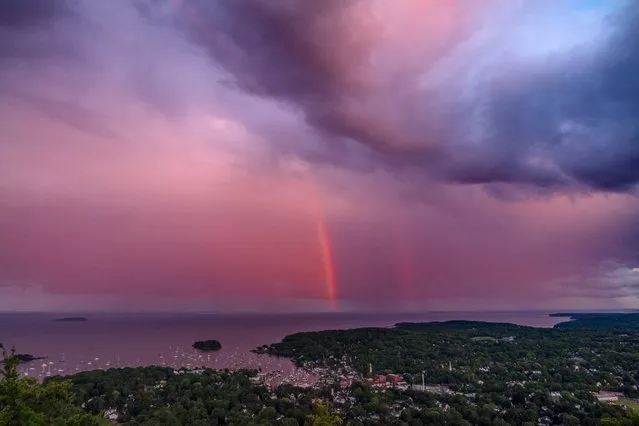
A rainstorm moves over the Atlantic Ocean after passing through Camden, Maine, at sunset, Tuesday, August 1, 2023. (Photo by Robert F. Bukaty/AP Photo)

A rainstorm moves over the Atlantic Ocean after passing through Camden, Maine, at sunset, Tuesday, August 1, 2023. (Photo by Robert F. Bukaty/AP Photo)
Details
04 Dec 2023 04:48:00
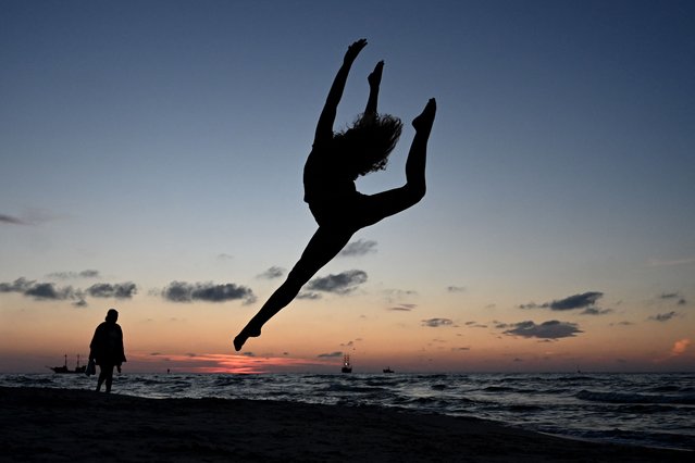
A member of the Grupa Magnifica acrobatics club poses for a photo on the Baltic Sea beach during sunset in the town of Leba, Pomeranian region, on August 6, 2024. (Photo by Sergei Gapon/AFP Photo)

A member of the Grupa Magnifica acrobatics club poses for a photo on the Baltic Sea beach during sunset in the town of Leba, Pomeranian region, on August 6, 2024. (Photo by Sergei Gapon/AFP Photo)
Details
02 Sep 2024 03:12:00
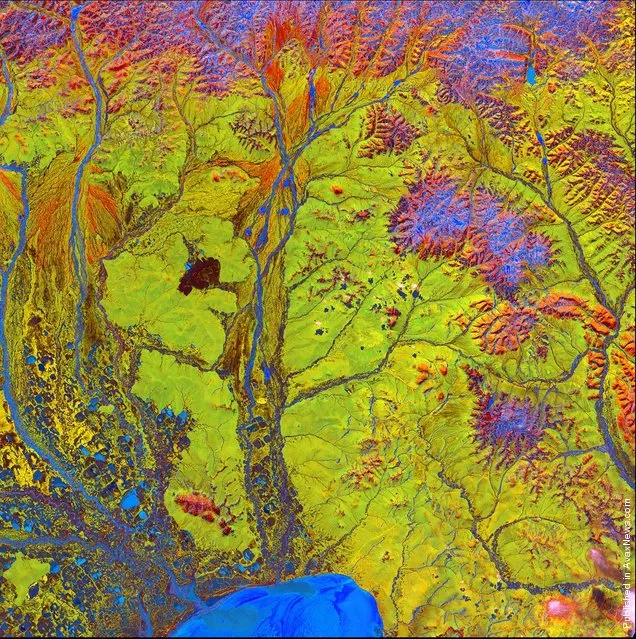
Vivid colors and bizarre shapes come together in a false-color image that could be an illustration for a fantasy story

Vivid colors and bizarre shapes come together in a false-color image that could be an illustration for a fantasy story. This labyrinth of exotic features winds its way along the edge of Russia’s Chaunskaya Bay in northeastern Siberia, seen as a vivid blue half-circle at the bottom of the image Two major rivers, the Chaun and Palyavaam, flow into the bay, which in turn opens into the Arctic Ocean. Ribbon lakes and bogs are present throughout the area, created by depressions left by receding glaciers. (Photo by USGS/NASA)
Details
14 Apr 2012 11:02:00
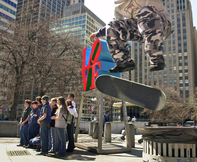
In this April 1, 2002, file photo, Mike Cole, of Jenkintown, Pa., right, performs a kick-flip over a trash can with his skateboard as tourists pose for photos in front of artist Robert Indiana's sculpture in John F. Kennedy Plaza, also known as Love Park, in Philadelphia. Granite slabs from Philadelphia's famed Love Park, a skateboarding mecca though for a long stretch an illegal one, are being shipped in 2017 to the city of Malmo, Sweden, nearly 4,000 miles away, for use in construction of a skate park there. (Photo by Douglas Bovitt/AP Photo)

In this April 1, 2002, file photo, Mike Cole, of Jenkintown, Pa., right, performs a kick-flip over a trash can with his skateboard as tourists pose for photos in front of artist Robert Indiana's sculpture in John F. Kennedy Plaza, also known as Love Park, in Philadelphia. Granite slabs from Philadelphia's famed Love Park, a skateboarding mecca though for a long stretch an illegal one, are being shipped in 2017 to the city of Malmo, Sweden, nearly 4,000 miles away, for use in construction of a skate park there. (Photo by Douglas Bovitt/AP Photo)
Details
15 Jun 2017 08:05:00
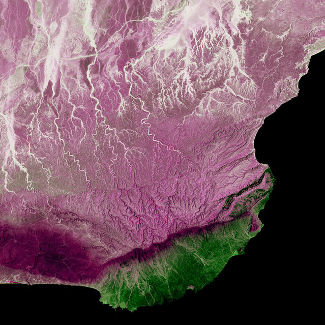
Dhofar Region, Oman. Much of Oman is desert, but the Arabian Sea coast in the Dhofar region represents a startling difference in climate. This coastal region catches the monsoon rains, or khareef, during the summer months. Drenching rains fall primarily on the mountainous ridge that separates the lush, fertile areas along the coast from the arid interior, recharging streams, waterfalls and springs that provide plentiful water supplies in the fertile lowlands for the remainder of the year. Image taken by Landsat 5 on April 2, 2005. (Photo by USGS/NASA)

Dhofar Region, Oman. Much of Oman is desert, but the Arabian Sea coast in the Dhofar region represents a startling difference in climate. This coastal region catches the monsoon rains, or khareef, during the summer months. Drenching rains fall primarily on the mountainous ridge that separates the lush, fertile areas along the coast from the arid interior, recharging streams, waterfalls and springs that provide plentiful water supplies in the fertile lowlands for the remainder of the year. Image taken by Landsat 5 on April 2, 2005. (Photo by USGS/NASA)
Details
25 Dec 2012 11:13:00
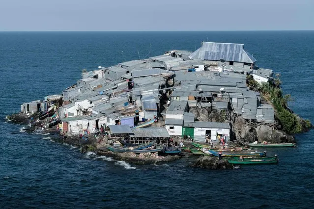
A picture taken on October 5, 2018, shows a general view of Migingo island which is densely populated by residents fishing mainly for Nile perch in Lake Victoria on the border of Uganda and Kenya. (Photo by Yasuyoshi Chiba/AFP Photo)

A picture taken on October 5, 2018, shows a general view of Migingo island which is densely populated by residents fishing mainly for Nile perch in Lake Victoria, the continent's largest lake, on the border of Uganda and Kenya. More than 500 people live on the island, which is barely 2,000-square-metres. (Photo by Yasuyoshi Chiba/AFP Photo)
Details
29 Oct 2018 00:03:00
People visit the artwork titled Seven Magic Mountains by artist Ugo Rondinone, Wednesday, May 11, 2016, near Jean, Nev. The artwork was recently completed in the desert south of Las Vegas. (Photo by John Locher/AP Photo)

People visit the artwork titled Seven Magic Mountains by artist Ugo Rondinone, Wednesday, May 11, 2016, near Jean, Nev. The artwork was recently completed in the desert south of Las Vegas. (Photo by John Locher/AP Photo)
Details
21 May 2016 11:18:00