Loading...
Done
Schoolchildren attend their first lesson on Knowledge Day in the town of Turov, Zhytkavichy District, Gomel Region, Belarus on September 1, 2017. Knowledge Day marks the beginning of a new school year in Belarus and is celebrated on September 1. (Photo by Viktor Drachev/TASS via Getty Images)

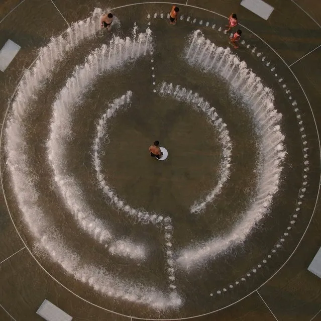
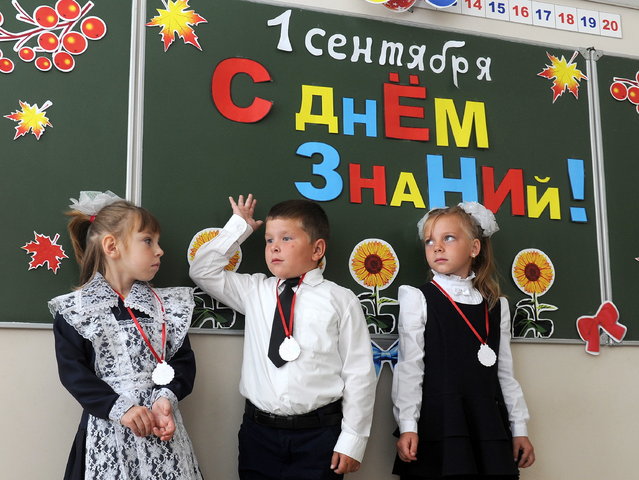
Though schools around the globe have different start dates, calendars and traditions, the first day of a new term is an exciting time filled with the prospects of gaining more knowledge, making new friends and building community. Here: Schoolchildren attend their first lesson on Knowledge Day in the town of Turov, Zhytkavichy District, Gomel Region, Belarus on September 1, 2017. Knowledge Day marks the beginning of a new school year in Belarus and is celebrated on September 1. (Photo by Viktor Drachev/TASS via Getty Images)
Details
20 Sep 2017 08:00:00
Miss India Manushi Chhilar (C) reacts as she wins the 67 th Miss World contest final next to France Aurore Andrée Raphaëlle Kichenin (R) and Miss Kenya Magline Jeruto (L) in Sanya, on the tropical Chinese island of Hainan on November 18, 2017. (Photo by Nicolas Asfouri/AFP Photo)

Miss India Manushi Chhilar (C) reacts as she wins the 67 th Miss World contest final next to France Aurore Andrée Raphaëlle Kichenin (R) and Miss Kenya Magline Jeruto (L) in Sanya, on the tropical Chinese island of Hainan on November 18, 2017. (Photo by Nicolas Asfouri/AFP Photo)
Details
20 Nov 2017 07:20:00
From Britain to China to Mali, new maps showing travel times to the nearest urban centre reveal huge differences between countries. Using Open Street Map and Google, a University of Oxford team have created a visual breakdown that suggests major inequalities when it comes to commuting. Here: China. The dataset used for China was unique as it relied solely on Open Street Map, due to restrictions on accessing Google data. The population is densely concentrated in the east and accessibility is increased, whereas rural provinces in the west remain remote. (Photo by Daniel Weiss/Jennifer Rozier/Malaria Atlas Project/University of Oxford )

From Britain to China to Mali, new maps showing travel times to the nearest urban centre reveal huge differences between countries. Using Open Street Map and Google, a University of Oxford team have created a visual breakdown that suggests major inequalities when it comes to commuting. Here: China. The dataset used for China was unique as it relied solely on Open Street Map, due to restrictions on accessing Google data. The population is densely concentrated in the east and accessibility is increased, whereas rural provinces in the west remain remote. (Photo by Daniel Weiss/Jennifer Rozier/Malaria Atlas Project/University of Oxford)
Details
12 Jan 2018 06:43:00
Performers at the opening ceremony of the 2018 FIFA World Cup at Luzhniki Stadium in Moscow, Russia on June 14, 2018. (Photo by Sergei Bobylev/TASS via Getty Images)

Dancers perform during the opening ceremony before the Russia 2018 World Cup Group A football match between Russia and Saudi Arabia at the Luzhniki Stadium in Moscow on June 14, 2018. (Photo by Sergei Bobylev/TASS via Getty Images)
Details
16 Jun 2018 00:01:00
Kawakanih Yawalapiti, 9, Upper Xingu region of Mato Grosso, Brazil, 2018: Kawakanih lives with her tribe, the Yawalapiti, in Xingu national park, a preserve in the Amazon basin of Brazil. The Yawalapiti collect seeds to preserve species unique to their ecosystem, which lies between the rain forest and savannah. Kawakanih’s diet is simple, consisting mainly of fish, cassava, porridge, fruit and nuts. “It takes five minutes to catch dinner”, says Kawakanih. “When you’re hungry, you just go to the river with your net”. (Photo by Gregg Segal/The Guardian)

Photographer Gregg Segal travelled the world to document children and the food they eat in a week. Partly inspired by the increasing problems of childhood obesity, he tracked traditional regional diets as yet unaffected by globalisation, and ironically, found that the healthiest diets were often eaten by the least well off. (Photo by Gregg Segal/The Guardian)
Details
03 Jul 2019 00:03:00
Kite Aerial By Seeing The World From New Heights

Kite Aerial photography (KAP) is a hobby and a type of photography. A camera is lifted using a kite and is triggered either remotely or automatically to take aerial photographs. The camera rigs can range from the extremely simple, consisting of a trigger mechanism with a disposable camera, to complex apparatus using radio control and digital cameras. On some occasions it can be a good alternative to other forms of aerial photography.
Details
17 Jan 2014 13:22:00
“Zeybeks”. That's Dance, Sunward and Zeybeks. (Photo by Hasan Baglar/2014 Sony World Photography Awards)

“Zeybeks”. That's Dance, Sunward and Zeybeks. (Photo by Hasan Baglar/2014 Sony World Photography Awards)
Details
07 Feb 2014 08:57:00
The double compound eyes of a male St. Mark's fly (Bibio marci), submitted by Dr. David Maitland from Feltwell, UK

The double compound eyes of a male St. Mark's fly (Bibio marci), submitted by Dr. David Maitland from Feltwell, UK. (Dr. David Maitland)
Details
07 Apr 2012 13:22:00