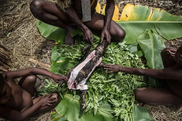
A man from the Dani tribe cuts the head of a pig after cooked by traditional way which is use burned hot stones at Obia Village on August 9, 2014 in Wamena, Papua, Indonesia. The stone-age Dani tribe live a traditional existence in the Baliem Valley, which is situated 1600 metres above sea level in the heart of the Cyclops Mountains. (Photo by Agung Parameswara/Getty Images)
14 Aug 2014 10:30:00,post received
0 comments