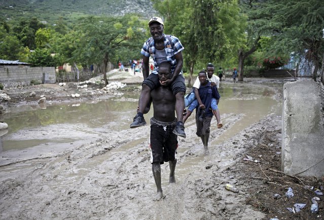
Men carry others, so they do not soil their shoes and clothes, through a mudslide caused by Tropical Storm Erika in Carries, Haiti, August 29, 2015. Erika, a tropical storm that killed 20 people on the Caribbean island of Dominica and at least one person in Haiti, fell apart on Saturday over eastern Cuba, the U.S. National Hurricane Center said. (Photo by Andres Martinez Casares/Reuters)
30 Aug 2015 11:47:00,post received
0 comments