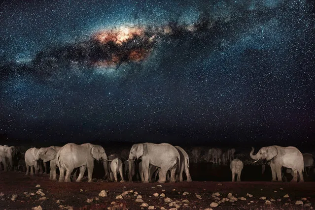
This watering hole is the social hub of the veldt; the scrubby grasslands that stretch across Namibia. The scorched earth supports sometimes fragile populations of magnificent wildlife – from endangered predators to plentiful herds of game. But these gentle giraffes and elephants need to be careful: lions don’t sleep at night, they hunt! The spectacular starscape above southern Africa is unchanged since explorers first mapped the continent. The photographer, Pietro Olivetta from Italy, said he had to be patient to capture these shots – but it was worth the wait. (Photo by Pietro Olivetta/Caters News)
20 Feb 2017 00:05:00,post received
0 comments