Loading...
Done
How Snakeskin Handbags Are Made

Images from a snake slaughterhouse at Kapetakan village in Indonesia’s West Java province. Wakira, who is known as “Boss Cobra”, owns the slaughterhouse that produces snake meat and skin. Snake meat is believed by some to be a remedy for skin diseases and asthma, as well as an aid to increase virility. The snake skins, measuring in the hundreds of metres, are sold to bag factories in the West and Central Java provinces on a monthly basis. The price of a bag made from snake skin costs between 150,000 rupiah ($ 15.60) and 300,000 rupiah ($31.20), depending on its size. That snakeskin handbag you’ll buy is costing a hell of a lot more.
Details
20 Feb 2013 12:00:00
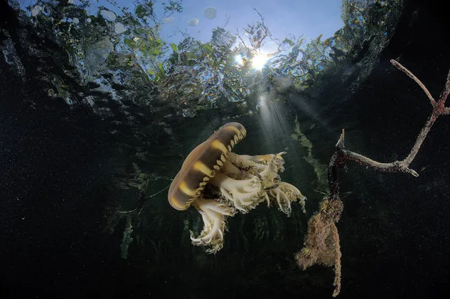
Under Water Photographers By Andrew Shpatak

I'm born in Russia in a village on the coast of the Sea of ​​Japan. The sea itself that always catches the attention of divers and underwater photographers from all over the Soviet Union.

I started with underwater photography recently, in 1998, with a simple underwater "boom box" "Canon" and "Epic".
Then a "Nikonos-5", complete with wide-angle and close-up.
The first trip to the Red Sea, with colorful fish .. The first attempts to make the macro and the knowledge that this equipment was not good.
ANDREY SHPATAK
Details
18 Apr 2013 11:13:00
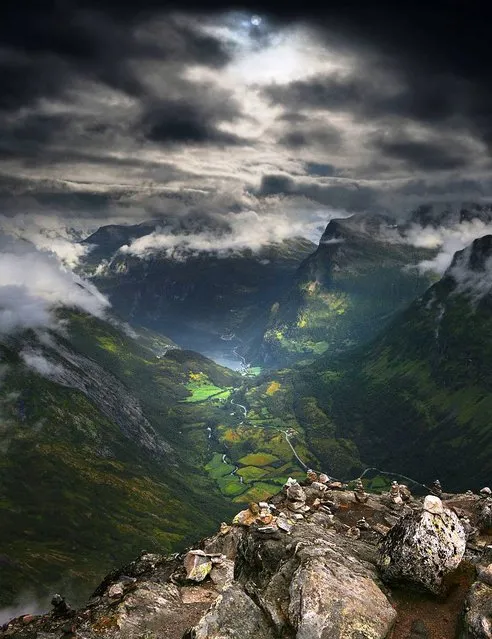
The Majesty Of Norway's Dalsnibba Mountain

Dalsnibba is a mountain in Stranda Municipality in More og Romsdal county, Norway. It is located at the end of the Geiranger valley, about 21 kilometres (13 mi) south of the village of Geiranger and the Geirangerfjorden. The 2-square-kilometre (0.77 sq mi) lake Djupvatnet lies directly to the southeast of the mountain. The mountain is located very near the county border with both Oppland and Sogn og Fjordane counties, in the southeastern part of Møre og Romsdal county.
Details
24 Jul 2013 10:28:00
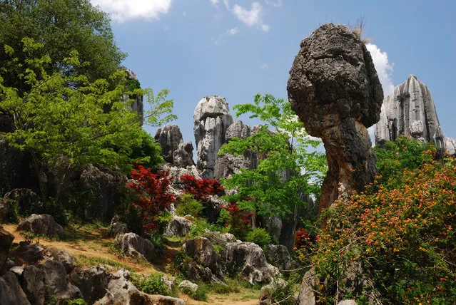
Shilin Stone Forest

The Stone Forest or Shilin is a notable set of limestone formations located in Shilin Yi Autonomous County, Yunnan Province, People's Republic of China, near Shilin approximately 120 km (75 mi) from the provincial capital Kunming. The tall rocks seem to emanate from the ground in the manner of stalagmites, with many looking like petrified trees thereby creating the illusion of a forest made of stone. Since 2007, two parts of the site, the Naigu Stone Forest (乃古石林) and Suogeyi Village (所各邑村), have been UNESCO World Heritage Sites as part of the South China Karst.
Details
27 Sep 2013 10:03:00
Aerial Views by  Ken Hong Leung

H. Leung has been acclaimed since 1952 for his brilliant artistic style. A master of oil on canvas, he achieves a haunting quality in his works that absorbs the viewer’s emotions like an irresistible melody. His brush, like a wand, seems to weave a sense of enchantment. In his landscapes and waterside villages, visions of Shangri-La come to mind, superbly mixed with subtle orchestrations of peacefulness and drama.

Technique is both a creative and expressive force in the art of H. Leung. Distinctively semi-abstract, his images allow the viewer’s eye to supply what is merely suggested. This very involving result adds power not only to the impact of his designs, it increases the joy that owning his works provides.
Details
26 Aug 2012 12:10:00
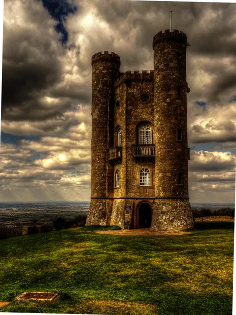
Broadway Tower In English

Broadway Tower is a folly located on Broadway Hill, near the village of Broadway, in the English county of Worcestershire, at the second highest point of the Cotswolds after Cleeve Hill. Broadway Tower's base is 1,024 feet (312 metres) above sea level. The tower itself stands 55 feet (17 metres) high. The “Saxon” tower was designed by James Wyatt in 1794 in the form of a castle, and built for Lady Coventry in 1799. The tower was built on a “beacon” hill, where beacons were lit on special occasions. Lady Coventry wondered if a beacon on this hill could be seen from her house in Worcester – approximately 22 miles (35 km) away – and sponsored the construction of the folly to find out. The beacon could be seen clearly.
Details
19 Dec 2013 10:06:00
Baatara Gorge Waterfall

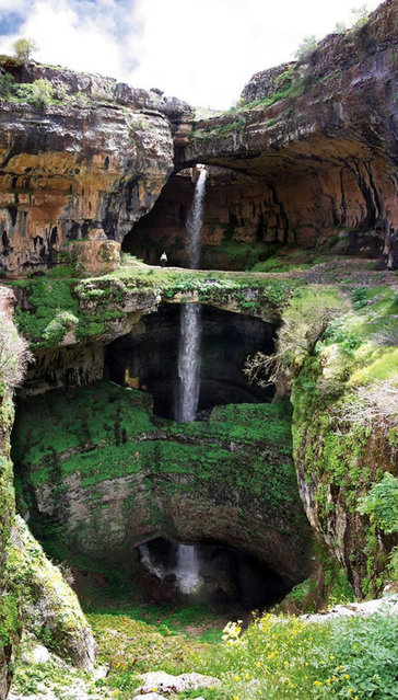
Discovered in 1952 by French bio-speleologist Henri Coiffait, the waterfall and accompanying sinkhole were fully mapped in the 1980s by the Spéléo club du Liban. The cave is also known as the "Cave of the Three Bridges." Traveling from Laklouk to Tannourine one passes the village of Balaa, and the "Three Bridges Chasm" (in French "Gouffre des Trois Ponts") is a five-minute journey into the valley below where one sees three natural bridges, rising one above the other and overhanging a chasm descending into Mount Lebanon. During the spring melt, a 90–100-metre (300–330 ft) cascade falls behind the three bridges and then down into the 250-metre (820 ft) chasm. A 1988 fluorescent dye test demonstrated that the water emerged at the spring of Dalleh in Mgharet al-Ghaouaghir.
Details
31 Aug 2013 11:27:00
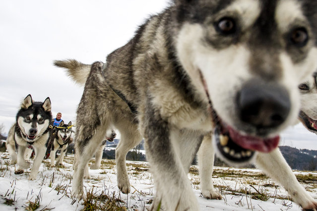
Mushers and theirs dog teams during the Sedivackuv long race, Orlicke Mountains, Czech Republic on January 28, 2016. (Photo by David Tanecek/CTK via ZUMA Press)

Mushers and theirs dog teams during the Sedivackuv long race, Orlicke Mountains, Czech Republic on January 28, 2016. The 240 Km (150 miles) race is a multi-day event, but was canceled today, two days early, because of poor snow conditions in the region. (Photo by David Tanecek/CTK via ZUMA Press)
Details
31 Jan 2016 09:34:00