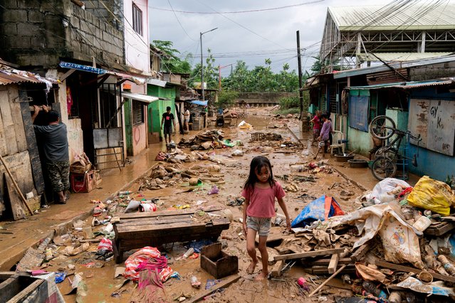
A girl walks past the debris and mud following the floods brought by Typhoon Gaemi, in Marikina City, Metro Manila, Philippines, on July 25, 2024. (Photo by Lisa Marie David/Reuters)
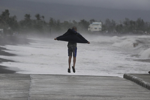
A resident jumps as he watches strong waves crash into shore as an effect of Typhoon Hagupit in Legazpi, Albay province, eastern Philippines on Sunday, December 7, 2014. Typhoon Hagupit knocked out power in entire coastal provinces, mowed down trees and sent more than 650,000 people into shelters before it weakened Sunday, sparing the central Philippines a repetition of unprecedented devastation by last year's storm. (Photo by Aaron Favila/AP Photo)
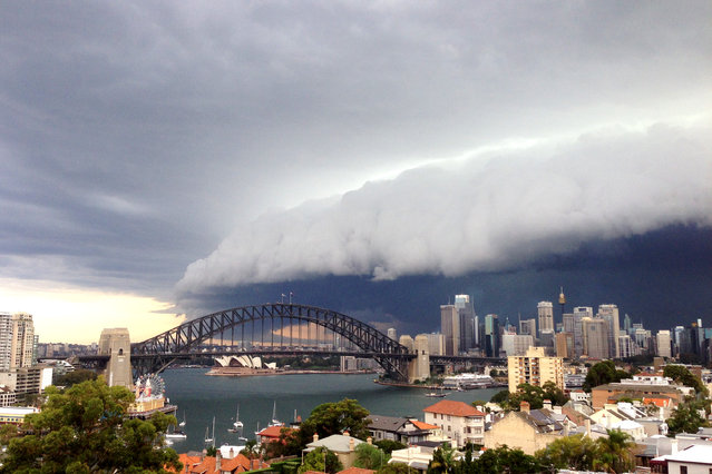
A large storm cloud covers the Sydney CBD on March 5, 2014 in Sydney, Australia. A severe thunderstorm warning was issued for the Sydney metropolitan area late this afternoon with heavy rainfall due to cause flash flooding in areas. (Photo by Cassie Trotter/Getty Images)
A driver maneuvers his classic American car along a wet road as a wave crashes against the Malecon in Havana, Cuba on Thursday. Hurricane Sandy blasted across eastern Cuba as a potent Category 2 storm and headed for the Bahamas after causing at least two deaths in the Caribbean. (Photo by Ramon Espinosa/Associated Press)
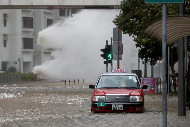
Waves triggered by Typhoon Hato are seen in Hong Kong, China on August 23, 2017. A powerful typhoon barreled into Hong Kong on Wednesday, forcing offices and schools to close and leaving flooded streets, shattered windows and hundreds of canceled flights in its wake. Typhoon Hato came within 60 kilometers (37 miles) of Hong Kong, close enough to be considered a direct hit under Hong Kong's storm warning system. It was headed toward the western side of mainland China's Pearl River Delta. (Photo by Tyrone Siu/Reuters)