Loading...
Done
Respects Are Paid To Three Killed In Hit And Run During Birmingham Riot

Flowers are left at the scene of a hit and run following civil disturbances in the Winson Green area on August 11, 2011 in Birmingham, England. Police are continuing investigations after three people – reportedly trying to protect shops from rioting and looting in Dudley Road – were struck by a car. Police have so far arrested over 1,000 people following rioting which erupted over a four-day period across the UK. (Photo by Jeff J Mitchell/Getty Images)
Details
11 Aug 2011 14:14:00
Dongchuan Red Lands, China

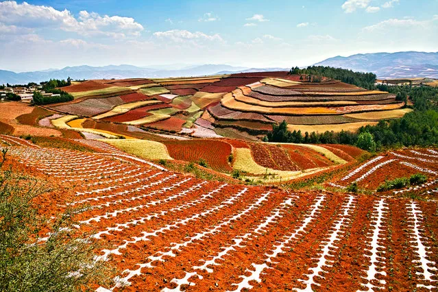
Dongchuan is a rural place located in the area of Wumeng Mountains. This place became one of the most favored destination spots for Chinese photographers all because of its red soil. The Wumeng’s scenery was first discovered in mid-90s. The first photographers who came here shot some award-winning photos, which made them keep the location of this place a secret. With time, however, more people found out about this place, making them want to visit these arid mountains. The contrasting red soil, yellow buckwheat, and brilliant blue skies make this place a paradise for photographers.
Details
29 Jan 2015 10:59:00
Oresund Bridge

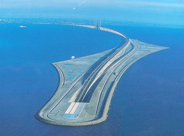
The Öresund or Øresund Bridge is a double-track railway and dual carriageway bridge-tunnel across the Øresund strait between Scania (southernmost Sweden) and Denmark. The bridge runs nearly 8 km (5 miles) from the Swedish coast to the artificial island of Peberholm, which lies in the middle of the strait. The remainder of the link is by a 4 km (2.5 mile) tunnel from Peberholm to the Danish island of Amager. The Øresund Bridge is the longest combined road and rail bridge in Europe, and connects two major metropolitan areas: Copenhagen, the Danish capital city, and the major Swedish city of Malmö. It connects the road and rail networks of Scandinavia with those of Central and Western Europe.
Details
10 Sep 2013 11:23:00
Moraine Lake Canada

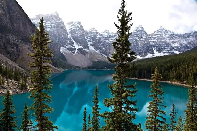
Moraine Lake is a glacially-fed lake in Banff National Park, 14 kilometres (8.7 mi) outside the Village of Lake Louise, Alberta, Canada. It is situated in the Valley of the Ten Peaks, at an elevation of approximately 6,183 feet (1,885 m). The lake has a surface area of .5 square kilometres (0.19 sq mi). The lake, being glacially fed, does not reach its crest until mid to late June. When it is full, it reflects a distinct shade of blue. The colour is due to the refraction of light off the rock flour deposited in the lake on a continual basis.
Details
15 Oct 2013 11:56:00
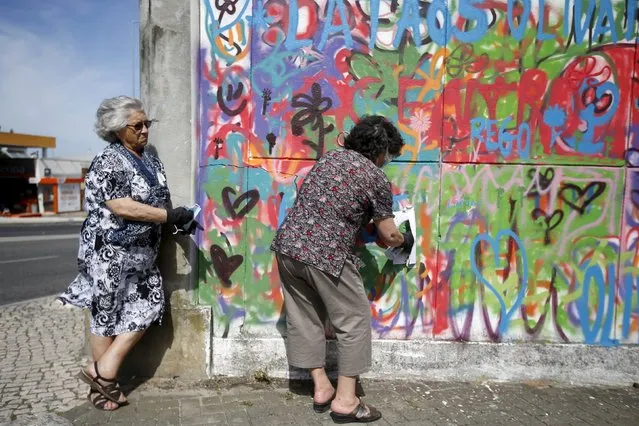
Women spray their designs on a wall during a graffiti class offered by the LATA 65 organization in Lisbon, Portugal May 14, 2015. (Photo by Rafael Marchante/Reuters)

Women spray their designs on a wall during a graffiti class offered by the LATA 65 organization in Lisbon, Portugal May 14, 2015. The LATA 65 organization is an initiative for the elderly in the area of urban art. Since it began in 2012, they have introduced the world of graffiti to over 100 senior citizens, giving workshops in different neighborhoods of Lisbon. (Photo by Rafael Marchante/Reuters)
Details
15 May 2015 10:16:00
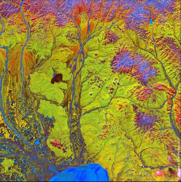
Vivid colors and bizarre shapes come together in a false-color image that could be an illustration for a fantasy story

Vivid colors and bizarre shapes come together in a false-color image that could be an illustration for a fantasy story. This labyrinth of exotic features winds its way along the edge of Russia’s Chaunskaya Bay in northeastern Siberia, seen as a vivid blue half-circle at the bottom of the image Two major rivers, the Chaun and Palyavaam, flow into the bay, which in turn opens into the Arctic Ocean. Ribbon lakes and bogs are present throughout the area, created by depressions left by receding glaciers. (Photo by USGS/NASA)
Details
14 Apr 2012 11:02:00
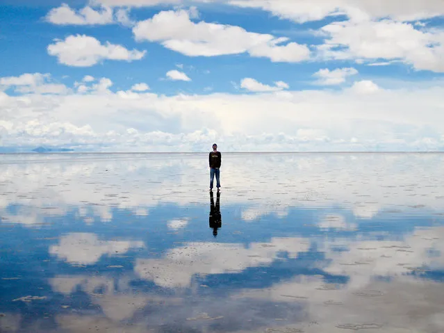
Salar de Uyuni

Salar de Uyuni (or Salar de Tunupa) is the world's largest salt flat at 10,582 square kilometers (4,086 sq mi). It is located in the Potosí and Oruro departments in southwest Bolivia, near the crest of the Andes, and is elevated 3,656 meters (11,995 ft) above mean sea level. The Salar was formed as a result of transformations between several prehistoric lakes. It is covered by a few meters of salt crust, which has an extraordinary flatness with the average altitude variations within one meter over the entire area of the Salar.
Details
04 Aug 2012 08:42:00
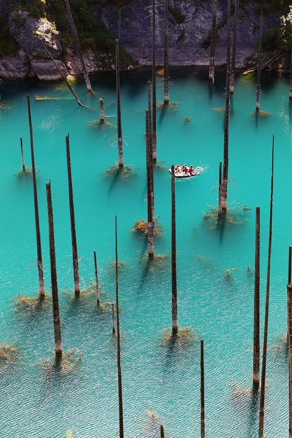
Kaindy Lake in Kazakhstan

Kaindy Lake (Kazakh: Қайыңды көлі, Qayındı köli) is a 400 metre long lake in Kazakhstan that reaches depths near 30 metres in some areas. It is located 129 km ESE of the city of Almaty and is 2,000 metres above sea level. It was created by the result of an enormous limestone landslide, triggered by the 1911 Kebin earthquake. The track to Kaindy lake has many scenic views to the Saty Gorge, the Chilik River valley and the Kaindy Gorge. Dried-out trunks of submerged Picea schrenkiana trees rise above the surface.
Details
06 Aug 2012 09:58:00