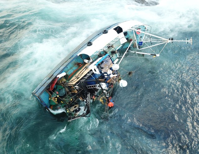
“The Supercell”. This shortlisted image by Dennis Oswald Huge farmland of was taken in south-west Oklahoma, US. (Photo by Dennis Oswald/2019 Weather Photographer of the Year/RMetS)
Settled snow is seen covering houses and Cecil Peak on New Zealand's lower South Island on November 4, 2011 in Queenstown, New Zealand. The unseasonal weather is not expected to clear until tomorrow, with snow continuing to fall. (Photo by Teaukura Moetaua/Getty Images)
Large waves break at Burleigh Heads on the Gold Coast,, Queensland, Australia, 05 June 2016. Recent wild weather unleashed heavy rainfalls, powerful winds and abnormally high tides in Southeast Queensland and northern New South Wales. (Photo by Dan Peled/EPA)
Take a walk on the wild side around some of the most down right dangerous places in the world - and all without leaving your desk, courtesy of Google Street View. Since 2007, Google's amazing technology has given people the chance to visit the Eiffel Tower, peer out over San Francisco's Golden Gate Bridge or walk along a beach in the Bahamas. But as well as mapping the tourist-friendly hotspots, Google also ventured into places you really wouldn't want to find yourself. Here is a collection of some the most notorious areas captured by the infamous roaming camera cars from around the UK and the world.