Participants go for a ride out with their motorbikes during women-only Petrolettes motorcycle festival in Neuhardenberg near Berlin, Germany on July 29, 2017. (Photo by Stefanie Loos/Reuters)
Revellers took to the bars and clubs of Birmingham, UK on Thursday night, April 6, 2023, knowing that they didn't have to go to work on Good Friday. (Photo by Roland Leon/News Group Newspapers Ltd)
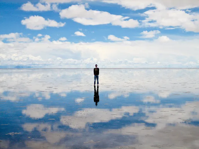
Salar de Uyuni (or Salar de Tunupa) is the world's largest salt flat at 10,582 square kilometers (4,086 sq mi). It is located in the Potosí and Oruro departments in southwest Bolivia, near the crest of the Andes, and is elevated 3,656 meters (11,995 ft) above mean sea level. The Salar was formed as a result of transformations between several prehistoric lakes. It is covered by a few meters of salt crust, which has an extraordinary flatness with the average altitude variations within one meter over the entire area of the Salar.
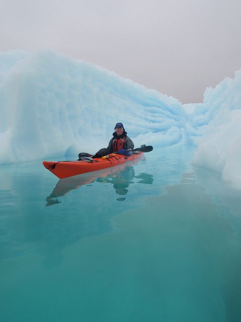
The Greenland ice sheet is a vast body of ice covering 660,235 sq miles, roughly 80% of the surface of Greenland. It is the second largest ice body in the world, after the Antarctic Ice Sheet. Some scientists predict that climate change may be near a "tipping point" where the entire ice sheet will melt in about 2000 years. If the entire 2,850,000 cubic kilometres (683,751 cu mi) of ice were to melt, it would lead to a global sea level rise of 7.2 m (23.6 ft).
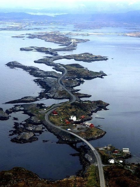
The Atlantic Ocean Road or the Atlantic Road (Norwegian: Atlanterhavsveien) is a 8.3-kilometer (5.2 mi) long section of County Road 64 that runs through an archipelago in Eide and Averøy in Møre og Romsdal, Norway. It passes by Hustadvika, an unsheltered part of the Norwegian Sea, connecting the island of Averøy with the mainland and Romsdalshalvoya peninsula. It runs between the villages of Karvag on Averoy and Vevang in Eida. It is built on several small islands and skerries, which are connected by several causeways, viaducts and eight bridges – the most prominent being Storseisundet Bridge.
A student from “the cliff village” in Atule'er climbs newly-constructed steel ladders after school to go home for holidays, in Liangshan Sichuan province, China, November 19, 2016. The steel ladders which replaced the unsafe vine ladders shortened the time taken for the children to go home, from three hours to two. (Photo by Reuters/Stringer)
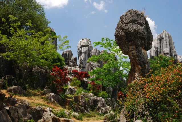
The Stone Forest or Shilin is a notable set of limestone formations located in Shilin Yi Autonomous County, Yunnan Province, People's Republic of China, near Shilin approximately 120 km (75 mi) from the provincial capital Kunming. The tall rocks seem to emanate from the ground in the manner of stalagmites, with many looking like petrified trees thereby creating the illusion of a forest made of stone. Since 2007, two parts of the site, the Naigu Stone Forest (乃古石林) and Suogeyi Village (所各邑村), have been UNESCO World Heritage Sites as part of the South China Karst.
American students going wild during their Spring Break week-long recess in Cancun, Mexico on March 10, 2007. (Photo by Keystone USA/ZUMA Press/Rex Features/Shutterstock)