Loading...
Done
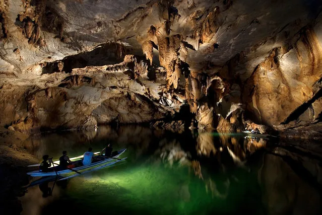
Underground River

The Puerto Princesa Subterranean River National Park is located about 50 kilometres (30 mi) north of the city centre of Puerto Princesa, Palawan, Philippines. The river is also called Puerto Princesa Underground River. The national park is located in the Saint Paul Mountain Range on the northern coast of the island. It is bordered by St. Paul Bay to the north and the Babuyan River to the east. The City Government of Puerto Princesa has managed the National Park since 1992. The park is also known as St. Paul's Subterranean River National Park, or St. Paul Underground River. The entrance to the Subterranean River is a short hike from the town of Sabang.
Details
16 Jul 2012 11:37:00
Trip to Xi'an 西安. (Photo by Grant)

“Mount Hua, or Hua Shan, or Xiyue located near the city of Huayin in Shaanxi province, about 120 kilometres (75 mi) east of Xi'an. It is one of China's Five Great Mountains, and has a long history of religious significance. Originally classified as having three peaks, in modern times the mountain is classified as five main peaks, of which the highest is the South Peak at 2,154.9 metres (7,070 ft)”. – Wikipedia

Photo: Trip to Xi'an 西安. (Photo by Grant Robinson)
Details
11 Nov 2012 11:39:00
Yang Juan, an employee at Goopal Group, takes a nap in her seat after lunch, in Beijing, China, April 21, 2016. (Photo by Jason Lee/Reuters)

Yang Juan, an employee at Goopal Group, takes a nap in her seat after lunch, in Beijing, China, April 21, 2016. Office workers sleeping on the job is a common sight in China, where a surplus of cheap labour can lead to downtime at work. But in China's technology sector, where business is growing faster than many start-up firms can hire new staff, workers burn the midnight oil to meet deadlines and compete with their rivals. Some companies provide sleeping areas and beds for workers to rest during late nights. (Photo by Jason Lee/Reuters)
Details
12 May 2016 14:53:00
In a photo taken on July 29, 2018 instructor Kim Ju Yang (20) holds a North Korean- made assault rifle as she poses for a portrait at the Meari shooting range in Pyongyang. The Meari shooting range offers customers the opportunity to shoot a number of North Korean and foreign- made firearms, most of which have been modifed to fire .22 calibre ammunition costing one US dollar per round. (Photo by Ed Jones/AFP Photo)

In a photo taken on July 29, 2018 instructor Kim Ju Yang (20) holds a North Korean- made assault rifle as she poses for a portrait at the Meari shooting range in Pyongyang. The Meari shooting range offers customers the opportunity to shoot a number of North Korean and foreign- made firearms, most of which have been modifed to fire .22 calibre ammunition costing one US dollar per round. (Photo by Ed Jones/AFP Photo)
Details
13 Aug 2018 00:05:00
Shilin Stone Forest

The Stone Forest or Shilin is a notable set of limestone formations located in Shilin Yi Autonomous County, Yunnan Province, People's Republic of China, near Shilin approximately 120 km (75 mi) from the provincial capital Kunming. The tall rocks seem to emanate from the ground in the manner of stalagmites, with many looking like petrified trees thereby creating the illusion of a forest made of stone. Since 2007, two parts of the site, the Naigu Stone Forest (乃古石林) and Suogeyi Village (所各邑村), have been UNESCO World Heritage Sites as part of the South China Karst.
Details
27 Sep 2013 10:03:00
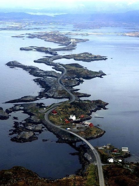
The Atlantic Road, Norway

The Atlantic Ocean Road or the Atlantic Road (Norwegian: Atlanterhavsveien) is a 8.3-kilometer (5.2 mi) long section of County Road 64 that runs through an archipelago in Eide and Averøy in Møre og Romsdal, Norway. It passes by Hustadvika, an unsheltered part of the Norwegian Sea, connecting the island of Averøy with the mainland and Romsdalshalvoya peninsula. It runs between the villages of Karvag on Averoy and Vevang in Eida. It is built on several small islands and skerries, which are connected by several causeways, viaducts and eight bridges – the most prominent being Storseisundet Bridge.
Details
18 Jan 2014 11:42:00
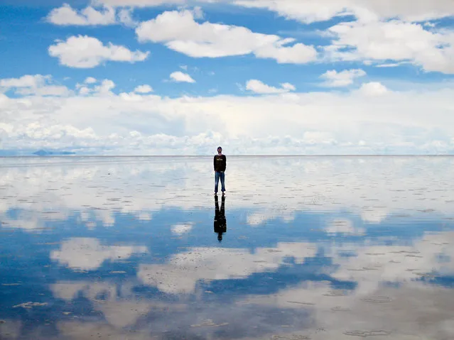
Salar de Uyuni

Salar de Uyuni (or Salar de Tunupa) is the world's largest salt flat at 10,582 square kilometers (4,086 sq mi). It is located in the Potosí and Oruro departments in southwest Bolivia, near the crest of the Andes, and is elevated 3,656 meters (11,995 ft) above mean sea level. The Salar was formed as a result of transformations between several prehistoric lakes. It is covered by a few meters of salt crust, which has an extraordinary flatness with the average altitude variations within one meter over the entire area of the Salar.
Details
04 Aug 2012 08:42:00
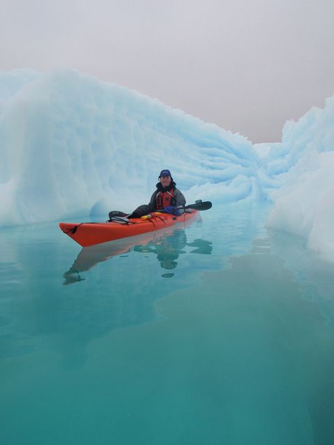
Chasing Ice in Greenland

The Greenland ice sheet is a vast body of ice covering 660,235 sq miles, roughly 80% of the surface of Greenland. It is the second largest ice body in the world, after the Antarctic Ice Sheet. Some scientists predict that climate change may be near a "tipping point" where the entire ice sheet will melt in about 2000 years. If the entire 2,850,000 cubic kilometres (683,751 cu mi) of ice were to melt, it would lead to a global sea level rise of 7.2 m (23.6 ft).
Details
30 Apr 2014 13:15:00