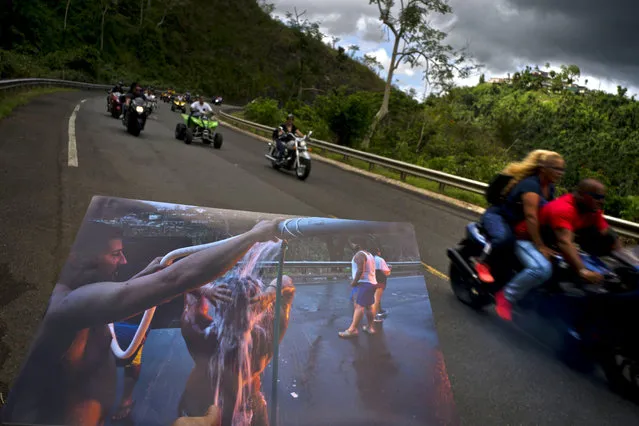
A printed photograph taken on September 28, 2017 shows people bathing on the highway after Hurricane Maria destroyed people's homes, held up at the same spot of the highway where motorcyclists ride past in Naranjito, Puerto Rico, May 27, 2018. Thanks to the owners of the land alongside the highway, creek water was piped to the side of the road for people without water to use for bathing, washing clothes and dishes. (Photo by Ramon Espinosa/AP Photo)
02 Jun 2018 00:03:00,post received
0 comments