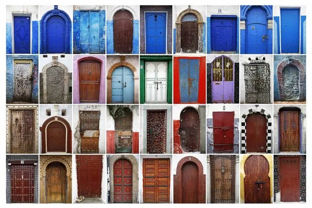
A combination photo shows some of the colourful doors seen in Rabat's Medina and Kasbah of the Udayas, September 2014. UNESCO made Rabat a World Heritage Site two years ago and media and tour operators call it a “must-see destination”. But it seems the tourist hordes have yet to find out. While visitors are getting squeezed through the better-known sites of Marrakesh and Fez, the old part of Rabat - with its beautiful Medina and Kasbah of the Udayas - remains an almost unspoiled oasis of calm. Smaller and more compact, its labyrinths of streets, passages and dead ends are a treasure trove of shapes and colours, of moments begging to be caught by the photographer's lens. (Photo by Damir Sagolj/Reuters)
08 Oct 2014 12:08:00,post received
0 comments