A model displays a collection called “Chubby Chaser” by Netherlands-based Maison The Faux during New York Fashion Week in New York on September 9, 2016. (Photo by Angela Weiss/AFP Photo)
US-British actress Lily Collins arrives for the 2023 Met Gala at the Metropolitan Museum of Art on May 1, 2023, in New York. (Photo by Angela Weiss/AFP Photo)
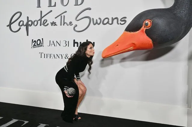
US television personality Bethenny Frankel arrives for FX's “Feud: Capote vs. The Swans” premiere at the Museum of Modern Art in New York, on January 23, 2024. (Photo by Angela Weiss/AFP Photo)
Hungarian model Barbara Palvin arrives for the 2019 CFDA fashion awards at the Brooklyn Museum in New York City on June 3, 2019. (Photo by Angela Weiss/AFP Photo)
Supporters of former US President and Republican presidential candidate Donald Trump arrive for a campaign rally at the PPL Center in Allentown, Pennsylvania, on October 29, 2024. (Photo by Angela Weiss/AFP Photo)
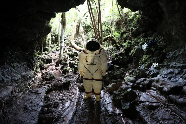
Peter Weiss, director of the Space Department of COMEX, (c) tests a pressurized suit identical to those used in space expeditions in the lava tunnel of “Caverne Gendarme” on October 12, 2018 in Saint-Philippe, the French overseas island of Reunion. Reunion could become a training site for astronauts. (Photo by Richard Bouhet/AFP Photo)
Burlesque performer Tallulah Talons dances in the “Pandemic Burlesque” show presented by Tallulah Talons at Club Cumming on March 18, 2021 in New York City. Like many other New York City nightlife venues, the club was shuttered in March 2020 due to the Covid-19 pandemic, but it continued to host cabaret and comedy shows via live stream for most of the year. The venue reintroduced on-site outdoor events in late December 2020. (Photo by Angela Weiss/AFP Photo)
From Britain to China to Mali, new maps showing travel times to the nearest urban centre reveal huge differences between countries. Using Open Street Map and Google, a University of Oxford team have created a visual breakdown that suggests major inequalities when it comes to commuting. Here: China. The dataset used for China was unique as it relied solely on Open Street Map, due to restrictions on accessing Google data. The population is densely concentrated in the east and accessibility is increased, whereas rural provinces in the west remain remote. (Photo by Daniel Weiss/Jennifer Rozier/Malaria Atlas Project/University of Oxford)