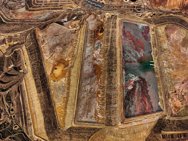
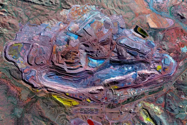
Loading...
Done
Dubai. (Photo by Airpano/Caters News)

These are the stunning panoramic shots of some of the worlds most beautiful locations. Company AirPano travel the world photographing its wonders from above. Their shots include famous cities – such as New York, Paris and Barcelona – as well as natural marvels, like volcanoes and waterfalls. The team, which consists of 12 members – nine photographers and three tech specialists – began looking into this style of photography in 2006. Project coordinator Sergey Semenov revealed after initially working with spherical panoramas on land, the group decided to take to the skies. They made a list of the 100 Best Places on the Planet, which they hoped to photograph over the coming years. Here: Dubai. (Photo by Airpano/Caters News)
Details
20 Mar 2015 11:23:00
Pontoons, which were previously used as a floating jetty, are seen on the cracked ground of the Atibainha dam, part of the Cantareira reservoir, during a drought in Nazare Paulista, Sao Paulo state February 12, 2015. (Photo by Paulo Whitaker/Reuters)

Pontoons, which were previously used as a floating jetty, are seen on the cracked ground of the Atibainha dam, part of the Cantareira reservoir, during a drought in Nazare Paulista, Sao Paulo state February 12, 2015. Brazil's worst drought in 80 years has left the Cantareira system, that provides greater Sao Paulo with most of its water, with the lowest water level on record. Brazil's economy is already expected to post zero growth this year. Worse yet, since Brazil depends on hydroelectric dams for about three quarters of its electricity, power shortages are also possible due to the drought, federal officials have said. (Photo by Paulo Whitaker/Reuters)
Details
15 Feb 2015 14:19:00
A Polish Air Force MIG-29 fighter (R) and an Italian Air Force Eurofighter Typhoon fighter patrol over the Baltics during a NATO air policing mission from Zokniai air base near Siauliai, Lithuania February 10, 2015. (Photo by Ints Kalnins/Reuters)

A Polish Air Force MIG-29 fighter (R) and an Italian Air Force Eurofighter Typhoon fighter patrol over the Baltics during a NATO air policing mission from Zokniai air base near Siauliai, Lithuania February 10, 2015. (Photo by Ints Kalnins/Reuters)
Details
11 Feb 2015 12:52:00
Industrial Sector, Tokai, Japan. (Photo by Benjamin Grant/Digital Globe/Caters News)

This series of pictures shot by satellite, show the man-made world as astronauts see it. Artist Benjamin Grant uses Google Earth to find the most compelling satellite images of human civilization. The stunning pictures of sprawling metropolises and vast reservoirs are sometimes unidentifiable until zoomed in. In order to find an extraordinary picture in the practically endless supply of satellite data, Benjamin focuses on the themes of current events or environmental issues. Here: Industrial Sector, Tokai, Japan. (Photo by Benjamin Grant/Digital Globe/Caters News)
Details
04 Feb 2015 12:21:00
Air Force One casts its shadow over homes as it comes in to land in Allentown, Pennsylania with U.S. President George W. Bush aboard in this October 1, 2004 file photo. (Photo by Jason Reed/Reuters)

Air Force One casts its shadow over homes as it comes in to land in Allentown, Pennsylania with U.S. President George W. Bush aboard in this October 1, 2004 file photo. (Photo by Jason Reed/Reuters)
Details
30 Jan 2015 11:00:00
Image of the Clouds taken in August 2014 by astronauts on board the International Space Station (ISS).  A year from space photographs of hurricanes, typhoons and meteorite craters show an astronauts-eye view of our planet from hundreds of miles above the earth. The illuminating images were taken by astronauts onboard the International Space Station (ISS) over the course of 2014. (Photo by NASA/SPL/Barcroft Media)

Image of the Clouds taken in August 2014 by astronauts on board the International Space Station (ISS). A year from space photographs of hurricanes, typhoons and meteorite craters show an astronauts-eye view of our planet from hundreds of miles above the earth. The illuminating images were taken by astronauts onboard the International Space Station (ISS) over the course of 2014. (Photo by NASA/SPL/Barcroft Media)
Details
31 Dec 2014 14:47:00
The Maldives Islands

Male is the capital and most populous city in the Republic of Maldives. The city is geographically located at the southern edge of North Malé Atoll (Kaafu Atoll). Administratively, it is a city-class constituency and is governed by the Malé City Council. Traditionally it was the King's Island, from where the ancient Maldive Royal dynasties ruled and where the palace was located. The city was then called “Mahal”. Formerly it was a walled city surrounded by fortifications and gates (doroshi).
Details
30 Dec 2014 11:23:00
Botswana By Zack Seckler

Aerial shots always amaze us by their magnificence. Human-sized footprints look like ant trails, trees resemble little pieces of broccoli, and landscapes are transformed into breathtaking images, which look like something that can be seen under a microscope. This set of pictures features surreal aerial shots of Botswana taken by Zack Seckler. In the past, to make these kinds of shots, someone had to go up in a helicopter to take a picture. However, today, such images can be easily made using quadcopters, such as DJI Phantom or any other. Thanks to the new technology, we are able to view our world in new ways, allowing us to better appreciate its complexity and beauty. (Photo by Zack Seckler)
Details
14 Dec 2014 11:32:00