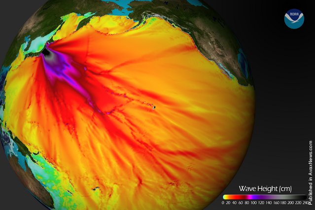
In this handout image provided by the National Oceanic and Atmospheric Administration (NOAA), model runs from the Center for Tsunami Research at the NOAA Pacific Marine Environmental Laboratory show the expected wave heights of the tsunami as it travels across the Pacific basin March 11, 2011. The largest wave heights are expected near the earthquake epicenter, off Japan. The wave will decrease in height as it travels across the deep Pacific but grow taller as it nears coastal areas. In general, as the energy of the wave decreases with distance, the near shore heights will also decrease (e.g., coastal Hawaii will not expect heights of that encountered in coastal Japan). (Photo by NOAA via Getty Images)
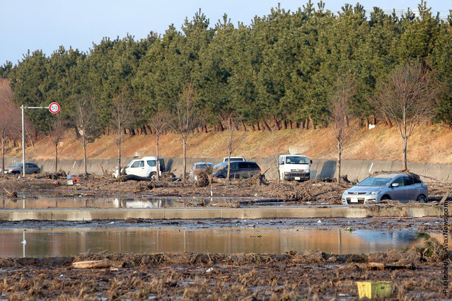
Cars are left abandonded in the area damaged by the tsunami after a 9.0 magnitude strong earthquake struck on March 11 off the coast of north-eastern Japan, on March 13, 2011 in Sendai, Japan. The quake struck offshore at 2:46pm local time, triggering a tsunami wave of up to 10 metres which engulfed large parts of north-eastern Japan. The death toll is currently unknown, with fears that the current hundreds dead may well run into thousands. (Photo by Kiyoshi Ota/Getty Images)
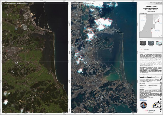
These two handout satellite photographs provided by the Center for Satellite Based Crisis Information (ZKI) of the German Aeropsace Center (DLR) show the city of Soma and surrounding area before (L) and after the devastating earthquake and tsunami on March 12, 2011 at Soma, Japan. At least 1,800 people are confirmed dead across northeastern Japan and at least two nuclear reactors at the Fukushima facility are facing meltdown. (Photo by German Aeorpace Center DLR/ZKI via Getty Images)

These two handout satellite photographs provided by the Center for Satellite Based Crisis Information (ZKI) of the German Aeropsace Center (DLR) show the Iwanuma-Matsushima area before (L) and after the devastating earthquake and tsunami on March 12, 2011 at Torinoumi, Japan. (Photo by German Aeorpace Center DLR/ZKI via Getty Images)
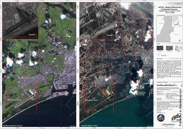
These two handout satellite photographs provided by the Center for Satellite Based Crisis Information (ZKI) of the German Aeropsace Center (DLR) show the Matsushima Airport and surrounding area before (L) and after the devastating earthquake and tsunami on March 12, 2011 at Higashi-Matsushima, Japan. (Photo by German Aeorpace Center DLR/ZKI via Getty Images)
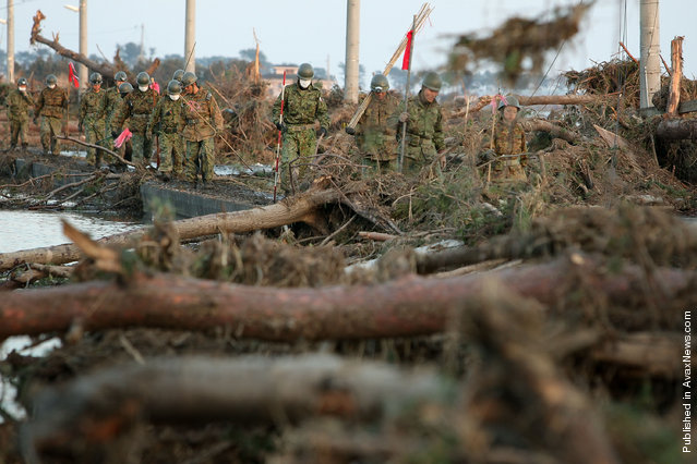
Members of the Ground Self-Defense Forces walk through an area damaged by tsunami after a 9.0 magnitude strong earthquake struck on March 11 off the coast of north-eastern Japan, on March 13, 2011 in Sendai, Japan. (Photo by Kiyoshi Ota/Getty Images)
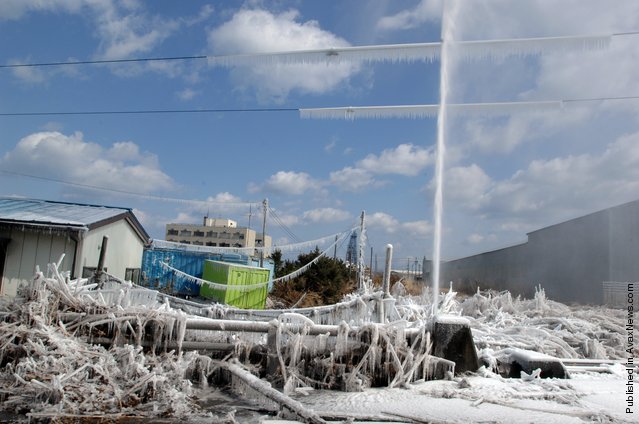
In this handout image provided by U.S. Navy, A water pipe spews water after being damaged by a tsunami, which was triggered by a massive earthquake off the Northeastern coast March 12, 2011 in Hachinohe, Japan. (Photo by Daniel Sanford/ U.S. Navy via Getty Images)
A local resident walks through area damaged by the tsunami after a 9.0 magnitude strong earthquake struck on March 11 off the coast of north-eastern Japan, on March 13, 2011 in Sendai, Japan. (Photo by Kiyoshi Ota/Getty Images)
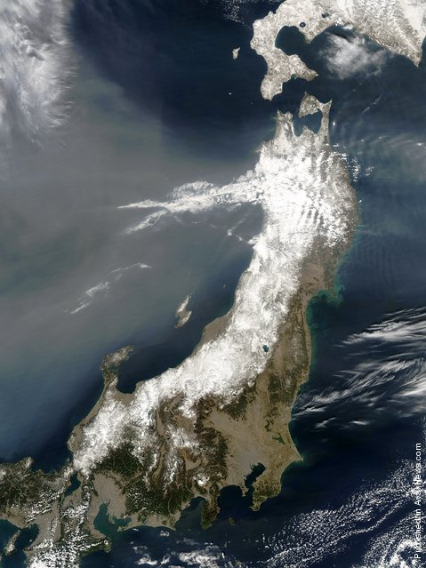
In this handout image provided by NASA, a satellite view of northeastern Japan following a massive earthquake captured March 13, 2011 at 03:55 UTC as seen from Space. An earthquake measuring 8.9 on the Richter scale has hit the northeast coast of Japan yesterday causing tsunami alerts throughout countries bordering the Pacific Ocean. (Photo by NASA via Getty Images)
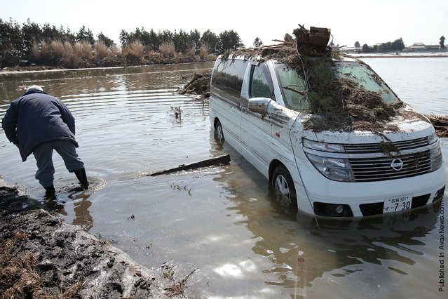
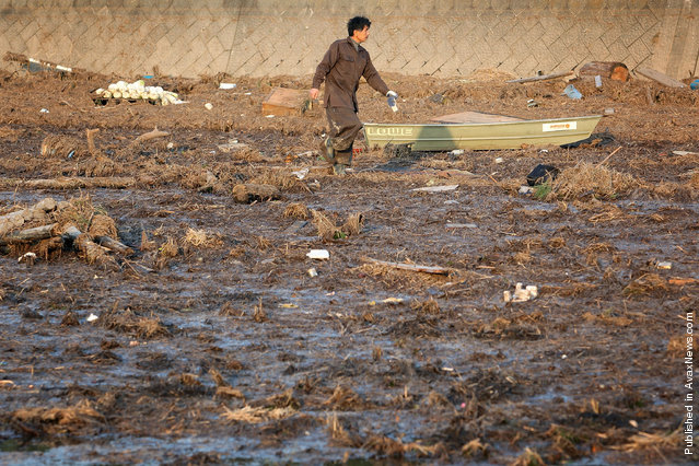
A local resident tries to approach a car left abandoned in the area damaged by tsunami after a 9.0 magnitude strong earthquake struck on March 11 off the coast of north-eastern Japan, on March 14, 2011 in Sendai, Japan. (Photo by Kiyoshi Ota/Getty Images)
13 Mar 2011 14:29:00,
post received
0 comments