Loading...
Done
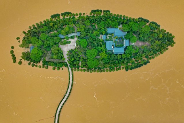
This aerial photograph taken on April 22, 2024 shows a flooded island after heavy rains in Qingyuan, in southern China's Guangdong province. More than 100,000 people have been evacuated due to heavy rain and fatal floods in southern China, with the government issuing its highest-level rainstorm warning for the affected area on April 23. (Photo by AFP Photo/China Stringer Network)

This aerial photograph taken on April 22, 2024 shows a flooded island after heavy rains in Qingyuan, in southern China's Guangdong province. More than 100,000 people have been evacuated due to heavy rain and fatal floods in southern China, with the government issuing its highest-level rainstorm warning for the affected area on April 23. (Photo by AFP Photo/China Stringer Network)
Details
07 May 2024 03:56:00
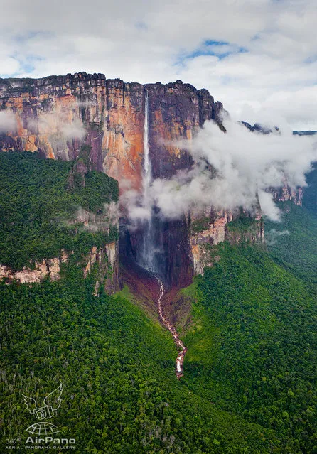
Angel Waterfall Of Venezuela  By Dima Moiseenko

Angel Falls is the world’s highest waterfall as well as the inspiration for Paradise Falls in the Pixar film Up. Unless you’re planning on visiting the falls in the heart of Venezuela in person, the next best thing might be this stunning series of 360° aerial panoramas recently captured by photographer Dmitry Moiseenko over two days from a helicopter. Pan around, zoom into the scene, and become immersed in the otherworldly landscapes found at Angel Falls.
Details
06 Nov 2013 10:58:00
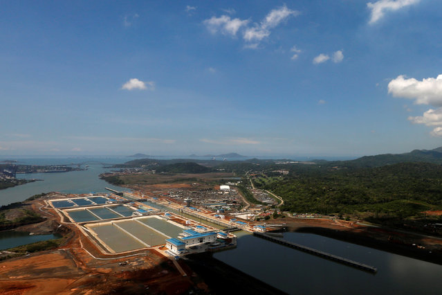
An aerial view of the new Panama Canal expansion project on the Atlantic side of the Panama Canal during an organized media tour by Italy's Salini Impregilo, one of the main sub contractors of the Panama Canal Expansion project, in Panama City May 11, 2016. The newly expanded Panama Canal will be inaugurated on June 26, 2016. (Photo by Carlos Jasso/Reuters)

An aerial view of the new Panama Canal expansion project on the Atlantic side of the Panama Canal during an organized media tour by Italy's Salini Impregilo, one of the main sub contractors of the Panama Canal Expansion project, in Panama City May 11, 2016. The newly expanded Panama Canal will be inaugurated on June 26, 2016. (Photo by Carlos Jasso/Reuters)
Details
13 May 2016 11:54:00
An aerial view of the Atibainha dam, part of the Cantareira reservoir, during a drought in Nazare Paulista, Sao Paulo state November 18, 2014. (Photo by Nacho Doce/Reuters)

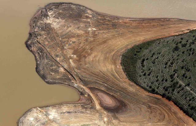
An aerial view of the Atibainha dam, part of the Cantareira reservoir, during a drought in Nazare Paulista, Sao Paulo state November 18, 2014. Brazil's worst drought in 80 years has left the Cantareira system, that provides greater Sao Paulo with most of its water, with the lowest water level on record, with daily rationing becoming common in the region's smaller cities, according to the state authorities and the two main reservoirs serving metropolitan Sao Paulo, South America's largest city, could dry out by February if relief does not arrive in the upcoming rainy season. (Photo by Nacho Doce/Reuters)
Details
20 Nov 2014 12:19:00
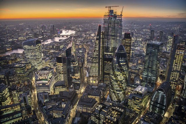
The city of London at dusk. (Photo by Jason Hawkes/Caters News Agency)

The amazing gallery shows parts of London shot from above – and the views are breathtaking. Jason Hawkes, an aerial photographer from Reading, England, captured the images over the past six months while flying in AS355 helicopters. Here: The city of London at dusk. (Photo by Jason Hawkes/Caters News Agency)
Details
23 Sep 2019 00:03:00
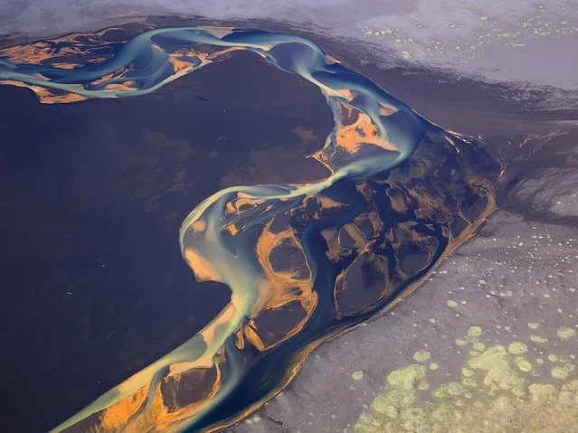
Photos Of Iceland By Andre Ermolaev Part 2

Andre Ermolaev is a photographer from Moscow, Russia (featured previously). In an ongoing series of aerial photos, Andre captures Iceland’s incredible landscape like you’ve never seen. Many of his images focus on capturing glacial rivers flowing through Iceland’s volcanic areas and the patterns and colours that emerge from the resulting flow.
Details
02 Jun 2014 11:19:00
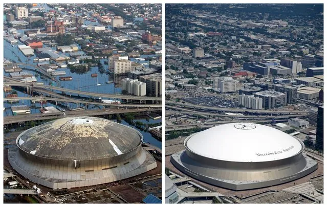
This combination of August 30, 2005 and July 29, 2015 aerial photos shows downtown New Orleans and the Superdome flooded by Hurricane Katrina and the same area a decade later. Katrina's powerful winds and driving rain bore down on Louisiana on August 29, 2005. (Photo by David J. Phillip/Gerald Herbert/AP Photo)

This combination of August 30, 2005 and July 29, 2015 aerial photos shows downtown New Orleans and the Superdome flooded by Hurricane Katrina and the same area a decade later. Katrina's powerful winds and driving rain bore down on Louisiana on August 29, 2005. The storm caused major damage to the Gulf Coast from Texas to central Florida while powering a storm surge that breached the system of levees that were built to protect New Orleans from flooding. (Photo by David J. Phillip/Gerald Herbert/AP Photo)
Details
29 Aug 2015 11:22:00
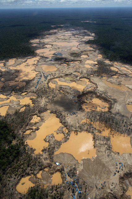
This November 11, 2014 aerial photo, shows a deforested area dotted with blue tarps, marking the area where miners reside, and craters filled with water, caused by illegal gold mining activities, in La Pampa, in Peru's Madre de Dios region. (Photo by Rodrigo Abd/AP Photo)

This November 11, 2014 aerial photo, shows a deforested area dotted with blue tarps, marking the area where miners reside, and craters filled with water, caused by illegal gold mining activities, in La Pampa, in Peru's Madre de Dios region. Less than a month before Peru plays host to global climate talks, the government sent a battalion of police into southeastern jungles to dismantle illegal gold-mining mining camps. Peru's anti-illegal mining czar, retired army Gen. Augusto Soto, marched the men to the wasteland known as La Pampa, where 50,000 hectares of rainforest have been obliterated in the past six years. (Photo by Rodrigo Abd/AP Photo)
Details
21 Nov 2014 12:35:00