Loading...
Done
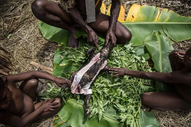
A man from the Dani tribe cuts the head of a pig after cooked by traditional way which is use burned hot stones at Obia Village on August 9, 2014 in Wamena, Papua, Indonesia. The stone-age Dani tribe live a traditional existence in the Baliem Valley, which is situated 1600 metres above sea level in the heart of the Cyclops Mountains. (Photo by Agung Parameswara/Getty Images)

A man from the Dani tribe cuts the head of a pig after cooked by traditional way which is use burned hot stones at Obia Village on August 9, 2014 in Wamena, Papua, Indonesia. The stone-age Dani tribe live a traditional existence in the Baliem Valley, which is situated 1600 metres above sea level in the heart of the Cyclops Mountains. (Photo by Agung Parameswara/Getty Images)
Details
14 Aug 2014 10:30:00
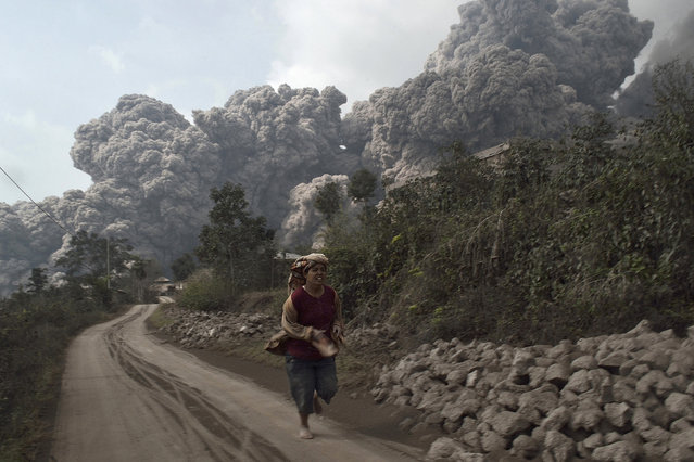
A villager run as Mount Sinabung erupt at Sigarang-Garang village in Karo district, Indonesia's North Sumatra province, February 1, 2014. Four people died and more than 28, 000 villagers have been evacuated since authorities raised the alert status for the volcano to the highest level in November 2013, local media reported on Saturday. (Photo by Reuters/Stringer)

A villager run as Mount Sinabung erupt at Sigarang-Garang village in Karo district, Indonesia's North Sumatra province, February 1, 2014. Four people died and more than 28, 000 villagers have been evacuated since authorities raised the alert status for the volcano to the highest level in November 2013, local media reported on Saturday. (Photo by Reuters/Stringer)
Details
02 Feb 2014 09:16:00
An art installation formed with milk churns, made by land art artist Gerard Benoit a la Guillaume, is seen at the Chenau de Mayen in the resort of Leysin, Switzerland August 7, 2015. More than 80 milk churns were placed between the Tour d'Ai and the Tour de Mayen summits at an altitude of 2,000 meters (6,561 feet) above sea level under the direction of the artist, to be photographed for his ongoing art project entitled “Milk churns without borders”. (Photo by Denis Balibouse/Reuters)

An art installation formed with milk churns, made by land art artist Gerard Benoit a la Guillaume, is seen at the Chenau de Mayen in the resort of Leysin, Switzerland August 7, 2015. More than 80 milk churns were placed between the Tour d'Ai and the Tour de Mayen summits at an altitude of 2,000 meters (6,561 feet) above sea level under the direction of the artist, to be photographed for his ongoing art project entitled “Milk churns without borders”. (Photo by Denis Balibouse/Reuters)
Details
08 Aug 2015 13:16:00
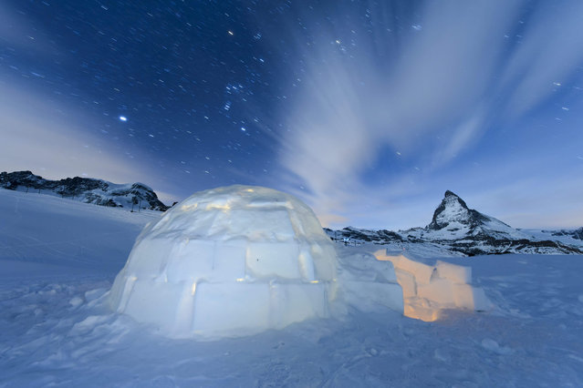
A long time exposure shows a Igloo at the “Igloo village” (Iglu Dorf) in front of the famous Matterhorn mountain in Zermatt, Switzerland, late 28 January 2016. The hotel-igloo village made of snow and ice at 2'815 meters about sea level with a bar, a restaurant, bedrooms and wellness are celebrating their 20th anniversary. (Photo by Jean-Christophe Bott/EPA)

A long time exposure shows a Igloo at the “Igloo village” (Iglu Dorf) in front of the famous Matterhorn mountain in Zermatt, Switzerland, late 28 January 2016. The hotel-igloo village made of snow and ice at 2'815 meters about sea level with a bar, a restaurant, bedrooms and wellness are celebrating their 20th anniversary. For this occasion the hosts built the largest classic igloo with a diameter of 13 meters and a ceiling hight of 11 meters in front of Matterhorn in Zermatt, and they will attempt the world record for this Igloo. (Photo by Jean-Christophe Bott/EPA)
Details
30 Jan 2016 14:16:00
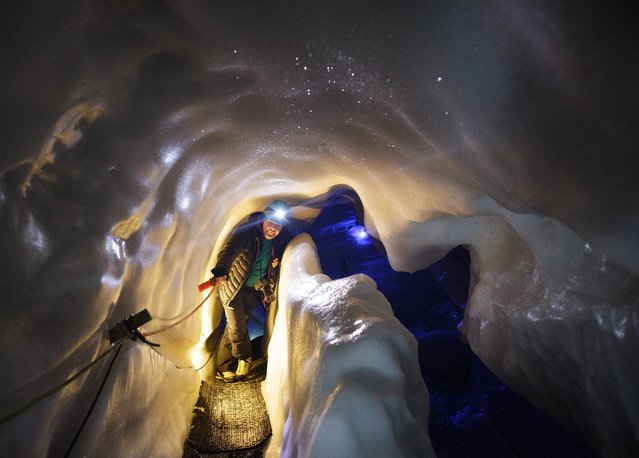
A tourist walks inside the Ice Palace glacier hollow at Hintertux glacier, located at around 3250 meters above sea level, in Zillertal, Austria, 02 March, 2016. The hollow's temperature remains constant at 0 degrees Celsius, in summer and winter alike, and is also used by the University of Innsbruck for scientific research projects. (Photo by Lisi Niesner/EPA)

A tourist walks inside the Ice Palace glacier hollow at Hintertux glacier, located at around 3250 meters above sea level, in Zillertal, Austria, 02 March, 2016. The hollow's temperature remains constant at 0 degrees Celsius, in summer and winter alike, and is also used by the University of Innsbruck for scientific research projects. (Photo by Lisi Niesner/EPA)
Details
03 Mar 2016 11:44:00
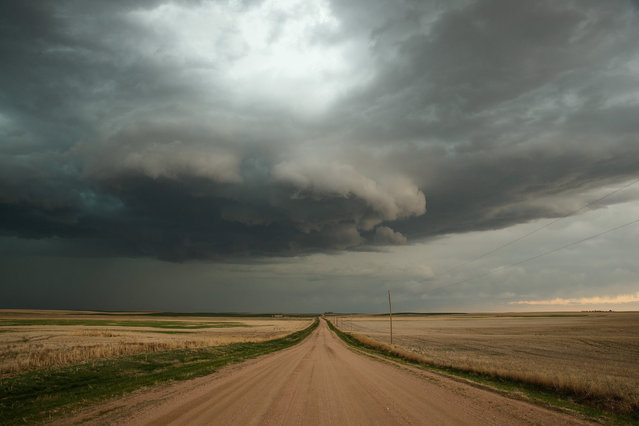
A supercell thunderstorm develops, May 8, 2017 in Elbert County outside of Limon, Colorado. With funding from the National Science Foundation and other government grants, scientists and meteorologists from the Center for Severe Weather Research try to get close to supercell storms and tornadoes trying to better understand tornado structure and strength, how low-level winds affect and damage buildings, and to learn more about tornado formation and prediction. (Photo by Drew Angerer/Getty Images)

A supercell thunderstorm develops, May 8, 2017 in Elbert County outside of Limon, Colorado. With funding from the National Science Foundation and other government grants, scientists and meteorologists from the Center for Severe Weather Research try to get close to supercell storms and tornadoes trying to better understand tornado structure and strength, how low-level winds affect and damage buildings, and to learn more about tornado formation and prediction. (Photo by Drew Angerer/Getty Images)
Details
16 Jun 2017 06:20:00
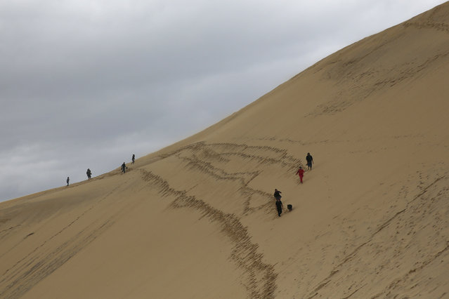
People walk along the Dune du Pilat (Dune of Pilat), the tallest sand dune in Europe, in La Teste de Buch, near Bordeaux, France, June 15, 2016. The dune has a volume of about 60,000,000 m³, measuring around 500 m wide from east to west and 2.7 km in length from north to south. Its height is currently 110 meters above sea level. The dune is a famous tourist destination with more than one million visitors per year. (Photo by Sergio Perez/Reuters)

People walk along the Dune du Pilat (Dune of Pilat), the tallest sand dune in Europe, in La Teste de Buch, near Bordeaux, France, June 15, 2016. The dune has a volume of about 60,000,000 m³, measuring around 500 m wide from east to west and 2.7 km in length from north to south. Its height is currently 110 meters above sea level. (Photo by Sergio Perez/Reuters)
Details
17 Jun 2016 13:38:00
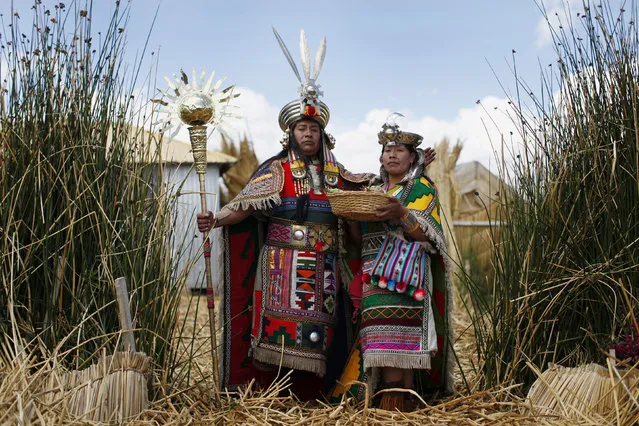
An Andean man and a woman, depicting Inca's legendary characters Manco Capac and Mama Ocllo, pose for a portrait in a Uros island at Lake Titicaca before a re-enactment in Puno November 5, 2014. The Uros islands are a group of 70 man-made totora reed islands floating on the lake, which according to Peru's tourism board iPeru is the world's highest navigable lake at over 4,000 meters above sea level. (Photo by Enrique Castro-Mendivil/Reuters)

An Andean man and a woman, depicting Inca's legendary characters Manco Capac and Mama Ocllo, pose for a portrait in a Uros island at Lake Titicaca before a re-enactment in Puno November 5, 2014. The Uros islands are a group of 70 man-made totora reed islands floating on the lake, which according to Peru's tourism board iPeru is the world's highest navigable lake at over 4,000 meters above sea level. The Uros people fish and hunt, but tourism is their main source of livelihood. (Photo by Enrique Castro-Mendivil/Reuters)
Details
07 Nov 2014 12:52:00