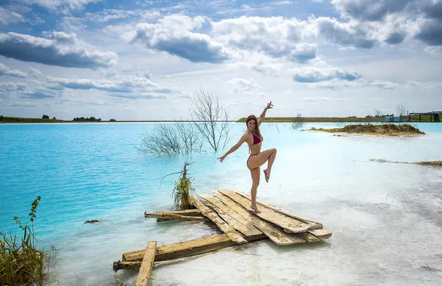
In this undated handout photo taken by mrwed54, a woman poses for a photo by a lake in the Siberian city of Novosibirsk, about 2,800 kilometers (1,750 miles) east of Moscow, Russia. Thousands of Novosibirsk residents, from scantily clad women to newlyweds have been instagramming selfies near the lake nicknamed the “Siberian Malvides” after the far-flung tropical islands in the Indian Ocean. This is in fact is a man-made dumb of coal from a nearby power station that provides for most of Novosibirsk’s energy needs. Environmentalists are warning people against coming into contact with the water. (Photo by mrwed54 via AP Photo)
15 Jul 2019 00:07:00,post received
0 comments