Loading...
Done
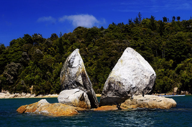
Split Apple Rock

Split Apple Rock is a geological rock formation in The Tasman Bay off the northern coast of the South Island of New Zealand. Made of granite, it is in the shape of an apple which has been cut in half. It is a popular tourist attraction in the waters of the Tasman Sea approximately 50 metres off the coast between Kaiteriteri and Marahau. The rock sits in shallow water at low tide and is accessible by wading. It is also a point of interest for the many tourist boats and pleasure craft which operate along the shores of the Abel Tasman National Park. The cleft to produce two sides of the 'apple' was a natural occurrence. It is unknown when this happened and therefore the cleaving of the rock has attracted mythological explanations.
Details
19 Oct 2013 10:58:00
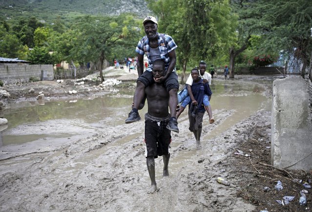
Men carry others, so they do not soil their shoes and clothes, through a mudslide caused by Tropical Storm Erika in Carries, Haiti, August 29, 2015. (Photo by Andres Martinez Casares/Reuters)

Men carry others, so they do not soil their shoes and clothes, through a mudslide caused by Tropical Storm Erika in Carries, Haiti, August 29, 2015. Erika, a tropical storm that killed 20 people on the Caribbean island of Dominica and at least one person in Haiti, fell apart on Saturday over eastern Cuba, the U.S. National Hurricane Center said. (Photo by Andres Martinez Casares/Reuters)
Details
30 Aug 2015 11:47:00
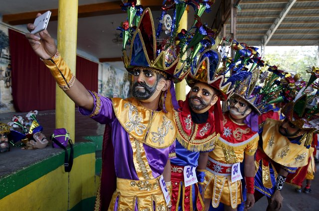
Penitents wearing masks, known locally as “Morions” take a selfie during the start of Holy Week celebrations in Mogpog, Marinduque in central Philippines March 21, 2016. (Photo by Erik De Castro/Reuters)

Penitents wearing masks, known locally as “Morions” take a selfie during the start of Holy Week celebrations in Mogpog, Marinduque in central Philippines March 21, 2016. The Moriones is an annual festival held on Holy Week on the island of Marinduque, Philippines. The “Moriones” are men and women in costumes and masks replicating the garb of biblical Roman soldiers as interpreted by local folks. (Photo by Erik De Castro/Reuters)
Details
22 Mar 2016 11:29:00
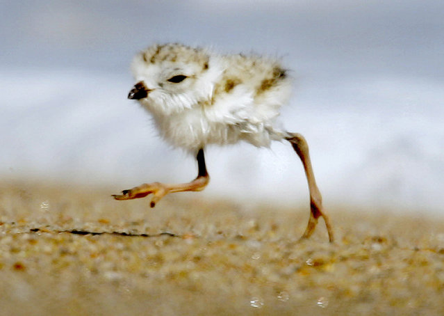
In this July 12, 2007 file photo, a two-day-old piping plover runs along a beach in the Quonochontaug Conservation Area in Westerly, R.I. A court fight to protect the piping plover, a bird listed as “threatened” under the federal Endangered Species Act, is holding up a $207 million plan to replenish sand along a 19-mile stretch of shoreline on New York's Fire Island. The sand was eroded during Superstorm Sandy. (Photo by Steven Senne/AP Photo)

In this July 12, 2007 file photo, a two-day-old piping plover runs along a beach in the Quonochontaug Conservation Area in Westerly, R.I. (Photo by Steven Senne/AP Photo)
Details
25 Nov 2014 11:28:00
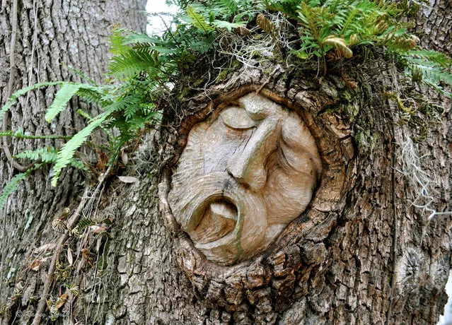
Tree Spirit Carvings by Keith Jennings

Created by artist and unassuming local celebrity, Keith Jennings, the first tree spirit arrived on St. Simons Island in 1982. The old story goes that Keith negotiated his way out of a bar tab, hence, a tree priestess was born behind Murphy’s Tavern, on a blurry Saturday morning. In his own words, however, Keith states that his first tree spirit was created in the back yard of a place called, “The Animal Farm”. Either way, Keith Jennings has been known to cut the rug around here, no matter how you slice it.
Details
20 Aug 2013 10:21:00
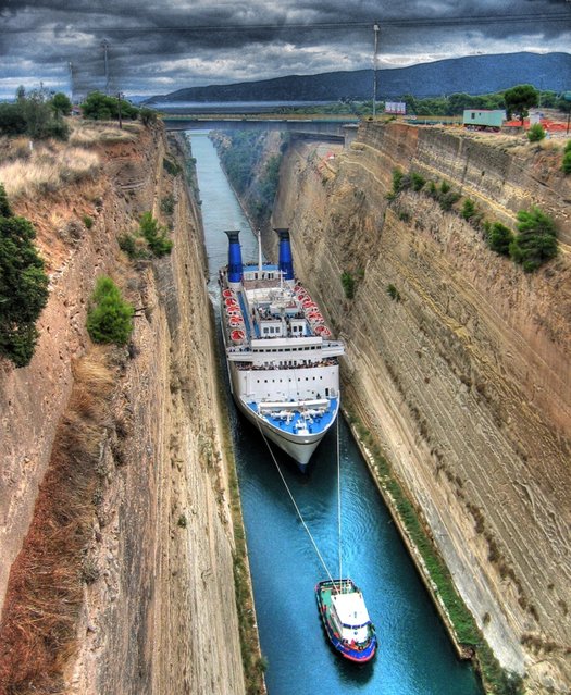
Corinth Canal

The Corinth Canal is a canal that connects the Gulf of Corinth with the Saronic Gulf in the Aegean Sea. It cuts through the narrow Isthmus of Corinth and separates the Peloponnesian peninsula from the Greek mainland, thus effectively making the former an island. The builders dug the canal through the Isthmus at sea level; no locks are employed. It is 6.4 kilometres (4.0 mi) in length and only 21.3 metres (70 ft) wide at its base, making it unpassable for most modern ships. It now has little economic importance.

Details
12 Mar 2013 12:21:00
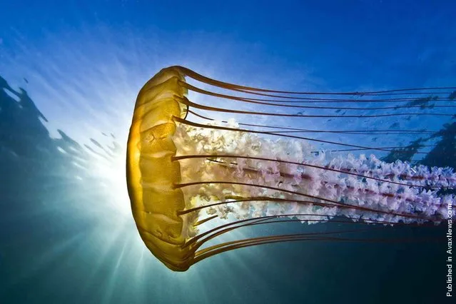
Marcello Di Francesco took third place in the Macro category for this picture of an Emperor shrimp (Periclimenes imperator), taken in the waters near Indonesia's Ambon Island

More than 700 underwater images were submitted for the 2012 Annual Underwater Photography Contest, hosted by the University of Miami's Rosenstiel School of Marine & Atmospheric Science. This year, for the first time, the University of Miami set up a “Fan Favorite” category for its underwater photo competition. Internet users could vote for their favorite among five pictures. Todd Aki's photo of a jellyfish took the prize, snaring 599 of the 1,221 votes cast. (Photo by Todd Aki)
Details
22 Apr 2012 12:47:00
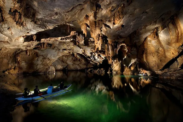
Underground River

The Puerto Princesa Subterranean River National Park is located about 50 kilometres (30 mi) north of the city centre of Puerto Princesa, Palawan, Philippines. The river is also called Puerto Princesa Underground River. The national park is located in the Saint Paul Mountain Range on the northern coast of the island. It is bordered by St. Paul Bay to the north and the Babuyan River to the east. The City Government of Puerto Princesa has managed the National Park since 1992. The park is also known as St. Paul's Subterranean River National Park, or St. Paul Underground River. The entrance to the Subterranean River is a short hike from the town of Sabang.
Details
16 Jul 2012 11:37:00