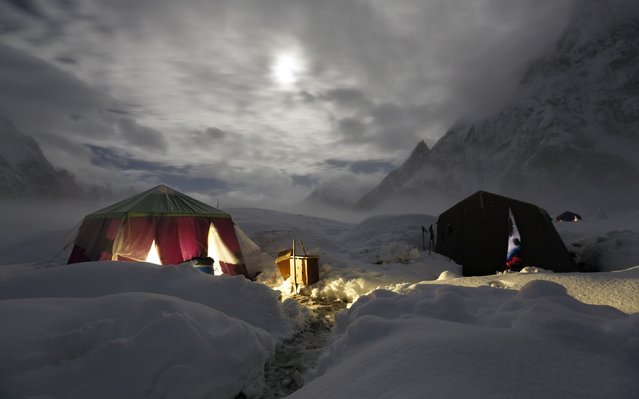
The moon illuminates the snow-covered Concordia, the confluence of the Baltoro and Godwin-Austen glaciers, near the world's second highest mountain the K2 (8,000 meters) in the Karakoram mountain range in Pakistan September 6, 2014. While other parts of Pakistan and northern India were flooded, Concordia in the Karakoram mountain range was covered with a seasonally unusual amount of snow. Geographically, Pakistan is a climbers paradise. It rivals Nepal for the number of peaks over 7,000 meters and is home to the world's second tallest mountain, K2, as well as four of the world's 14 summits higher than 8,000 meters. (Photo by Wolfgang Rattay/Reuters)