“The longest-operating Earth observing satellite is ending its mission after nearly 29 years, more than 150,000 orbits and 2.5 million images. Landsat 5 outlived its planned 3-year operation almost 10 times over, saving the continuity of the Landsat mission. Landsat 5's longevity became critical after Landsat 6 failed to reach orbit in 1993.
The U.S. Geological Survey was able to rescue the satellite from failures several times over the years, but recently a broken gyroscope has permanently hobbled the aging craft. Landsat 7, launched in 1999 and also well past its planned 5-year mission, is still keeping an eye on the planet until Landsat 8's launch, which is planned for February 2013.
To celebrate this mighty spacecraft's contribution to our understanding of the Earth, here are some of our favorite images Landsat 5 has taken over its three decades in space”. – Wired.com

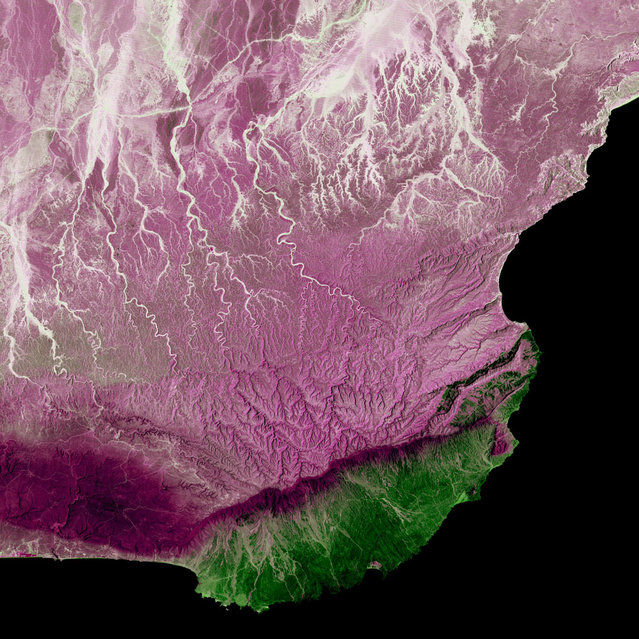
Belcher Islands, Canada. Like sweeping brushstrokes of pink and green, the Belcher Islands meander across the deep blue of Canada's Hudson Bay. The islands' only inhabitants live in the small town of Sanikiluaq, near the upper end of the middle island. Despite the green hues in this image, these rocky islands are too cold to sustain more than a smattering of low-growing vegetation. Image taken by Landsat 5 on September 21, 2001. (Photo by USGS/NASA)
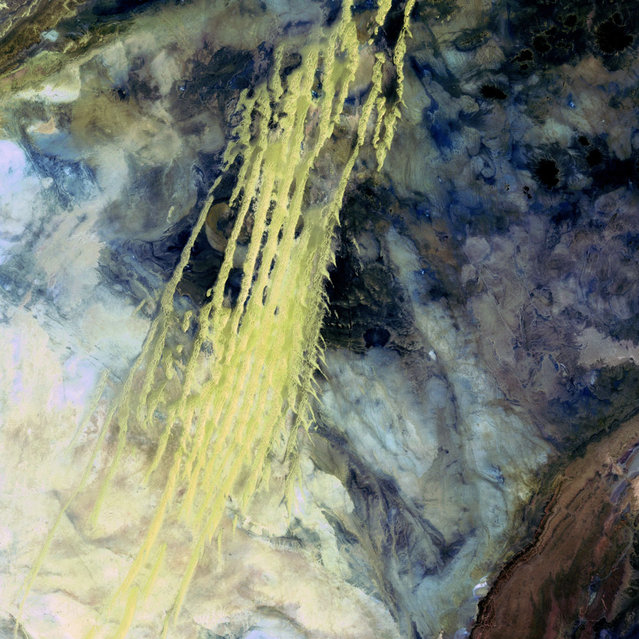
Erg Iguidi, Algeria. What look like pale yellow paint streaks slashing through a mosaic of mottled colors are ridges of wind-blown sand that make up Erg Iguidi, an area of ever-shifting sand dunes extending from Algeria into Mauritania in northwestern Africa. Erg Iguidi is one of several Saharan ergs, or sand seas, where individual dunes often surpass 500 meters – nearly one-third of a mile – in both width and height. Image taken by Landsat 5 on April 8, 1985. (Photo by USGS/NASA)
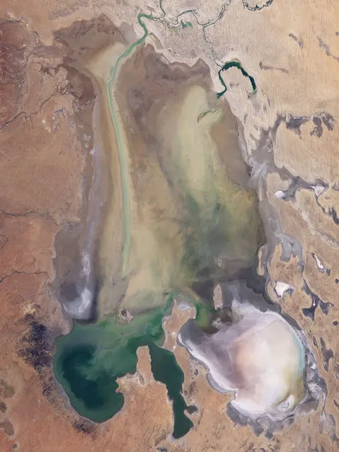
Lake Eyre, Australia. Australia’s Lake Eyre is usually dry, but Landsat 5 caught the image after an unusually wet rainy season in 2009. Image taken by Landsat 5 on June 10, 2009. (Photo by USGS/NASA)
[img alt="Mount Elgon, Uganda-Kenya Border. Clouds encircle the lofty rim of Africa's Mount Elgon, a huge, long-extinct volcano on the border between Uganda and Kenya. The solitary volcano has one of the world's largest intact calderas, a cauldron-like central depression. The caldera is about 6.5 kilometers [4 miles] across. It formed following an eruption, when the emptied magma chamber collapsed under the weight of volcanic rock above it. Image taken by Landsat 5 on August 9, 1984. (Photo by USGS/NASA)"]44366[/img]
Mount Elgon, Uganda-Kenya Border. Clouds encircle the lofty rim of Africa's Mount Elgon, a huge, long-extinct volcano on the border between Uganda and Kenya. The solitary volcano has one of the world's largest intact calderas, a cauldron-like central depression. The caldera is about 6.5 kilometers [4 miles] across. It formed following an eruption, when the emptied magma chamber collapsed under the weight of volcanic rock above it. Image taken by Landsat 5 on August 9, 1984. (Photo by USGS/NASA)
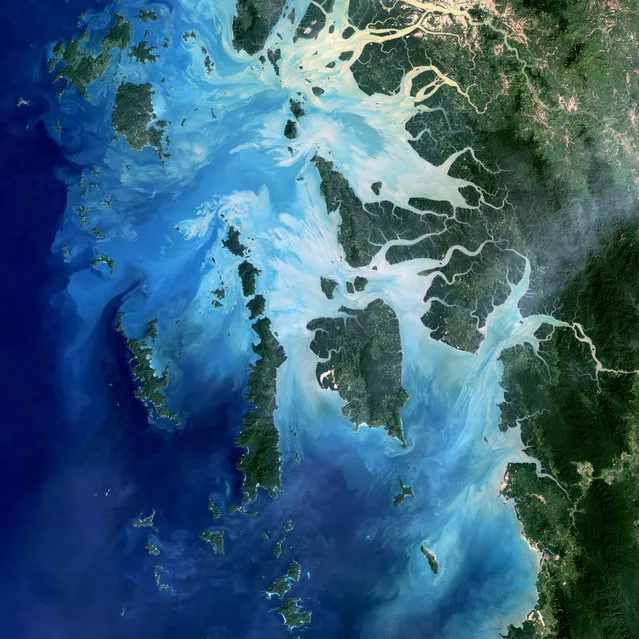
Mergui Archipelago, Myanmar. The Mergui Archipelago in the Andaman Sea consists of more than 800 islands. This natural-color image of the center portion of the archipelago was captured by Landsat 5 on December 14, 2004. (Photo by USGS/NASA)
Dhofar Region, Oman. Much of Oman is desert, but the Arabian Sea coast in the Dhofar region represents a startling difference in climate. This coastal region catches the monsoon rains, or khareef, during the summer months. Drenching rains fall primarily on the mountainous ridge that separates the lush, fertile areas along the coast from the arid interior, recharging streams, waterfalls and springs that provide plentiful water supplies in the fertile lowlands for the remainder of the year. Image taken by Landsat 5 on April 2, 2005. (Photo by USGS/NASA)
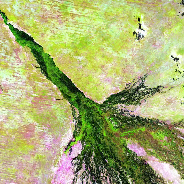
Okavango River, Botswana. Like a watercolor in which a brushstroke of dark green has bled into a damp spot on the paper, southern Africa's Okavango River spreads across the pale, parched landscape of northern Botswana to become the lush Okavango Delta. The delta forms where the river empties into a basin in the Kalahari Desert, creating a maze of lagoons, channels and islands where vegetation flourishes, even in the dry season, and wildlife abounds. Image taken by Landsat 5 on April 27, 2009. (Photo by USGS/NASA)
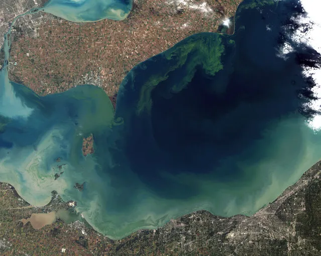
Lake Erie. Though Lake Erie looks beautiful in this image, the green swirls in the water are evidence of the worst toxic algae bloom the lake has suffered in decades. Image taken by Landsat 5 on October 5, 2011. (Photo by USGS/NASA)
25 Dec 2012 11:13:00,
post received
0 comments