Storm chasing photographer Mike Hollingshead makes a living following the worst storms in America, from snarling tornadoes chewing up the Kansas farmland to supercell thunderstorms massing over the Dakotas. His style is to get right in the path of the storm. While he says it’s less scary than you think – because most of the storm consists of heavy rain – it’s still extremely stressful.
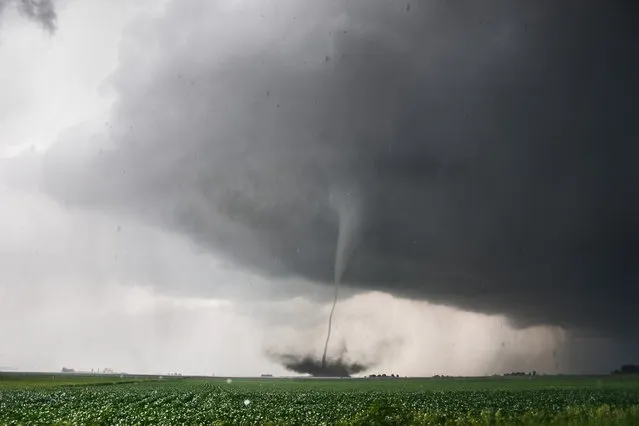
Tornado kicks up debris near Ft. Dodge Iowa June 11, 2004. (Photo by Mike Hollingshead)
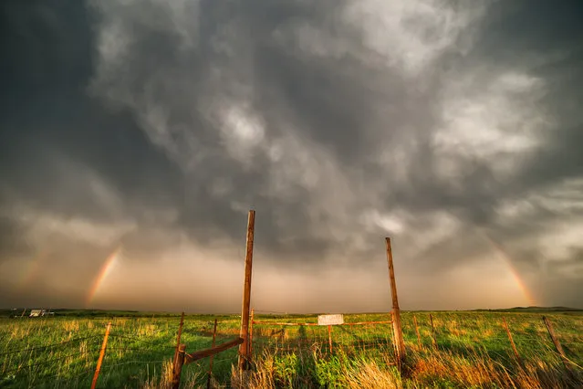
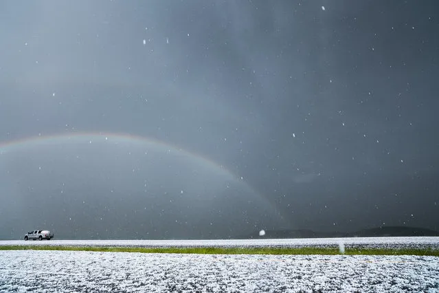
Double rainbow forms over a field in central Kansas following a line of severe storms. (Photo by Mike Hollingshead)
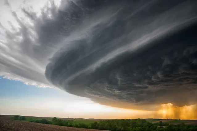
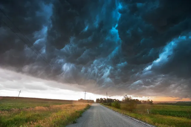
Long-lived supercell moves across northeast Nebraska May 28, 2004, allmost following highway 12 from Niobrara down to Sioux City perfectly. (Photo by Mike Hollingshead)
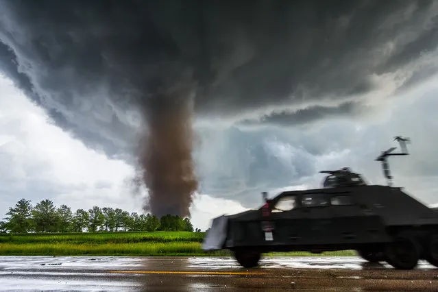
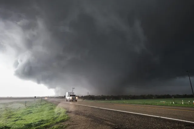
Tornado from a tornadic supercell approaches from the south, west of York Nebraska June 20, 2011, as the tornado intercept vehicle moves in for an intercept. (Photo by Mike Hollingshead)
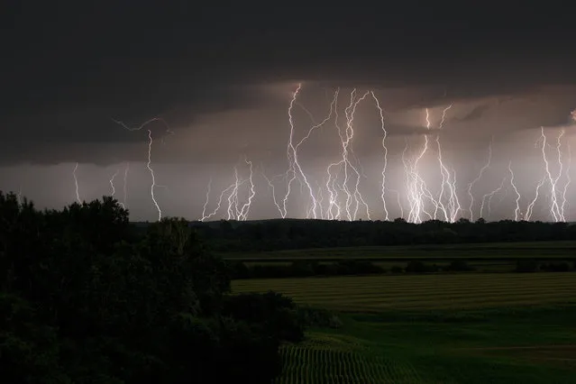
Several same position lightning images stacked. Storms tracking northwest of Omaha produced multiple cloud to ground bolts. (Photo by Mike Hollingshead)
Base of a supercell storm moves into Kadoka South Dakota July 13, 2009, producing intense and frequent cloud to ground lightning. (Photo by Mike Hollingshead)
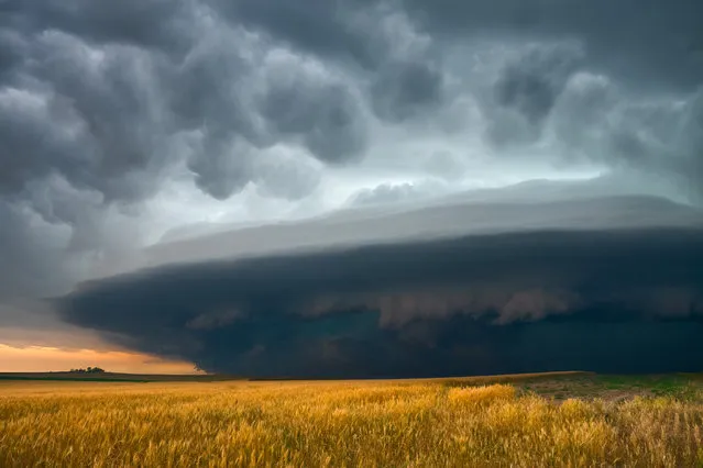
Very intense high precipitation supercell storm moves south in the Nebraska Sand Hills south of Valentine, July 13, 2009. Very low, long and fat inflow cloud stretches east of the storm. Winds gusted upwards of 60+ mph into this storm. Tornado warning with the storm mentioned baseball size hail and winds in excess of 100 mph, a rare warning text indeed. As intense of a storm as it was, it only produced one short-lived small tornado. Traffic heading north up highway 83 would be driving right into the storm's forward flank downdraft, which contained large hail and intense rain. (Photo by Mike Hollingshead)
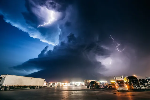
Amazing supercell storm during twilight nears a York Nebraska truck stop on I80 as it spits out lightning, June 17, 2009. Only a half hour or so earlier this storm was producing a long-lived large tornado near Aurora Nebraska. (Photo by Mike Hollingshead)
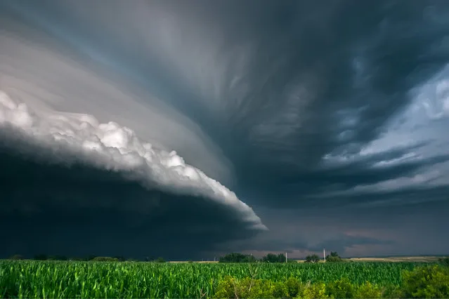
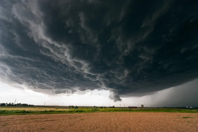
Slow moving tornadic supercell speeds up and gusts out as a fast moving shelf cloud July 12, 2004 near Bartlett Nebraska. (Photo by Mike Hollingshead)
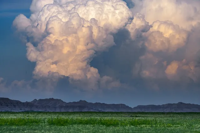
Storm towers erupt over the badlands of South Dakota June 18, 2008. (Photo by Mike Hollingshead)
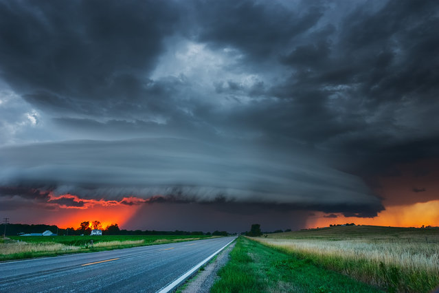
Vivid sunset under severe storm in central Nebraska August 17, 2005. (Photo by Mike Hollingshead)
Long-lived supercell produces an EF4 tornado that tracks across northeast South Dakota, just missing the town of Bowdle, May 22, 2010. Early formation of the wedge is happening west of Bowdle now. Tim Samaras can be seen in the white truck after having deployed a probe on the road back there. Rapid and violent wedge formation is underway on the right/north side of the road in the image. Contrast was very poor at this angle but rotation was violent all around the tornado. (Photo by Mike Hollingshead)
Up to baseball hail falls near Fairburn SD south of Rapid City from a high based summer storm. (Photo by Mike Hollingshead)
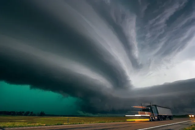
Shelf cloud moves over a storm chaser producing what they term the “whales mouth” in southeast Nebraska August 9, 2009. (Photo by Mike Hollingshead)
Severe storm races southeast in southwest Nebraska June 10, 2006 producing high winds and small hail. (Photo by Mike Hollingshead)
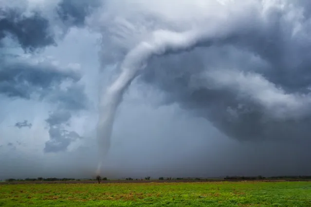
Tornado ropes out in central Kansas during an outbreak April 14, 2012. (Photo by Mike Hollingshead)
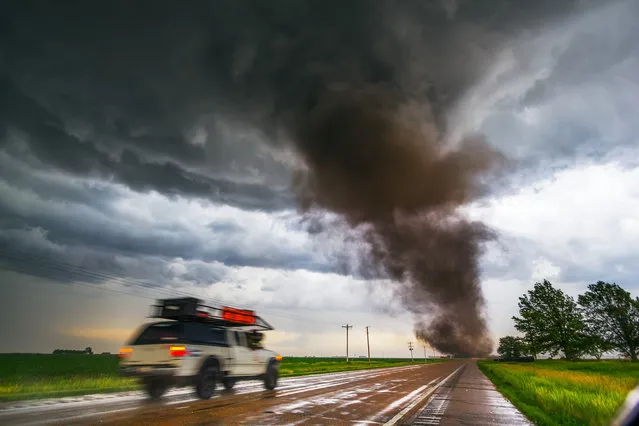
Tornado from a tornadic supercell approaches from the south, west of York Nebraska June 20, 2011. (Photo by Mike Hollingshead)
13 Aug 2014 11:25:00,
post received
0 comments