|
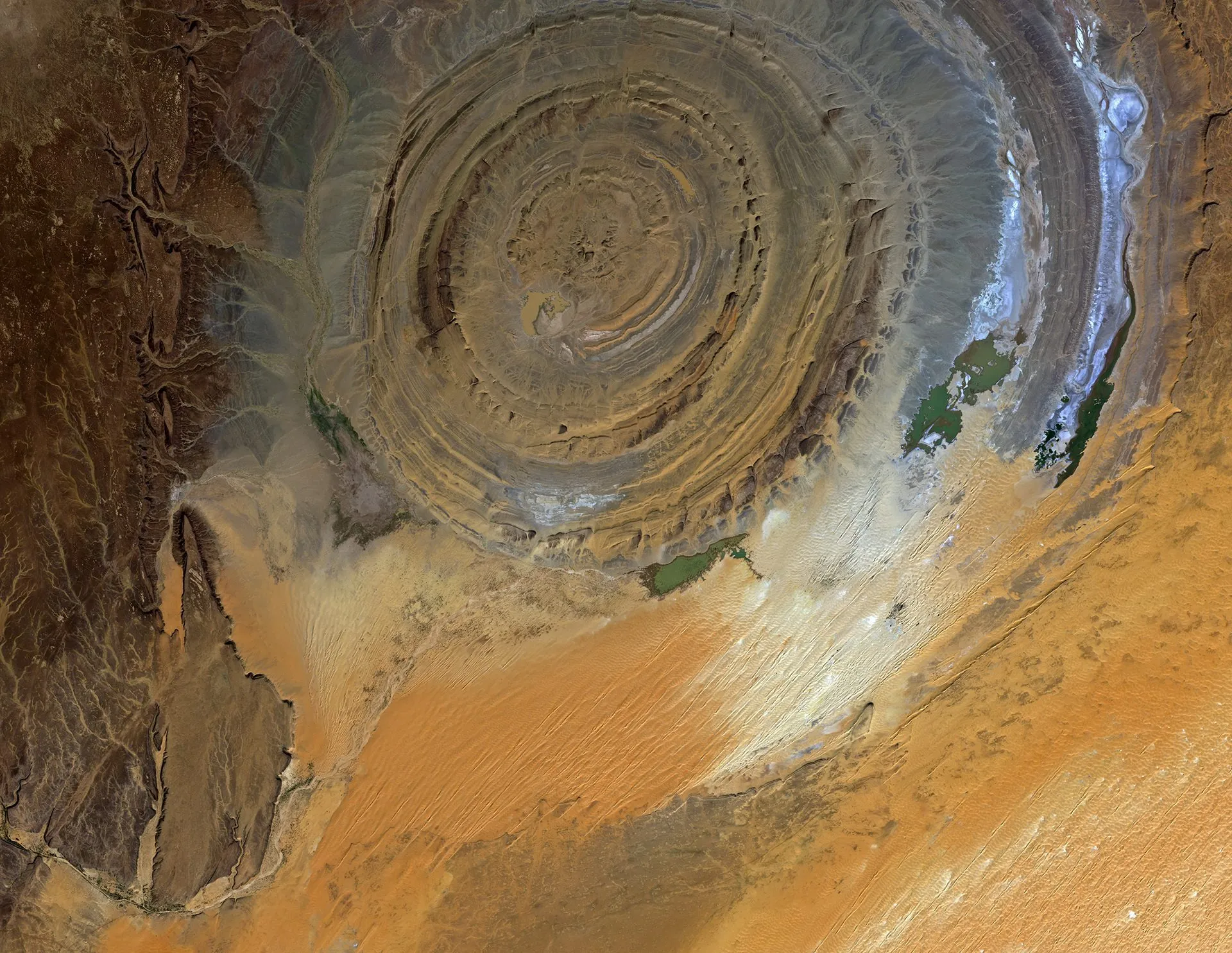
A handout picture released by ESA on 02 May 2014 and taken by Japan's ALOS satellite on 23 November 2010 shows the 40 km-diameter circular Richat structure in the Sahara desert of Mauritania, one of the geological features that is easier to observe from space than from down on the ground, and has been a familiar landmark to astronauts since the earliest missions. Once thought to be the result of a meteor impact, researchers now believe it was caused by a large dome of molten rock uplifting and, once at the surface, being shaped by wind and water into what we see today. Concentric bands of resistant quartzite rocks form ridges, with valleys of less-resistant rock between them. The dark area on the left is part of the Adrar plateau of sedimentary rock standing some 200 m above the surrounding desert sands. A large area covered by sand dunes – called an erg – can be seen in the lower-right part of the image, and sand is encroaching into the structure’s southern side. (Photo by EPA/Jaxa/European Space Agency)
|