Loading...
Done
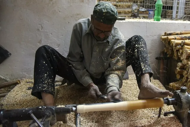
In this photograph taken on December 14, 2016, an Indian craftsman works on unfinished cricket bats in a factory in Meerut, some 70 kms north- east of New Delhi. As Indian factory worker Jitender Singh carves out another big- hitting slab of thick willow he insists MCC proposals to limit the size of cricket bats won' t tame Twenty20 marauders. “I don' t think the thickness matters. It' s more about the balance of the bat and the talent of the batsman”, says Singh, who has made bats for many stars, including South Africa's AB de Villiers. The World Cricket committee of the MCC, the guardians of the game, recommended in December 2016 that limitations be placed on the width and depth of bats because it had become too easy to smash fours and sixes. (Photo by Dominique Faget/AFP Photo)

In this photograph taken on December 14, 2016, an Indian craftsman works on unfinished cricket bats in a factory in Meerut, some 70 kms north- east of New Delhi. (Photo by Dominique Faget/AFP Photo)
Details
11 Jan 2017 14:32:00
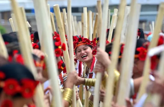
Sümi women gesture as they line up to perform a traditional Sümi rice pounding folk song called “Thishole” during Western Sumi Torimi Hoho Silver Jubilee at Thilixü Village in Chumoukedima district, India north eastern state of Nagaland on June 7, 2023. Altogether 1400 Sülimis perform their traditional rice pounding folk song to mark their 25th Anniversary. (Photo by Caisii Mao/Rex Features/Shutterstock)

Sümi women gesture as they line up to perform a traditional Sümi rice pounding folk song called “Thishole” during Western Sumi Torimi Hoho Silver Jubilee at Thilixü Village in Chumoukedima district, India north eastern state of Nagaland on June 7, 2023. Altogether 1400 Sülimis perform their traditional rice pounding folk song to mark their 25th Anniversary. (Photo by Caisii Mao/Rex Features/Shutterstock)
Details
18 Jun 2023 04:01:00
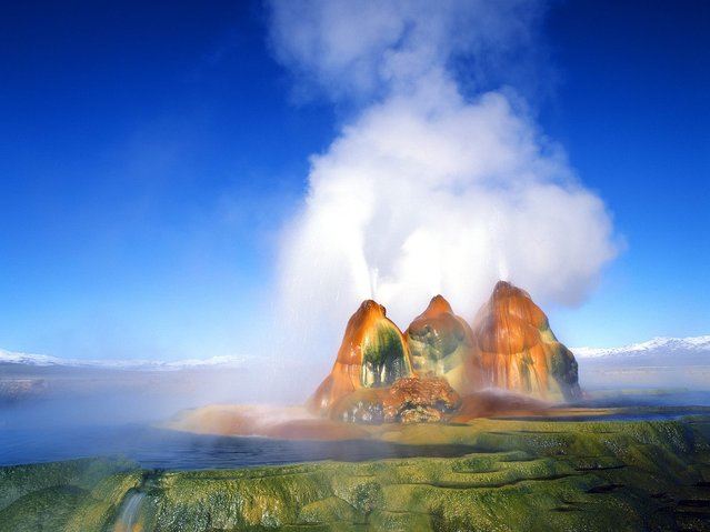
Black Rock Desert

The Black Rock Desert is an arid region of lava beds and playa, or alkali flats, situated in the Black Rock Desert-High Rock Canyon Emigrant Trails National Conservation Area, a silt playa 100 miles north of Reno that encompasses more than 300,000 acres of land and contains more than 120 miles of historic trails. It is in the northern Nevada section of the Great Basin with a lakebed that is a dry remnant of Pleistocene Lake Lahontan.
Details
22 Mar 2013 11:01:00
Best Kavkaz Georgian Dances

“Georgia is a sovereign state in the Caucasus region of Eurasia. Located at the crossroads of Western Asia and Eastern Europe, it is bounded to the west by the Black Sea, to the north by Russia, to the south by Turkey and Armenia, and to the southeast by Azerbaijan. The capital of Georgia is Tbilisi. Georgia covers a territory of 69,700 km², and its population is almost 4.7 million. Georgia is a unitary, semi-presidential republic, with the government elected through a representative democracy”. – Wikipedia
Details
29 Apr 2013 15:52:00
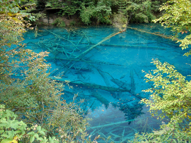
Plitvice Lakes National Park

Plitvice Lakes National Park is the oldest national park in Southeast Europe and the largest national park in Croatia. The national park was founded in 1949 and is situated in the mountainous karst area of central Croatia, at the border to Bosnia and Herzegovina. The important north-south road connection, which passes through the national park area, connects the Croatian inland with the Mediterranean coastal region.
Details
12 Aug 2012 16:42:00
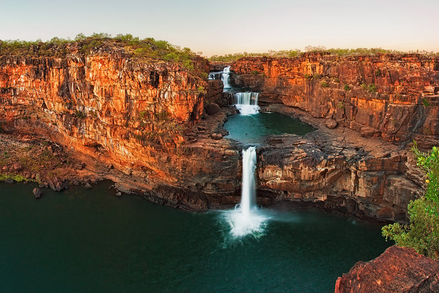
Mitchell Falls Australia

Mitchell Falls are a chain of four waterfalls located in the remote north of the Kimberley Region (Western Australia, a little more than 2,000 kilometers northeast of Perth.). It is a part of Mitchell River National Park (one of the protected areas of Western Australia), Mitchell Falls are probably one of the park’s main attractions.
Details
14 Dec 2013 13:29:00
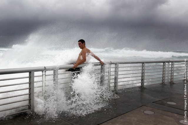
Florida Beaches Feel Effects Of Hurricane Irene

Cory Ritz braces himself as a wave bursts onto a pier at the Boynton Beach inlet on August 25, 2011 in Boynton Beach, Florida. Hurricane Irene is moving over the Bahamas and could still be a major storm as it approaches the North Carolina coast the morning of August 27. (Photo by Joe Raedle/Getty Images)
Details
26 Aug 2011 09:11:00


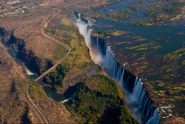
Victoria Falls is a town in the province of Matabeleland North, Zimbabwe. It lies on the southern bank of the Zambezi River at the western end of the Victoria Falls themselves. It is connected by road and railway to Hwange (109 km away) and Bulawayo (440 km away), both to the south-east.


See Also: “Devil's Pool”
Details
09 Oct 2013 11:06:00