Loading...
Done
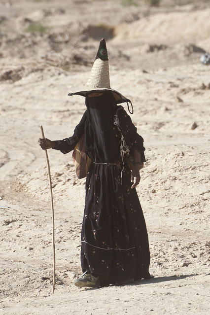
Wadi Hadhramaut, Hadhramaut Governorate, Yemen: women in abayas and traditional straw hats – conical witches hats, known as madhalla. (Photo by Eric Lafforgue)

“Hadhramaut (Hadhramout, Hadramawt or Ḥaḍramūt) is the formerly independent Qu'aiti state and Kathiri sultanate encompassing a historical region of the south Arabian Peninsula along the Gulf of Aden in the Arabian Sea, extending eastwards from Yemen to the borders of the Dhofar region of Oman. The name of the region is currently retained in the smaller Hadhramaut Governorate of the Republic of Yemen. The people of Hadhramaut are called Hadhramis and speak Hadhrami Arabic”. – Wikipedia

Photo: Wadi Hadhramaut, Hadhramaut Governorate, Yemen: A woman in abayas and traditional straw hats - conical witches hats, known as madhalla. (Photo by Eric Lafforgue)
Details
08 Jan 2013 11:45:00
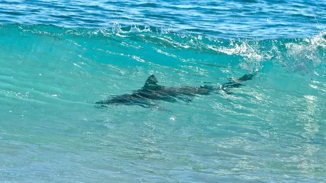
A spinner shark swims just offshore on Midtown Beach in Palm Beach on Tuesday. (Photo by Jeffrey Langlois/Palm Beach Daily News)

Several beaches along South Florida's Atlantic coast line were closed after thousands of sharks were seen migrating in the waters. The sharks were migrating from Boca Raton to Jupiter since the beginning of March, marine biologists told NBC Miami. Photo: A spinner shark swims just offshore on Midtown Beach in Palm Beach on Tuesday. (Photo by Jeffrey Langlois/Palm Beach Daily News)
Details
10 Mar 2013 09:39:00
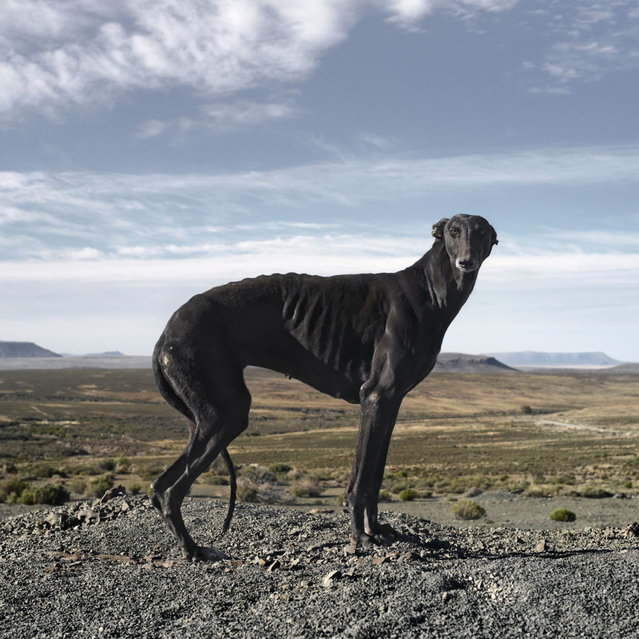
Africanis 18. Murraysburg, Western Cape, May 10, 2010. (Photo by Daniel Naudé)

“The Africanis is a landrace of South African dogs. It is believed to be of ancient origin, directly descended from hounds and pariah dogs of ancient Africa, introduced into the Nile Valley from the Levant. The Swahili name for the breed is umbwa wa ki-shenzi meaning common or mongrel or “traditional dog”. Africanis is also an umbrella name for all the aboriginal dogs in southern Africa”. – Wikipedia. Photo: Africanis 18. Murraysburg, Western Cape, May 10, 2010. (Photo by Daniel Naudé)
Details
19 May 2013 11:51:00
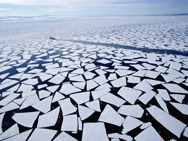
McMurdo Station Antarctic

McMurdo Station is a U.S. Antarctic research centre located on the southern tip of Ross Island, which is in the New Zealand-claimed Ross Dependency on the shore of McMurdo Sound in Antarctica. It is operated by the United States through the United States Antarctic Program, a branch of the National Science Foundation. The station is the largest community in Antarctica, capable of supporting up to 1,258 residents, and serves as the United States Antarctic science facility. All personnel and cargo going to or coming from Amundsen–Scott South Pole Station first pass through McMurdo.
Details
05 Sep 2013 10:18:00
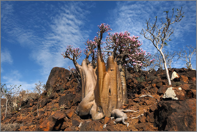
The Wonder Land of Socotra, Yemen

The largest island, also called Socotra, is about 95% of the landmass of the archipelago. It lies some 240 kilometres (150 mi) east of the Horn of Africa and 380 kilometres (240 mi) south of the Arabian Peninsula. The island is very isolated and through the process of speciation, a third of its plant life is found nowhere else on the planet. It has been described as the most alien-looking place on Earth. The island measures 132 kilometres (82 mi) in length and 49.7 kilometres (30.9 mi) in width.
Details
25 Sep 2013 09:11:00
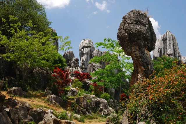
Shilin Stone Forest

The Stone Forest or Shilin is a notable set of limestone formations located in Shilin Yi Autonomous County, Yunnan Province, People's Republic of China, near Shilin approximately 120 km (75 mi) from the provincial capital Kunming. The tall rocks seem to emanate from the ground in the manner of stalagmites, with many looking like petrified trees thereby creating the illusion of a forest made of stone. Since 2007, two parts of the site, the Naigu Stone Forest (乃古石林) and Suogeyi Village (所各邑村), have been UNESCO World Heritage Sites as part of the South China Karst.
Details
27 Sep 2013 10:03:00
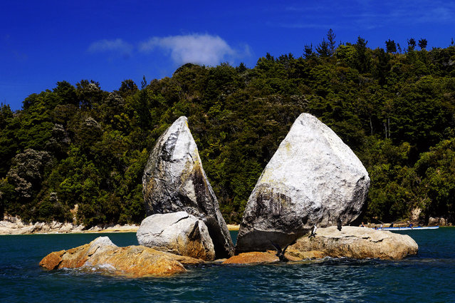
Split Apple Rock

Split Apple Rock is a geological rock formation in The Tasman Bay off the northern coast of the South Island of New Zealand. Made of granite, it is in the shape of an apple which has been cut in half. It is a popular tourist attraction in the waters of the Tasman Sea approximately 50 metres off the coast between Kaiteriteri and Marahau. The rock sits in shallow water at low tide and is accessible by wading. It is also a point of interest for the many tourist boats and pleasure craft which operate along the shores of the Abel Tasman National Park. The cleft to produce two sides of the 'apple' was a natural occurrence. It is unknown when this happened and therefore the cleaving of the rock has attracted mythological explanations.
Details
19 Oct 2013 10:58:00
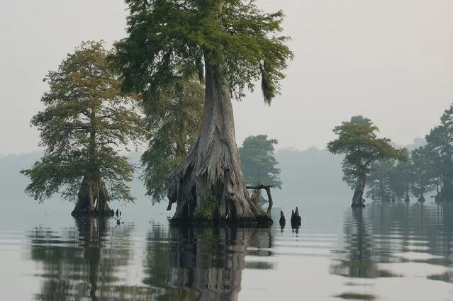
The Great Dismal Swamp

The Great Dismal Swamp is a marshy area in the Coastal Plain Region of southeastern Virginia and northeastern North Carolina, between Norfolk, Virginia, and Elizabeth City, North Carolina. It is located in parts of southern Virginia cities Chesapeake and Suffolk and northern North Carolina counties Gates, Pasquotank and Camden. It is a southern swamp, one of many along the Atlantic Ocean's coast, including the Everglades and Big Cypress Swamp in Florida, the Okefenokee Swamp in Georgia, the Congaree and Four Holes swamps of South Carolina, and some of the Carolina bays in the Carolinas and Georgia. Along the eastern edge runs the Dismal Swamp Canal, completed in 1805.
Details
09 Dec 2013 11:40:00