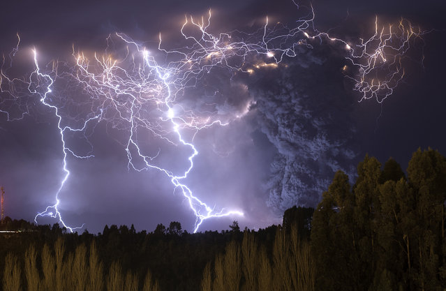
The eruption of Cordon Caulle began on June 4, 2011, located in the Region of Los Rios in Chile. For about 12 months, people and animals became accustomed to living with the daily fall of ash, which also caused problems in the air traffic in South America. The explosions and lightning during first days of the eruption could be seen from hundreds of miles around. This photograph was taken on the second night of eruption from the town of Lago Ranco. (Photo and caption by Francisco Negroni/National Geographic Traveler Photo Contest)
ATTENTION! All pictures are presented in high resolution. To see Hi-Res images – just TWICE click on any picture. In other words, click small picture – opens the BIG picture. Click BIG picture – opens VERY BIG picture.
ATTENTION! All pictures are presented in high resolution. To see Hi-Res images – just TWICE click on any picture. In other words, click small picture – opens the BIG picture. Click BIG picture – opens VERY BIG picture.
23 Jun 2013 11:24:00,post received
0 comments